Search
Search Results
-
Hydrogeomorphic Changes Along mid-Atlantic Coastal Plain Rivers Transitioning from Non-tidal to Tidal: Implications for a Rising Sea Level
Sea level rise is affecting reaches of coastal rivers by increasing water levels and propagating tides inland. The transition of river systems into...

-
Interactions of gulf cordgrass, Spartina spartinae (Trin.) Merr. ex Hitchc., habitat with ixodids on the South Texas coastal plain
Many ixodid species on the South Texas coastal plain can transmit pathogens to their hosts. Substantial areas are dominated by gulf cordgrass, Spartina...

-
Geo-environmental factors controlling groundwater hydrogeochemistry, salinization and quality in El Qaa plain coastal aquifer, Southwest Sinai, Egypt
El Qaa plain is one of the promising areas for agriculture projects, owing to its soil and groundwater resources. So, 14 groundwater samples were...
-
Present and future groundwater depletion rates in Wadi Zabid, Tihama Coastal Plain, Yemen
This paper presents a simple water budget model that can be used to quantify present and to predict future groundwater depletion rates in areas where...

-
The coastal plain headwater stream restoration (CP-HStR) index: a macroinvertebrate index for assessing the biological effectiveness of stream restoration in the Georgia coastal plain, USA
Stream restoration projects undertaken as compensatory mitigation pursuant to Sect. 404 of the U.S. Clean Water Act must be evaluated using...

-
Statistical assessment of seasonal variation of groundwater quality in Çarşamba coastal plain, Samsun (Turkey)
Çarşamba aquifer is one of the most important coastal aquifers in Turkey. This aquifer is confronted by overexploitation due to the agricultural and...

-
Hurricane Effects on Benthic Nitrogen Cycling in an Emerging Coastal Deltaic Floodplain Within the Mississippi River Delta Plain
Hurricanes are one of the most common natural events that disturb estuarine and coastal wetlands along the Gulf of Mexico. The episodic and energetic...
-
Accelerating Elevation Gain Indicates Land Loss Associated with Erosion in Mississippi River Deltaic Plain Tidal Wetlands
In recent years, the Mississippi River Deltaic Plain (MRDP) has experienced the highest rates of wetland loss in the USA. Although the process of...
-
Geoelectrical exploration of the Coastal Plain Sands of Okitipupa area, southwestern Nigeria
The quest for sustainable potable water is an unendless struggle as it is one of the pillars that sustain the growth of any community. Okitipupa is...

-
Response of coastal phytoplankton to pollution from various sources in the coastal Bay of Bengal
The coastal ocean receives nutrient pollutants from various sources, such as aerosols, municipal sewage, industrial effluents and groundwater...

-
Assessment of seawater intrusion vulnerability of coastal aquifers in context of climate change and sea level rise in the central coastal plains, Vietnam
Vietnam’s coastal aquifers face the challenge of saltwater intrusion due to factors like climate change, sea level rise, and over-exploitation. This...
-
Assessment of coastal vulnerability using integrated fuzzy analytical hierarchy process and geospatial technology for effective coastal management
The vulnerability of coastal regions to climate change is a growing global concern, particularly in Bangladesh, which is vulnerable to flooding and...

-
The mechanism of iodine enrichment in groundwater from the North China Plain: insight from two inland and coastal aquifer sediment boreholes
As an element relevant to human health, iodine is highly worthy of researchers’ attention, especially the mechanism of iodine migration and...

-
New geochemical data for defining origin and distribution of mercury in groundwater of a coastal area in southern Tuscany (Italy)
A geochemical study was conducted in a coastal plain in the Orbetello Lagoon area in southern Tuscany (Italy), acquiring new data on groundwater,...

-
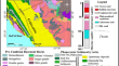
The Brazilian Coastal Landscapes: A Narrative
Brazil’s coastline runs along an expressive latitudinal range from 04° 26′12″ N to 33° 45′07″ S characterized by diverse landscapes that extends from...
-
Coastal vulnerability assessment for the coast of Tamil Nadu, India—a geospatial approach
A coastal region is a section of land that borders a significant body of water, often the sea or ocean. Despite their productivity, they are...

-
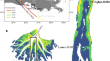
Elevation Dynamics Between Polders and the Natural Sundarbans of the Ganges-Brahmaputra Delta Plain
The Ganges-Brahmaputra Delta (GBD) in Bangladesh exists at a nexus of stability and vulnerability, as the rivers annually carry ~ 800–1000 MT of...

-
Horizontal Integrity a Prerequisite for Vertical Stability: Comparison of Elevation Change and the Unvegetated-Vegetated Marsh Ratio Across Southeastern USA Coastal Wetlands
Surface elevation tables (SETs) estimate the vertical resilience of coastal wetlands to sea-level rise (SLR) and other stressors but are limited in...

-
Comparative study for coastal aquifer vulnerability assessment using deep learning and metaheuristic algorithms
Coastal aquifer vulnerability assessment (CAVA) studies are essential for mitigating the effects of seawater intrusion (SWI) worldwide. In this...

-
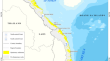
Remote sensing monitoring of mining tailings in the fluvial-estuarine-coastal ocean continuum of the Lower Doce River Valley (Brazil)
Water clarity is a key parameter of aquatic ecosystems impacted by mining tailings. Tracking down tailings dispersion along the river basin requires...
