Search
Search Results
-
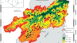
Rockfall hazard assessment of the slope of Mogao Grottoes, China based on AHP, F-AHP and AHP-TOPSIS
Hosting precious superb murals and painted sculptures from the fourth to the fourteenth century, the UNESCO word heritage site Mogao Grottoes are one...

-
Evaluation of the prediction capability of AHP and F-AHP methods in flood susceptibility map** of Ernakulam district (India)
Floods are one of the frequent natural hazards occurring in Kerala because of the remarkably high annual rate of rainfall. The objective of this...

-
Map** the Potential for Erosion Gullies Using Frequency Ratio and Fuzzy Analytical Hierarchy Process: Case Study Medjerda Basin, Northeast Algeria
AbstractSoil erosion poses a significant problem in the Mediterranean region, posing serious threats to the environment and natural resources. The...
-
A novel data-driven approach to pairwise comparisons in AHP using fuzzy relations and matrices for landslide susceptibility assessments
Over the last 2 decades, Analytical Hierarchy Process (AHP) has attracted great interest of the researchers in many fields like landslide...

-
Development of an Automatic Water Monitoring Network by Using Multi-Criteria Analysis and a GIS-Based Fuzzy Process
AbstractSelection of the appropriate sampling sites is a fundamental task in the design of a surface water quality monitoring network (WQMN)....

-
Landslide susceptibility zonation of the Western Ghats region in Thiruvananthapuram district (Kerala) using geospatial tools: A comparison of the AHP and Fuzzy-AHP methods
Landslides are one of the most common geohazards occurring in the Western Ghats region of Kerala, causing substantial loss of life and property. The...

-
Assessment of Mouza Level Flood Resilience in Lower Part of Mayurakshi River Basin, Eastern India
One of the most destructive natural catastrophes in the globe is flooding. Every year flood causes huge losses of lives and properties. To reduce the...
-
A comparative study based on AHP and fuzzy logic approaches for landslide susceptibility zoning using a GIS-based multi-criteria decision analysis
This work discusses the effectiveness of the Analytical Hierarchy Process (T-AHP) and fuzzy logic approach (FL-AHP) for landslide susceptibility...

-
A novel seismic vulnerability assessment for the urban roadway by using interval valued fermatean fuzzy analytical hierarchy process
Seismic activity poses significant challenges to urban road infrastructure, often resulting in road closures due to the combined effects of damaged...
-
An Improved Connection Cloud Model of an Updated Database: A Multicriteria Uncertainty Model for Coal Burst Liability Evaluation
In the context of complex geological environments, coal burst liability (CBL) evaluation struggles with uncertainty and fuzziness of indices and with...

-
The spatiotemporal evolution of hydrochemical characteristics and groundwater quality assessment in Urumqi, Northwest China
This study investigated the spatiotemporal evolution of hydrochemical characteristics and discussed the results of water quality assessment by using...

-
Flood susceptibility and flood frequency modeling for lower Kosi Basin, India using AHP and Sentinel-1 SAR data in geospatial environment
The Lower Kosi Basin (LKB) in North Bihar is highly prone to floods and is influenced by upstream hydrology. A flood susceptibility index has been...

-
Managed aquifer recharge site suitability analysis in the Nabogo Basin of Ghana using GIS and Monte Carlo simulation-aided analytic hierarchy process
Groundwater in the Nabogo Basin is threatened by increasing domestic and irrigation demands during the dry season, owing to climate change and...

-
An interpretable framework for the hazard assessment of debris flow based on an improved AHP-EWM method and the SHAP model: a case study of Heishuiwan gully
Debris flows are significant geological hazard in Bei**g mountainous areas. As a non-engineering means, hazard assessment is instructive for debris...

-
Integration Hybrid Multi Criteria Decision Making of GIS, AHP and TOPSIS in Evaluating Suitable Locations for CNG Fuel Stations: A Case of Bonab City, Iran
As the demand for vehicle usage continues to surge, the strategic placement of fuel stations within urban areas has become a topic of significant...
-
Spatial modeling of soil erosion risk: a multi-criteria decision-making (MCDM) approach in the paguyaman watershed, gorontalo, Indonesia
Soil erosion is a pressing natural phenomenon confronting nations all over the world. The study's objectives are to establish an evaluation model of...

-
Optimized Land Suitability Map** for Wheat Cultivation by Integrating Fuzzy Hierarchical Analysis and Satellite Images
This study focuses on identifying optimal areas for wheat cultivation in the northwestern part of the Khuzestan province- southwest Iran. This...
-
Delineation of Flood Susceptibility Zone Using Analytical Hierarchy Process and Frequency Ratio Methods: A Case Study of Dakshin Dinajpur District, India
This research explored the effectiveness of two computer ensemble classifiers in assessing flood susceptibility in the Dakshin Dinajpur District,...

-
Development of landslide susceptibility map** with a multi-variance statistical method approach in Kepahiang Indonesia
Landslides are an example of severe natural disasters that occur worldwide and generate many harmful effects that can affect the stability and...

-
Assessing the soil erosion susceptibility of watersheds based on morphometric parameters using different MCDM techniques and their evaluation with field survey
The soil erosion susceptibility depends on the morphometric, geological and hydrological conditions of the watershed. Multi-criteria decision-making...
