Search
Search Results
-
Estimation of Total Dissolved Solids in Water Bodies by Spectral Indices Case Study: Shatt al-Arab River
In recent years, the problem of rising salinity levels in the Shatt al-Arab river in southern Iraq has been repeated, which has directly affected the...

-
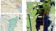
Climate change and future challenges to the sustainable management of the Iraqi marshlands
The application of restoration plans for the Iraqi marshlands is encountering significant challenges due to water scarcity and the impacts of climate...

-
Impact of using magnetic water on the micro structure of leached saline-sodic soil
Structural changes in the porous media are critical in evaluating the soil pore system and other physical properties of leached soil. In this work,...

-
Monitoring Wetlands in Southern Iraq Based on Landsat Data
The wetlands in southern Iraq, known as the Mesopotamian Marshes, are an important element of the continental ecosystem that requires a simple and...
-
Use of remote sensing techniques to assess water storage variations and flood-related inflows for the Hawizeh wetland
High spatial and temporal resolution remote sensing data are becoming readily available. This has made the use of remote sensing to monitor and...
-
Challenges of the Water Crisis in the Arab Gulf Countries (2011–2021)
This study aimed at analyzing and diagnosing the water sector in the Gulf Cooperation Council Countries, in terms of identifying water sources,...
-
Assessment of Heavy Metal Pollution in Sirwan River by Heavy Metal Pollution Index (HPI) and Metal Index (MI)
The study aims to evaluate the quality of Sirwan River water based on its heavy metal contents by using two of the most recent indexes regarding...

-
A Study of Nature-Based Solutions via a Thematic Analysis of the Stakeholders’ Perceptions to Address Water Scarcity in a Hot and Semiarid Climate: A Case Study of Iran
Water scarcity is an old and long-term problem in the Middle East, especially in Iran, where water shortage has been a challenge for over a decade....
-
Estimation of Muskingum's equation parameters using various numerical approaches: flood routing by Muskingum's equation
Flood routing in natural channels is essential to predict the location and the physical properties of the flood waves, which is very important for...

-
Sediment of the Tigris and Euphrates rivers: an early modern perspective
Sediment deposition by the Tigris and Euphrates rivers created the physical landscape on which the civilizations of ancient Iraq evolved. Scholars in...

-
Activity Concentrations of Natural Radionuclides in Soil and Water Around Some Quarries and Potential Human Health Effects
In this study, radioactivity levels were measured in surface soil and water around some large quarries and quarry lakes in Binh Duong Province,...

-
Classification Maps for TDS Concentrations in the GIS Along Euphrates River, Iraq
Iraq currently undergoing the problem of water shortage, although Iraq has two Rivers (Euphrates and Tigris) pass throughout most of its areas, and...

-
Megacities’ environmental assessment for Iraq region using satellite image and geo-spatial tools
Urban areas are quickly established, and the overwhelming population pressure is triggering heat stress in the metropolitan cities. Climate change...

-
Climate Change Impacts on the Seasonal Variation of Hydro-Physical Characteristics in the Persian Gulf
Climate change affects atmospheric circulation patterns and intensifies recurrent extreme weather events across the globe. It has resulted in...

-
Heavy metal and persistent organic pollutant profile of sediments from marine protected areas: the northern Persian Gulf
Marine protected areas (MPAs) are one of the policy tools to support marine biodiversity conservation and sustainable use of marine resources. The...

-
Map** pollution dynamics: utilizing GNOME to model oil spill trajectories in tanker terminals
The aim of this study is to uncover the multifaceted environmental threats posed by Oil Spill Water Pollution (OSWP) originating from tanker...

-
Will Peaceful Waters Flow Again? A Game-Theoretic Insight into a Tripartite Environmental Conflict in the Middle East
A tripartite environmental conflict over the Al-Hawizeh–Azim Marsh located in the Tigris River Basin is strategically investigated as an instance of...

-
GIS-based multi-criteria decision-making techniques and analytical hierarchical process for delineation of groundwater potential
The profound knowledge and management of groundwater resources is a prerequisite in order to ensure the sustainability of these resources. In this...

-

-
Uranium Concentrations and Some Physicochemical Parameters of Water Samples at Marshes (Ahwar) in Dhi-Qar Governorate
The solid-state nuclear track detector techniques were used in this study to measure the level of uranium isotopes ( 238 U, 235 U, and 234 U) that were...
