Search
Search Results
-
A study of non-landslide samples and weights for map** landslide susceptibility using regression and clustering methods
Landslides are considered one of the most frequent natural disasters that cause human loss and damage property, affecting the sustainability of...

-
Parameterizations of Snow Cover, Snow Albedo and Snow Density in Land Surface Models: A Comparative Review
Snow plays a vital role in the interaction between land and atmosphere in the state-of-the-art land surface models (LSMs) and the real world. While...

-
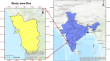
Integration of GIS and Machine Learning Techniques for Map** the Landslide-Prone Areas in the State of Goa, India
A landslide susceptibility map (LSM) assists in reducing the danger of landslides by locating the landslide-prone locations within the designated...
-
Development of landslide susceptibility map** with a multi-variance statistical method approach in Kepahiang Indonesia
Landslides are an example of severe natural disasters that occur worldwide and generate many harmful effects that can affect the stability and...

-
A quick method of early landslide identification based on dynamic susceptibility analysis using M-SVM method: a case study
Landslides are irreversible and highly destructive disasters, so the early identification of landslides is necessary to minimize damage and the loss...

-
Statistical-based models for the production of landslide susceptibility maps and general risk analyses: a case study in Maçka, Turkey
The district of Maçka in Trabzon, in the Eastern Black Sea Region of Turkey, frequently experiences landslides, resulting in the highest number of...

-
Comparison of tree-based ensemble learning algorithms for landslide susceptibility map** in Murgul (Artvin), Turkey
Turkey’s Artvin province is prone to landslides due to its geological structure, rugged topography, and climatic characteristics with intense...

-
Landslide susceptibility map** using GIS-based statistical and machine learning modeling in the city of Sidi Abdellah, Northern Algeria
Landslides are one of the most common and damaging geological hazards that constrain the urban planning and development of many cities in northern...

-
Landslides in Mila town (northeast Algeria): causes and consequences
The Mila town (east Algeria) has suffered frequent landslides during the last few decades because of its geological, geomorphological, and...

-
Effect of the Normalized Difference Vegetation Index (NDVI) on GIS-Enabled Bivariate and Multivariate Statistical Models for Landslide Susceptibility Map**
In this study, the effect of NDVI is observed on the landslide susceptibility maps (LSMs) being created using GIS-based bivariate and multivariate...

-
Application of RBF and MLP Neural Networks Integrating with Rotation Forest in Modeling Landslide Susceptibility of Sampheling, Bhutan
The objective of this study is to prepare detailed landslide susceptibility maps (LSMs) for the Sampheling area of Southern Bhutan. First, the...
-
Investigation of the effects of approaches used in the production of training and validation data sets on the accuracy of landslide susceptibility map** models: Samsun (Turkey) example
In this study, the landslide susceptibility maps (LSMs) of the Canik, İlkadım, and Atakum districts of Samsun province of Turkey were produced. The...

-
An Advanced Hybrid Machine Learning Technique for Assessing the Susceptibility to Landslides in the Upper Meenachil River Basin of Kerala, India
The ambition of the current study was to generate landslide susceptibility maps (LSMs) for the Meenachil river basin’s upper catchment using the...
-
Landslide susceptibility map** in parts of Aglar watershed, Lesser Himalaya based on frequency ratio method in GIS environment
The Himalayan Mountain range is prone to landslides and its influential factors vary from region to region. To identify these factors, it is...

-
Comprehensive performance assessment of landslide susceptibility map** with MLP and random forest: a case study after Elazig earthquake (24 Jan 2020, Mw 6.8), Turkey
Quality assessment (QA) for landslide susceptibility maps (LSMs) is essential to increase their usability. A QA approach based on the landslide...

-
Application of GIS-based statistical modeling for landslide susceptibility map** in the city of Azazga, Northern Algeria
Landslide susceptibility map** is a necessary tool in order to manage the landslides hazard and improve the risk mitigation. In this research, we...

-
Artificial Neural Network Ensemble with General Linear Model for Modeling the Landslide Susceptibility in Mirik Region of West Bengal, India
Landslide is one of the important problems in the Mirik region of West Bengal. For managing this problem it is important to delineate the areas which...
-
GIS-based landslide susceptibility map** using hybrid MCDM models
Landslide susceptibility map** plays an important role in integrated watershed management planning, especially in the field of land-use planning in...

-
Uncertainty of land surface model and land use data on WRF model simulations over China
The land–atmosphere interaction has been considered one of the most important part for weather prediction and climate modeling. To evaluate the...

-
A user-friendly software package for modelling gravimetric geoid by the classical Stokes-Helmert method
With the progress in Global Navigation Satellite Systems (GNSS) technology, accurate geoid modelling has started to play an essential role in...