Search
Search Results
-
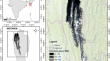
Rainfall-runoff-inundation (RRI) model for Kalu River, Sri Lanka
Climate change, urbanization, and many anthropogenic activities have intensified the floods in today’s world. However, poor attention was given to...

-
Estimating tidal inundation in the aftermath of the 2018 Palu earthquake
Disasters broadly impact livelihood and the environment. Interrelated disasters cause significant casualties and loss because each type of disaster...

-
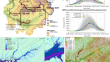
Hydrological-hydrodynamic nexus for predicting flood plain inundation: a case study in Pagladiya-Putimari catchment, India
Alluvial catchments are susceptible to frequent flooding due to complex geomorphologic characteristics and upstream rainfall. For the implementation...

-
Flood Inundation Modeling: A Brief Review
Numerous mathematical models were developed for flood hazard map**, flood inundation modeling and flood risk assessment. This study aims to have a...
-
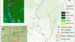
Assessment of Storm Surge and Flood Inundation in Chittagong City of Bangladesh Based on ADCIRC and GIS
Coastal flooding caused by tropical cyclones has long been a major threat to life, property, and infrastructure in coastal zones. This study assessed...
-
Simulation of Flood Inundation Extent by Integration of HEC-HMS, GA-based Rating Curve and Cost Distance Analysis
Flood inundation modeling is crucial for analyzing floods and understanding the impact of rainfall on runoff. Traditional hydraulic models require...
-
Rapid and quantitative uncertainty estimation of coseismic slip distribution for large interplate earthquakes using real-time GNSS data and its application to tsunami inundation prediction
This study proposes a new method for the uncertainty estimation of coseismic slip distribution on the plate interface deduced from real-time global...

-
Suitability of the height above nearest drainage (HAND) model for flood inundation map** in data-scarce regions: a comparative analysis with hydrodynamic models
Unprecedented floods from extreme rainfall events worldwide emphasize the need for flood inundation map** for floodplain management and risk...

-
Multiple Kernel Learning with Maximum Inundation Extent from MODIS Imagery for Spatial Prediction of Flood Susceptibility
Identifying flood prone areas is essential for basin management. In this paper, a spatial prediction technology of flood susceptibility based on...

-
Extension of the Geomorphic Flood Index classifier to predict flood inundation maps for uncalibrated rainfall depths in arid regions
Flash floods are a rapid hydrological response that occurs within a short time with rapidly rising water levels and could lead to massive structural,...

-
Simulating block-scale flood inundation and streamflow using the WRF-Hydro model in the New York City metropolitan area
This study assesses the performance of the Weather Research and Forecasting-Hydrological modeling system (WRF-Hydro) in the simulation of...

-
Study on Multi-Time Scale Hydrodynamic Model Based on Local Time Step** Scheme and GPUs and its Application in Urban Inundation
In view of the frequent occurrence of urban inundation, this paper establishes a multi-time scale non-uniform grid model that integrates a...

-
Ensemble rainfall–runoff and inundation simulations using 100 and 1000 member rainfalls by 4D LETKF on the Kumagawa River flooding 2020
This paper presents the 1000 ensemble flood simulations using ensemble rainfalls simulated by 4D LETKF. The number of ensemble rainfall members is...
-
A new framework integrating flood inundation modeling and multicriteria decision-making for enhanced flood risk map**
Flood risk map** is instrumental in guiding land-use decisions, development planning, disaster management, and mitigation strategies. However, the...

-
Impacts of DEM type and resolution on deep learning-based flood inundation map**
The increasing availability of hydrological and physiographic spatiotemporal data has boosted machine learning’s role in rapid flood map**. Yet,...

-
Flood Inundation Modelling in Data-Sparse Flatlands: Challenges and Prospects
In the last three decades, many sophisticated tools have been developed that can accurately predict the dynamics of flooding. However, due to the...
-
Detection of Urban Flood Inundation from Traffic Images Using Deep Learning Methods
Urban hydrological monitoring is essential for analyzing urban hydrology and controlling storm floods. However, runoff monitoring in urban areas,...

-
Improving flood inundation modeling skill: interconnection between model parameters and boundary conditions
Flooding is one of the most notorious natural disasters that adversely impact people's lives, and damages their properties. To properly simulate the...
-
Finite Element Modeling of Tsunami-induced Water Levels and Associated Inundation Extent: A Case Study of the 26th December 2004 Indian Ocean Tsunami
In recorded history, the tsunami due to the Great Sumatra earthquake of 26 th December 2004 has been the most devastating, causing the loss of over...
-
Map** inundation from sea level rise and its interaction with land cover in the Sundarbans mangrove forest
The sea level rise (SLR) in the Sundarbans areas is higher than the global-average rate of sea rise, and many studies assume that most of the dry...
