Search
Search Results
-
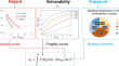
Geo-engineering Evaluation with Prime Consideration to Liquefaction Potential for Eskisehir City (Turkey)
In Turkey, cities are growing in importance and urban areas are expanding rapidly. Eskisehir is one of the highly urbanized and industrialized cities...
-
Earth Science, Art and Coastal Engineering at the Seaside: Envisioning an Open Exploratorium or Geo-Promenade at Weston-super-Mare, Somerset, United Kingdom
The paper outlines how an outdoor ‘exploratorium’ can be curated to place field observations, together with some knowledge of the local environment,...

-
Solving large deformation problems in geotechnical and geo-environmental engineering with the smoothed particle hydrodynamics: a state-of-the-art review of constitutive solutions
Coupled fluid–solid phase continuum problems associated with large deformation as geotechnics experts encounter in slope stability problems have been...

-
Engineering Potentials and Stability of Nigerian Waste Rocks as Alternative construction Geo-materials and Earth Structure Fills
Recycling of waste rocks from mines and its use in facility building is imperative due to its eco-friendly nature. Laboratory analysis and numerical...

-
Application of artificial neural networks and geographic information system to provide hazard susceptibility maps for rockfall failures
The presented article attempted to analysis rockfalls susceptibility map** which is considered as one the most important type of the land-slides...

-
Development and optimization of geotechnical soil maps using various geostatistical and spatial interpolation techniques: a comprehensive study
The substantial spatial variability of subsoil information in small grids poses a significant challenge for geological and geotechnical experts. In...

-
Seismic hazard prediction using multispectral amplification maps in a complex topographic area: A case study of Qiaozhuang town, Sichuan Province, Southwest China
Earthquakes can cause widely distributed slope failures and damage in mountainous areas. The accurate prediction of ground motions in mountainous...
-
Impact of Input Data on the Quality of the Landslide Susceptibility Large-Scale Maps: A Case Study from NW Croatia
The study presents analyses of input data impact on the quality of the landslide susceptibility large-scale maps. For comparison, two input data sets...
-
Application of Kriging for development of SPT N value contour maps and USCS-based soil type qualitative contour maps for Islamabad, Pakistan
Geotechnical maps provide preliminary knowledge of sub-surface parameters which help in hazard identification, planning of detailed investigations,...

-
Influence of local site effects on seismic risk maps and ranking of Italian municipalities
The latest studies concerning seismic risk assessment in Italy were developed without considering the site geo-lithological effects, thus limiting...
-
Investigation of soil corrosivity, competence and comprehensive aquifer evaluation of Orlu and environs, Southeastern Nigeria
The increasing demand for clean water for domestic and industrial purposes for the rapidly growing population of Orlu and its environs motivated this...
-
Africa Alive Corridors: Transdisciplinary Research based on African Footprints
The idea of Africa Alive Corridors (AAC) evolved from Gondwana geological map** to a comprehensive, more inclusive and dynamic approach to...

-
Step Wells of Jodhpur, Western Rajasthan, India: Implication for Hydro-geosites and Hydro-geotourism
Geodiversity is defined as the variety of geological, geomorphological, pedological and hydrogeological phenomena (IUCN
2022 ). Step wells in India...
-
Generic comparison of ISM and LSIT interpretation of geo-resistivity technology data, using constraints of ground truths: a tool for efficient explorability of groundwater and related resources
Geo-electrical resistivity technology, an investigative tool for prognosis or prospection of subsurface resources in relation to hydrogeology,...

-
A Novel Approach to Uncertainty Quantification in Groundwater Table Modeling by Automated Predictive Deep Learning
Uncertainty quantification ( UQ ) is an important benchmark to assess the performance of artificial intelligence ( AI ) and particularly deep learning...

-
Slope failures and safety index assessment of waste rock dumps in Nigeria’s major mines
Dump slope failure has become a recurring incident in Nigeria’s major mine sites while the visible signs of instability in Nigeria’s waste rock dumps...

-
Urban geology from a GIS-based geotechnical system: a case study in a medium-sized city (Oviedo, NW Spain)
This paper describes the development of a GIS-based geotechnical system designed to face challenges on urban geology in a Spanish mid-sized city. Its...

-
Debris flow susceptibility map** using the Rock Engineering System (RES) method: a case study
The main purpose of the present study is to develop a debris flow susceptibility map of a mountain area (Susa Valley, Western Italian Alps) by using...
-
Background and Current Situation of Geosciences in Peru
In this chapter, an overview of geoscientific development based on Peru is discussed. It recounts the history of the Peruvian geoscientific...
-
Landslide susceptibility map** and risk assessment using total estimated susceptibility values along NH44 in Jammu and Kashmir, Western Himalaya
Domain-specific mesoscale landslide susceptibility map** (LSM) and risk assessment was carried out along National Highway (NH44) of Jammu and...
