Search
Search Results
-
Bottomside ionospheric snapshot modeling using the LEO navigation augmentation signal from the Luojia-1A satellite
The ionospheric delay is still a major challenge for achieving precise global positioning since current global ionospheric modeling techniques still...

-
Research on Prediction of the Effects of Oil-Increasing Measures Driven by Data
A large number of major oil fields in China have entered the late stages of development, and the decreasing production is increasingly unable to meet...
-
Nested Augmentation of Rainfall Monitoring Network: Proposing a Hybrid Implementation of Block Kriging and Entropy Theory
One of the most influential environmental variables is rainfall which has significant effect on water resources management, agricultural development,...
-
Multi-GNSS PPP/INS tightly coupled integration with atmospheric augmentation and its application in urban vehicle navigation
Precise point positioning (PPP) is receiving increasing interest due to its cost-effectiveness, global coverage and high accuracy. However, its...

-
A rapid field crop data collection method for complexity crop** patterns using UAV and YOLOv3
Crop type map** using remote sensing is critical for global agricultural monitoring and food security. However, the complexity of crop planting...
-
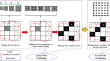
Data augmentation based morphological classification of galaxies using deep convolutional neural network
From the early stages of Astronomy, the classification of galaxies has been a conundrum that has left astrophysicists in a situation of quandary....

-
Impact of satellite thickness data assimilation on bias reduction in Arctic sea ice concentration
The impact of assimilating satellite-retrieved Arctic sea ice thickness (SIT) on simulating sea ice concentration (SIC) climatology in CICE5 is...

-
Multi-constellation GNSS PPP instantaneous ambiguity resolution with precise atmospheric corrections augmentation
Precise point positioning (PPP) can be significantly improved with the multi- multi-GNSS constellation, but it still takes more than 10 min to obtain...

-
Role of Simulated Lidar Data for Training 3D Deep Learning Models: An Exhaustive Analysis
The use of 3D Deep Learning (DL) models for LiDAR data segmentation has attracted much interest in recent years. However, the generation of labeled...

-
A Conditional Generative Adversarial Network for urban area classification using multi-source data
Classifying urban land use/cover types poses significant challenges due to the complex and heterogeneous nature of urban landscapes. Recent years...

-
Automatic traffic data extraction tool for mixed traffic conditions using image processing techniques
This study addresses challenges related to extracting detailed data about vehicle movements in diverse traffic situations, such as those in India....

-
Advancing Geotechnical Analysis with Octree-based Processing: Voxel-Level Integration of Mobile Laser Scanning Data, Geological Models, and Microseismic Data
This study introduces an enhanced octree-based framework for integrated geotechnical analysis, combining geological, microseismic, and Mobile Laser...

-

-
A two-stage seismic data denoising network based on deep learning
Seismic data with a high signal-to-noise ratio is beneficial in the inversion and interpretation. Thus, denoising is an indispensable step in the...
-
Classification of imbalanced cloud image data using deep neural networks: performance improvement through a data science competition
Image data classification using machine learning is an effective method for detecting atmospheric phenomena. However, extreme weather events with a...

-
An improved method for LEO orbit prediction using predicted accelerometer data
The Low Earth Orbit (LEO) enhanced Global Navigation Satellite System (LeGNSS) relies on LEO satellites to broadcast GNSS-like navigation signals,...
-
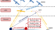
Mineral Prospectivity Prediction Based on Self-Supervised Contrastive Learning and Geochemical Data: A Case Study of the Gold Deposit in the Malanyu District, Hebei Province, China
Data-driven prospectivity modeling based on deep learning, particularly supervised learning, has demonstrated outstanding performance for mineral...

-
Robust Face Verification Using Deep Learning in Uncontrolled Environment
Face recognition in an unconstrained environment has progressively become prevalent in various applications, such as intelligent visual surveillance...
-
LEO augmented precise point positioning using real observations from two CENTISPACE™ experimental satellites
LEO augmentation systems are attracting worldwide attention. However, their performance in real-world environments has not yet been reported,...

-
Lithology identification technology of logging data based on deep learning model
Traditional machine learning models have mainly been used to study geological logging data of a single sample point, ignoring the fact that logging...
