Search
Search Results
-
Riparian Zone Assessment and Management: an Integrated Review Using Geospatial Technology
Riparian zones act as ecological engineers through stream bank stabilization, pollutant buffering, energy provision to food webs, and groundwater...
-
Re-examining Geospatial Online Participatory Tools for Environmental Planning
Geospatial online participatory tools, or geo-OPTs, are increasingly used worldwide for engaging the public in planning. Yet, despite growth in the...
-
Geospatial Analytics for Environmental Pollution Modeling Analysis, Control and Management
This book aims to provide a comprehensive study on various aspects of environmental pollution dynamics using geospatial technology and modeling...
-
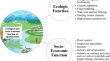
A socio-ecological and geospatial approach for evaluation of ecosystem services to communities of the Eastern Himalayan Region, India
Mountains are one of the most ecological functional areas and provide wide range of ecosystem services (ESs) to the adjoining people. However, the...

-
Geospatial technology in agroforestry: status, prospects, and constraints
Agroforestry has an indispensable role in food and livelihood security in addition to its capacity to combat the detrimental effects of climate...

-
Meteorological data source comparison—a case study in geospatial modeling of potential environmental exposure to abandoned uranium mine sites in the Navajo Nation
Meteorological (MET) data is a crucial input for environmental exposure models. While modeling exposure potential using geospatial technology is a...

-
Analytical study on the relationship among land surface temperature, land use/land cover and spectral indices using geospatial techniques
Monitoring changes in Land Use/Land Cover (LULC), spectral indices, and Land Surface Temperature (LST) can help to identify the areas at risk for...

-
Geospatial passives for dynamic vegetation monitoring around thermal power plants
As point sources of pollution, thermal power plants (TPPs) emanate hazardous gaseous and particulate matter that are of significant detriment to...

-
iGuess4ESTIMUM: A Geospatial Ecosystem Service and Urban Metabolism Platform Based on iGuess®
The iGuess4ESTIMUM platform is based on the geospatial software technology framework iGuess®, a software technology aiming at enhancing...
-
Quantifying the scale of erosion along major coastal aquifers of Pakistan using geospatial and machine learning approaches
Insufficient freshwater recharge and climate change resulted in seawater intrusion in most of the coastal aquifers in Pakistan. Coastal aquifers...

-
Geospatial Map** of COVID-19 Cases in Kerala Using Clinical Data: A Case Study from South India for Policy Advocacy
The first case of the COVID-19 pandemic in India was confirmed on 30th January 2020 in the Thrissur district of Kerala, a State along the south-west...
-
Combining Participatory Map** and Geospatial Analysis Techniques to Assess Wildfire Risk in Rural North Vietnam
Participatory map** (PM) is a valuable research tool for assessing fire risk, especially in regions where data are difficult to collect or...

-
Public Attitudes Toward Policy Instruments for Flood Risk Management
Effective flood risk management (FRM) requires a mix of policy instruments that reduces, shares, and manages flood risk. The social acceptability of...
-
Spatial analysis and predictive modeling of energy poverty: insights for policy implementation
Understanding and alleviating energy poverty is critical for sustainable development. This study harnesses a suite of Machine Learning (ML)...

-
A geospatial approach to understanding clean cooking challenges in sub-Saharan Africa
Universal clean cooking is a key target under Sustainable Development Goal (SDG) 7, with implications for several other SDGs, such as good health,...

-
Fleeing the unsustainable city: soft policy and the dual effect of social capital in hurricane evacuation
Why do citizens evacuate and where do they go once they have left disaster zones? Using Facebook data aggregated to the neighborhood level, this...

-
Towards a public policy of cities and human settlements in the 21st century
Cities and other human settlements are major contributors to climate change and are highly vulnerable to its impacts. They are also uniquely...

-
Application of Geospatial Methods in Evaluating Environmental Interventions and Related Socioeconomic Benefits
Environmental interventions underpin the Sustainable Development Goals (SDGs) and the Rio Conventions. The SDGs are integrated and embody all three...
-
Integrated seawater intrusion and groundwater quality assessment of a coastal aquifer: GALDIT, geospatial and analytical approaches
The pressure and dependence on coastal aquifers are on the rise in many parts of the globe. These lead to overexploitation, aggravated levels of...

-
Assessment of coastal vulnerability using integrated fuzzy analytical hierarchy process and geospatial technology for effective coastal management
The vulnerability of coastal regions to climate change is a growing global concern, particularly in Bangladesh, which is vulnerable to flooding and...
