Search
Search Results
-
Quantifying corn LAI using machine learning and UAV multispectral imaging
Predicting leaf area index (LAI) is essential for understanding crop growth status and water-fertilizer management. The aim of this study was to...

-
Urban Tree Species Classification Using UAV-Based Multispectral Images and LiDAR Point Clouds
Multispectral imagery and light detection and ranging (LiDAR) point clouds fused data collected from an unmanned aerial vehicle (UAV) can provide...

-
Evaluation of winter-wheat water stress with UAV-based multispectral data and ensemble learning method
AimsCombining multiple features of UAV-based multispectral images with the stacking ensemble model, to improve the feasibility and accuracy of...

-
European beech spring phenological phase prediction with UAV-derived multispectral indices and machine learning regression
Acquiring phenological event data is crucial for studying the impacts of climate change on forest dynamics and assessing the risks associated with...

-
Predictive monitoring of soil organic carbon using multispectral UAV imagery: a case study on a long-term experimental field
Effective monitoring of the soil organic carbon (SOC) content at the field scale is crucial for supporting sustainable agricultural practices. This...

-
UAV-based canopy monitoring: calibration of a multispectral sensor for green area index and nitrogen uptake across several crops
The fast and accurate provision of within-season data of green area index ( GAI ) and total N uptake ( total N ) is the basis for crop modeling and...

-
Karst vegetation coverage detection using UAV multispectral vegetation indices and machine learning algorithm
BackgroundKarst vegetation is of great significance for ecological restoration in karst areas. Vegetation Indices (VIs) are mainly related to plant...
-
Using UAV multispectral photography to discriminate plant species in a seep wetland of the Fynbos Biome
Wetlands harbour a wide range of vital ecosystems. Hence, map** wetlands is essential to conserving the ecosystems that depend on them. However,...

-
Damage Assessment Due to Wheat Lodging Using UAV-Based Multispectral and Thermal Imageries
Lodging in wheat can reduce grain output both in terms of quality and quantity. Accurate and timely assessment of lodged areas as well as a reduction...

-
Evaluation of canopy fraction-based vegetation indices, derived from multispectral UAV imagery, to map water status variability in a commercial vineyard
Water stress is a major factor affecting grapevine yield and quality. Standard methods for measuring water stress, such as midday stem water...

-
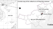
Assessing the characteristics and seasonal changes of mangrove forest in Dong Rui commune, Quang Ninh Province, Vietnam based on multispectral UAV data
Mangroves are estuarine and coastal ecosystems strongly influenced by the local tidal regime and climate, so there is a strong variation between...
-
Using UAV-based multispectral remote sensing imagery combined with DRIS method to diagnose leaf nitrogen nutrition status in a fertigated apple orchard
Monitoring plant growth information by timely and effective approaches, such as UAV remote sensing, is crucial to achieve the precise nutrient...

-
Water Quality Inversion of UAV Multispectral Data Using Machine Learning
The majority of water quality inversions rely on satellite data with poor spectral resolution. Satellite data is tougher to obtain for a specific...
-
Olive Tree Canopy Assessment Based on UAV Multispectral Images
Unmanned Aerial Vehicle (UAV) is widely used to acquire data on the biometric and spectral characteristics of olive trees through multispectral...
-
Machine learning algorithm inversion experiment and pollution analysis of water quality parameters in urban small and medium-sized rivers based on UAV multispectral data
To examine and analyze the applicability of UAV multispectral images to urban river monitoring, this paper, taking the Fuyang River in the urban area...

-
UAV-based multispectral image analytics for generating crop coefficient maps for rice
Crop coefficients are important to determine crop evapotranspiration (ET c ), seasonal crop water requirement, and irrigation water depth. Similarities...

-
A channel-gained single-model network with variable rate for multispectral image compression in UAV air-to-ground remote sensing
Unmanned aerial vehicle (UAV) air-to-ground remote sensing technology, has the advantages of long flight duration, real-time image transmission, wide...

-
Vine water status map** with multispectral UAV imagery and machine learning
Optimizing water management has become one of the biggest challenges for grapevine growers in California, especially during drought conditions....

-
Assessment of habitat for disturbance-dependent species using light detection and ranging and multispectral sensors mounted on a UAV
Recently, technological advances in UAV-mounted sensors, such as light detection and ranging (LiDAR) and multispectral sensors, have expanded the...

-
Tree-Level Evapotranspiration Estimation of Pomegranate Trees Using Lysimeter and UAV Multispectral Imagery
This chapter presents an in-depth investigation into the tree-level evapotranspiration estimation of pomegranate trees, employing a novel approach...