Search
Search Results
-
Analyzing the urban sustainable development impact of degraded visual quality on streetscape causing visual variation: a case of Dharamshala, Himachal Pradesh
In urban hill towns, the visual aspect plays a crucial role in sha** the streetscape and contributes significantly to the overall livability and...

-
Opportunities for blue carbon restoration projects in degraded agricultural land of the coastal zone in Queensland, Australia
Restoring degraded agricultural lands to their original coastal wetland cover is an approach for enhancing blue carbon storage. This approach...

-
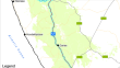
An evaluation of different approaches which use Google Street View imagery to ground truth land degradation assessments
Member states of the United Nations Convention to Combat Desertification are required to report on the proportion of land that is degraded in their...
-
Motor imagery, forward models and the cerebellum: a commentary on Rieger et al., 2023
In this commentary on Rieger et al., Psychological Research Psychologische Forschung, 2023, I discuss possible ways to test the hypothesis that...
-
Estimating high-density aboveground biomass within a complex tropical grassland using Worldview-3 imagery
A large percentage of native grassland ecosystems have been severely degraded as a result of urbanization and intensive commercial agriculture....

-
Parameters, Properties, and Process: Conditional Neural Generation of Realistic SEM Imagery Toward ML-Assisted Advanced Manufacturing
The research and development cycle of advanced manufacturing processes traditionally requires a large investment of time and resources. Experiments...

-
Murdoch and Visual Art
The years preceding Iris Murdoch’s first meeting with Harry Weinberger in 1975 prepared the ground for their fruitful friendship. Murdoch’s enduring...
-
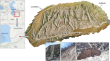
Orthorectification of Large Datasets of Multi-scale Archival Aerial Imagery: A Case Study from Türkiye
Recent research has unveiled the immense potential of orthorectifying small datasets of scanned historical aerial imagery for multi-temporal...

-
Imagery ability assessments: a cross-disciplinary systematic review and quality evaluation of psychometric properties
BackgroundOver the last two centuries, researchers developed several assessments to evaluate the multidimensional construct of imagery. However, no...
-
Enhancing Low-light Images for Monocular Visual Odometry in Challenging Lighting Conditions
Visual odometry (VO) estimates the robot’s current position based on feature matching or brightness variation between images, making it primarily...
-
Restoration of turbulence-degraded images using the modified convolutional neural network
Atmospheric turbulence can severely degrade images obtained by remote imaging systems. The most noticeable effects of atmospheric turbulence on...

-
Foundations and Characteristics of the Use of Motor Imagery and Brain–Computer Interfaces in Rehabilitation in Juvenile Cerebral Palsy
We present here an analysis of the literature on various aspects of the use of motor imagery and brain–computer interface (BCI) technologies in the...
-
Single Encoder and Decoder-Based Transformer Fusion with Deep Residual Attention for Restoration of Degraded Images and Clear Visualization in Adverse Weather Conditions
Removing adverse weather conditions from images, such as haze, fog, rain, and snowfall, is a significant issue in several scenarios. Many techniques...

-
A novel dual-step transfer framework based on domain selection and feature alignment for motor imagery decoding
In brain-computer interfaces (BCIs) based on motor imagery (MI), reducing calibration time is gradually becoming an urgent issue in practical...

-
Automated Speckle Noise Suppression from Sentinel-1A Synthetic Aperture Radar Imagery Using Adaptive Filtering Techniques
Synthetic aperture radar (SAR) imagery is formed by measuring the backscattered microwave energy to the satellite. However, it is well known that...
-
Evaluating Coastal Wetland Restoration Using Drones and High-Resolution Imagery
Coastal marsh ecosystems are changing and being lost at a rapid rate around the world. One of the fastest rates of land loss, specifically coastal...

-
VISUAL ODOMETRY FOR PRECISION LUNAR LANDING
As part of its historic 2022 mission, Intuitive Machines has developed a state-ofthe- art precision landing and hazard avoidance (PLHA) system that...
-
Use of SAR Imagery for Oil Spill Detection and Map** in Angola
Oil spills are a significant source of marine pollution worldwide and can severely impact marine ecosystems and harm human health. Furthermore, they...
-
Evaluation of Various Deep Learning Algorithms for Landslide and Sinkhole Detection from UAV Imagery in a Semi-arid Environment
Sinkholes and landslides occur due to soil collapse in different slope types, often triggered by heavy rainfall, presenting challenges in the...
-
Optical Flow as a Virtual Gyro and Altimeter for Safer Spacecraft Visual Inertial Target Approaches
A high burden lies on the autonomous onboard guidance and navigation system of spacecraft to reliably perform a given maneuver even if parts of the...
