Search
Search Results
-
Modeling of geophysical derived parameters for groundwater potential zonation using GIS-based multi-criteria conceptual model
This study modeled geophysical derived parameters and multi-critically synthesized their themes based on geospatial and analytical hierarchy...

-
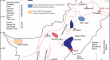
Application of geoelectrical resistivity for delineating crystalline basement aquifers in Basiri, Ado-Ekiti, Southwestern Nigeria
Delineating crystalline basement aquifers with adequate capacity to store and transmit sufficient groundwater is quite challenging as substantial...

-
Geoelectrical Resistivity and Geological Characterization of Hydrostructures for Groundwater Resource Appraisal in the Obudu Plateau, Southeastern Nigeria
Electrical resistivity tomography (ERT) and vertical electrical sounding (VES) techniques were employed to assess the hydrogeological structures and...

-
Geoelectrical and magnetic survey of Tatta Pani thermal spring: a case study from Kotli District, Jammu and Kashmir, Pakistan
AbstractThis study presents resistivity and geomagnetic surveys to identify the subsurface structure of Tatta Pani geothermal spring, Kotli, Jammu &...
-
Geophysical Researches to Detect Karst Caves in the Main Polje of Apulia
Canale di Pirro, the main polje in Apulia, extends for 12 km in the Low Murge karst area. It hosts the deepest cave in the region, reaching the depth...
-
Investigation of Groundwater Occurrences Along the Nile Valley Between South Cairo and Beni Suef, Egypt, Using Geophysical and Geodetic Techniques
Water is becoming one of the most critical strategic challenges for any country. Egypt has numerous water resources, the most notable being the Nile...

-
Assessment of groundwater aquifer using geophysical and remote sensing data on the area of Central Sinai, Egypt
The study aims to assess groundwater resources in Sinai's central area using remote sensing, geoelectric, and well-logging data, utilising techniques...

-
Hydrogeophysical investigation of aquifer parameters and seawater intrusion: a case study from Eastern Mitidja plain, Algeria
The rapid depletion of surface water due to climate change increases the world's water demand. As a result, groundwater resources are rapidly...

-
Estimation of the hydraulic parameters by using an alternative vertical electrical sounding technique: case study from semiarid Khanasser valley region, Northern Syria
Vertical electrical sounding technique (VES) is proposed as an alternative geoelectrical approach to estimate the hydraulic conductivity and...

-
A review on the use of geoelectrical methods for characterization and monitoring of contaminant plumes
Geophysical characterization of contaminated sites is an important procedure in pre- and post-site remediation. It has been carried out in several...

-
Contribution of Geophysical and Borehole Data in the Study of the Geological Structures of the Gantour Plateau and Bahira Basin (Morocco)
Geophysical methods and geological investigations are efficient techniques for studying the geological structures of the sedimentary basins (Jaffal...
-
Geoelectrical characterisation of CO2–water systems in porous media: application to carbon sequestration
Carbon sequestration is a promising method for the reduction of carbon dioxide (CO 2 ) emissions as it permits the storage of compressed CO 2 in the...

-
Analysis of Geoelectric Data Through Machine Learning Algorithms for Waste Leachate Detection
Electrical resistivity tomography (ERT) is an effective method for detecting the leachate plume due to the plume's very low resistivity values....
-
Hydrogeochemical status and geoelectrical characteristics of the shallow aquifers of Kalanad Basin, Kasaragod, Kerala, India
Groundwater demand has increased due to overpopulation and intensive irrigation which resulted in decline of water resources and deterioration of...

-
Geoelectrical characterisation of aquifers in Bauchi-Alkaleri-Kirfi geological transition zones, Northeast Nigeria
Geological transition zones (GTZ) have proved to be hydrogeologically problematic, owing to poorly defined basal and lateral contacts between the...
-
Integrated geophysical and hydrogeochemical characterization of groundwater vulnerability conditions in part of Ikom-Mamfe Embayment, southeastern Nigeria
The shallow groundwater resource within the Ikom-Mamfe Embayment has been under serious threats from anthropogenic contaminants, carbonate and...

-
Hydrogeological, geophysical, geochemical and statistical integrated techniques to assess a multilayered groundwater aquifer system in an arid region: the case of the Sbeitla aquifers in Central Tunisia
This study focuses on the hydrogeological conditions and the hydrodynamic process controlling the sandy Miocene aquifer system in the Sbeitla basin,...

-
Integrated application of geophysical methods in Earth dam monitoring
Given the mounting apprehension surrounding the recurrence of incidents involving accidents and the failure of earthen dams in the past two decades,...

-
A review of open software resources in python for electrical resistivity modelling
Geophysical modelling performs to obtain subsurface structures in agreement with measured data. Freeware algorithms for geoelectrical data inversion...

-
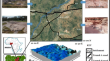
Understanding the quality and potential of groundwater for human purposes and peat fire disaster mitigation
Issues related to groundwater sources in peat coastal areas are very complex. These include sea water intrusion and the quality of the groundwater...
