Search
Search Results
-
Welcome to the Geoportal of Satellite Radiothermovision
As shown in the previous chapters, the approach of satellite radiothermovision is without limitation applicable to the study of various mesoscale and...
-
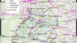
Geography and Geoecology of Russia in the Mosaic of River Basins
AbstractFor the first time, an electronic vector map of small river basins and their interfluves with a regional level of spatial detail (1 :...
-
Academic Atlas Map**: Structural and Semiotic Analysis of the Main Results of Russian–Mongolian Cooperation
AbstractThis article presents the main results of the joint academic atlas map** of the transboundary Baikal region obtained by the Sochava...

-
Von Bildungsquellen, Wissensströmen und Datenfluten
Die digitale Wissensgesellschaft erfordert einen reflektierten Umgang mit zahlreichen Informationen und Angeboten. Offene Lehr-Lern-Gemeinschaften...
-
Introducing Digital Technologies to Forest Monitoring in the Baikal Natural Territory
AbstractCharacteristic features of the Baikal natural territory (BNT) are analyzed and the problems of forest monitoring are highlighted. An approach...

-
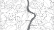
Development of River Atlas Using Space and Ground-Based Inputs for Brahmaputra and Barak Valleys in Assam, India
The Brahmaputra and Barak basins regularly face the problems of flooding and riverbank erosion. Better management of water resources in this region...
-
Some Results and Prospects of Landscape Map** of Russia
AbstractLandscape maps of Russia at various scales, including individual cartographic products, maps in scientific papers, and comprehensive...
-
Real Estate Property and Cadaster: The Impact of New Map** Techniques on Land Management and Planning in Greece
Develo** a sound land administration system is not a standard recipe to be globally applied. It must take into consideration the country-specific...
-
Performance-Based Site Selection of Nature-Based Solutions: Applying the Curve Number Model to High-Resolution Layers to Steer Better Greening Strategies
Urbanisation and consequential soil sealing are primary sources of urban vulnerability towards extreme water-related events, which will be even more...
-
Urban Safety and Resilience: Agent-Based Modelling Simulations for Pre-disaster Planning
One of the issues that today’s urban planner is probably called upon to question is the ability to succeed in sha** a dynamic approach to be able...
-
Wolin Island–Outstanding Geodiversity on the Polish Coast
Wolin, the only large island in Poland, is a unique place on the map of geodiversityGeodiversity of Poland. Quaternary glacial and fluvioglacial...
-
Fächerübergreifend lernen
Raum-zeitliche Interdisziplinarität wird im neuen Deutschschweizer Lehrplan 21 im Integrationsfach Natur-Mensch-Gesellschaft (NMG) auf der...
-
German and European Ground Motion Service: a Comparison
Since the end of 2022, two ground motion services that cover the complete area of Germany are available as web services: the German Ground Motion...
-
Long-Term Evolution of the Shoreline of the South Lazio Region (Italy) Littoral Cell by Combining Historical Aerial Photography and Satellite Imagery
Historical maps, aerial photos, and satellite images are often used to investigate coastal area conditions and their historical evolution, in terms...
-
Advanced Technological Approach for Risk Mitigation and Land Protection: The SICURA Project
The SICURA project: Smart House of Security Technology, aims to catalyze new business models driven by 5G technology, focusing on enhancing the...
-
Mit WebGIS und digitalen Geowerkzeugen Fach- und Medienkompetenzen für das 21. Jahrhundert entwickeln
WebGIS-Anwendungen gehören mittlerweile in allen gesellschaftlichen und wirtschaftlichen Bereichen, in denen Geodaten genutzt werden, zum Standard...
-
Effects of spatial configuration on the patient’s journey to the Emergency Department
Reaching the destination, users often encounter complex interfaces created between hospital spaces and the urban tissue. The literature highlights...

-
Geodaten in multimedialen Produkten realisieren
Lernfeld 9 behandelt die digitale Bearbeitung von Geodaten und die Bereitstellung der daraus entstandenen digitalen Geoprodukte. Der Bereich...
-
Baseline determination, pollution source and ecological risk of heavy metals in surface sediments of the Amu Darya Basin, Central Asia
Central Asia (CA) is one of the most fragile regions worldwide owing to arid climate and accumulated human activities, and is a global hotspot due to...
-
Open Map** with Official Cartographies in the Americas
Governments need data to be effective and accountable to the SDGs. Spatial data are key to meeting these goals, and youth open map** represents one...