Search
Search Results
-
The use of linear smoothing methods to remove artefacts resulting from the seabed’s DTM lossy compression
The article describes research on the use of local linear smoothing methods to remove artefacts resulting from the lossy compression of seabed’s...

-
Technology and Use of Lithic Raw Materials from the Delta of the Paraná River and the Interior of the Province of Entre Ríos, Argentina. Preliminary Results of the Application of Micro-wear Analysis
This paper presents the first results of the technological and functional analysis of some lithic assemblages from archaeological sites located in...
-
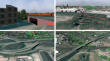
Automatically Evaluating the Service Quality of Bicycle Paths Based on Semantic 3D City Models
The growing demand for sustainable mobility has led to an increased focus on the development and improvement of bicycle infrastructure, especially...
-
Virtual Reality Experience Analysis from Point Cloud Data
This study explores the implementation of point cloud visualization in virtual reality environments to evaluate immersion based on point cloud...
-
Geometric Feedback System for Robotic Spraying
In this paper, we tackle the task of replacing labor intensive and repetitive manual inspection of sprayed concrete elements with a sensor-based and...

-
Automatic Landform Recognition, Extraction, and Classification using Kernel Pattern Modeling
Detection of terrain features more quickly and accurately is crucial in geosciences for the extracting and classifying landforms. Part of the local...

-
Landscape Structure as the Regulator of the Siberian Stone Pine Growth Dynamics in the Northern Taiga of Western Siberia
AbstractThis paper presents the results of studies aimed at identifying statistical relationships between the landscape structure and variability in...

-
Performance Assessment of Spatial Interpolation Methods for the Estimation of Atmospheric Carbon Dioxide in the Wider Geographic Extent
Spatially continuous observed atmospheric carbon dioxide (CO 2 ) is necessary to validate spatially resolved emission inventory and measure policy...

-
3D Reconstruction of Bridges from Airborne Laser Scanning Data and Cadastral Footprints
The given paper describes a method for automatic 3D reconstruction of bridges from cadastral footprints and airborne laser scanning point clouds. The...
-
Inverse distance weighting method optimization in the process of digital terrain model creation based on data collected from a multibeam echosounder
This paper presents the optimization of the inverse distance weighting method (IDW) in the process of creating a digital terrain model (DTM) of the...

-
Dynamic 3D-Cartographic Symbols for VR Geovisualizations
Geovisualizations that use a virtual reality headset can have a more immersive effect on users than when only a desktop application is viewed....

-
Combining terrestrial, marine, and satellite gravity data to compute gravity potential values at IHRF stations
In 2015, the International Association of Geodesy published a resolution on the International Height Reference System definition. It is defined that...
-
Modeling and Predicting Influenza Circulations Using Earth Observing Data
Influenza is a common respiratory disease which causes significant mortality and morbidity. In the USA alone, the annual economic burden is nearly...
-
Geospatial Techniques and Methods for Sustainability in Agricultural Management
The role of high resolution geospatial techniques is increasingly recognized as key for managing inputs and making technical decisions in agriculture...
-
A Cloud Framework for High Spatial Resolution Soil Moisture Map** from Radar and Optical Satellite Imageries
Soil moisture plays an important role in crop yield estimation, irrigation management, etc. Remote sensing technology has potential for large-scale...
-
Guiding Deep Learning with Expert Knowledge for Dense Stereo Matching
Dense depth information can be reconstructed from stereo images using conventional hand-crafted as well as deep learning-based approaches. While...

-
Road Surface Reconstruction by Stereo Vision
This paper covers the problem of road surface reconstruction by stereo vision with cameras placed behind the windshield of a moving vehicle. An...

-
GIS, Geostatistics, and Machine Learning in Medical Geology
Geographical information system (GIS) is gaining its popularity beyond geography and information technology (IT) with its strong power in managing...
-
Automatic non-destructive UAV-based structural health monitoring of steel container cranes
Container cranes are of key importance for maritime cargo transportation. The uninterrupted and all-day operation of these container cranes, which...

-
Remote Sensing and Digital Image Processing
Obtaining information with the help of remote sensing systems deployed on aircraft, on satellites and increasingly also on drones (UAVs, unmanned...