Search
Search Results
-
Soils of Floodplain Landscapes of the River Selenga Basin
AbstractThe factors of formation and patterns of spatial differentiation of soils within the floodplain landscapes of the River Selenga and its...
-
Floodplain Soils of the Closed Uldz–Torei Basin (Mongolia)
AbstractData on the diversity; morphological structure; and physical, chemical, and agrochemical properties of soils within the Uldz River floodplain...

-
Integrating social and ecological considerations in floodplain relocation and restoration programs
In the United States, most floodplain relocation (or buyout) programs focus on moving homeowners, then deal separately with what happens with the...

-
Unique Floodplain and Aeolian Landforms: Záhorská Nížina Lowland
Extensive braiding and voluminous deposition of gravelly sands and sands of the Lower Morava river was due to significant loss of gradient and rock...
-
Point-Cloud Technology for Coastal and Floodplain Geomorphology
This chapter starts the section of applications of pointcloud technologies in geomorphology, and as this section starts at the shore, going up the...
-
The Danube Floodplain National Park: A Fluvial Landscape with Expiration Date?
Situated between the European capitals Vienna and Bratislava in the Vienna Basin, the Danube Floodplain National Park covers one of the largest...
-
Priority sites and conservation gaps of wintering waterbirds in the Yangtze River floodplain
The Yangtze River floodplain is critical for migratory waterbirds along the East Asian-Australasian Flyway (EAAF). Greater awareness of its global...
-
Geomorphic control on wetland classification: a case study in Himalayan Floodplain region
Wetland classification is the primary tool to identify and determine wetland landscapes, but it seems to be very difficult as wetlands are the...

-
The Chobe-Zambezi Channel-Floodplain System: Anatomy of a Wetland in a Dryland
In this chapter, the ChobeChobe-ZambeziZambezi channelChannel-floodplainFloodplain system is defined as the fluvially influenced area that is located...
-
Quantifying and assessing land use and land cover changes around the critical waterbodies — a case study of Bhagirathi-Hooghly floodplain, East India
The study strictly inclined to the Land Use and Land Cover (LULC) change map** and assessing, surrounding and inside the abandoned natural river...

-
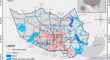
Enhancing Flood Risk Analysis in Harris County: Integrating Flood Susceptibility and Social Vulnerability Map**
Due to climate change, the frequency and intensity of floods have dramatically increased worldwide. The innate social inequality has been exposed and...
-
The Niger Delta Region
The Niger DeltaNiger Delta is the largest in Africa and the third-largest in the world, with a total area of 112,106 km2. The region has the largest...
-
Structure, Age, and Formation Stages of the First River Terraces in the Selenga Drainage Basin
AbstractNew and generalized published data on the structure, age, and formation stages of deposits of the mantle and alluvial genetic complexes of...

-
Geographical Patterns of River Channel Meandering in Russia
AbstractA geographical analysis of the manifestation of various forms of meandering of river flows and conditions for the occurrence of bends of...

-
Using LiDAR-DEM based rapid flood inundation modelling framework to map floodplain inundation extent and depth
Map** floods is important for policy makers to make timely decisions in regards to emergency responses and future planning. It is therefore crucial...
-
The Valley of Anastomosing Narew River (NE Poland)—A Unique Fluvial Landscape of the European Lowlands
There are three basic types of rivers in the world. Apart from the frequent meandering and braided rivers, the anastomosing river type is one of the...
-
Environmental Changes and Human Impacts on Landscapes near Medieval Steklyanukha-2 Fortress in Russia from Early Iron Age to Modern Times
The development of landscapes in one of the most populated river basins of the southern Russian Far East was studied using pollen and diatom data....
-
Growing impacts of low-flow events on vegetation dynamics in hydrologically connected wetlands downstream Yangtze River Basin after the operation of the Three Gorges Dam
Wetland vegetation is intimately related to floodplain inundations, which can be seriously affected by dam operation. Poyang Lake is the largest...
-
Assessing the Geoecological Status of the Floodplain-Terrace Complex of the Tuul River Within Ulaanbaatar (Mongolia)
The paper gives characteristics of natural and anthropogenic factors responsible for the geoecological situation inside the boundaries of the...
-
Relict Floodplain Forests as a Refuge for Rare and Protected Species Within the City
Urbanization can have a deteriorating effect on the ecology of an area. However, small green areas can have an important value as a refuge for rare...