Search
Search Results
-
Dryland Social-Ecological Systems in Africa
In Africa, dryland ecosystem is the largest biome complex, covering 60% of the continent and home to ~525 million people. Coupled with adverse...
-
Framing the Complexities of Chinese Investments in Africa
China-Africa relations have become an increasingly important subject in scholarly work as well as for policymakers. While dating back to the colonial...
-
Evolution and influencing factors of the transnational investment network of China—Africa international cooperation parks
Based on development data relating to China-Africa International Cooperation Parks (CAICPs) from 2003 to 2018, this study examined the transnational...
-
South Africa
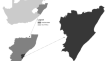
South Africa is prone to drought. The country recently experienced the combined effects of a severe drought and a strong El Niño event, which led to...
-
Chinese Investment in Africa Its Variegated and Contradictory Character in Relation to Land, Agriculture, Mining and Infrastructure
This edited volume systematically interrogates the Chinese investment presence in Africa, focusing on land and agriculture, mining and other...
-
Achievements and Challenges of Geographical Research in Africa
In 2017, the International Geographical Commission on African Studies was established based on the need to promote geographical research on Africa by...
-
Distribution patterns of fire regime in the Pendjari Biosphere Reserve, West Africa
Pendjari Biosphere Reserve (PBR), a primary component of the W-Arly-Pendjari transboundary biosphere reserve, represents the largest intact wild...
-
Health Geography in Sub-Saharan Africa
Health geography is concerned with understanding how space and place pattern the health and well-being of populations―based on a recognition of the...
-
Power Grid Map** in West Africa
YouthMappers helps to map fundamental features of rural communities across the countryside of Sierra Leone as an innovative model for how to bring...
-
Comparison between orthometric, normal and spheroidal orthometric heights over South Africa
This study has been carried out to estimate the differences between spheroidal orthometric, orthometric and normal heights at 141 GPS/levelling...

-
Geospatial Analysis of Tungiasis Disease Transmission Risk in East Africa
Tungiasis is a cutaneous parasitic disease caused by the flea Tunga penetrans. The disease has a broad geographic range throughout tropical and...
-
Cadmium exposure experiments on calanoid copepods reveal significant shortfall in water quality criteria for managing coastal marine ecosystems in West Africa
Coastal marine waters in the Gulf of Guinea are severely affected by heavy metal pollution, particularly from small scale mining activities around...

-
Is eThekwini metropolitan municipality (EMM) experiencing light pollution?: A remote sensing analysis of nighttime data of EMM, South Africa
Nighttime light remote (NTL) sensing has improved the approaches taken in studying natural and social sciences. NTLs on the Earth surface can be...
-
Integrating random forest and synthetic aperture radar improves the estimation and monitoring of woody cover in indigenous forests of South Africa
Woody canopy cover (CC) is important for characterising terrestrial ecosystems and understanding vegetation dynamics. The lack of accurate...

-
Land use change and its influencing factors along railways in Africa: A case study of the Ethiopian section of the Addis Ababa–Djibouti Railway
Railways are a crucial part of the African transport network and have a significant impact on the socio-economy and urban development. Previous...
-
Health and Medical Geography in Africa Methods, Applications and Development Linkages
This contributed volume focuses on the evolution and current state of the sub-discipline of health and medical geography in Africa. It encompasses...

-
Philosophy, Questions and Methods in Health and Medical Geography in Africa
This chapter discusses the prevailing paradigms in the practice of health and medical geography in Africa. It focuses on the philosophical...
-
Assessing YouthMappers Contributions to the Generation of Open Geospatial Data in Africa
As leaders of tomorrow, we, the African YouthMappers, are taking the initiative of contributing toward the attainment of the Sustainable Development...
-
Climate change and coastal population dynamics in Togo (West Africa)
Global warming is a worldwide phenomenon. Some of the consequences are ocean warming, melting glaciers, sea levels rising and coastal erosion. One of...

-
Examining similarity indicators in six planned capital cities from Africa and Asia: a qualitative research technique
There is little research-based evidence regarding the similarities and differences in urban plans and urban forms, regarding urban planning and...
