Search
Search Results
-
Open-Source Satellite Repository and Geographic Information System (GIS) for Soil Resource Map**
To get the most out of geographical data, people are being encouraged to use open-sourceOpen-source data and softwareSoftware. Freely available...
-
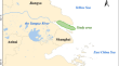
Distinguishing the determinative landscape factors influencing the spatial variation of soil quality in Chongming Island, China
Soil quality of coastal wetlands plays an important role in maintaining biological productivity, improving environmental quality, and promoting plant...
-
Application of Remote Sensing and GIS Techniques in Assessment of Salt Affected Soils for Management in Large Scale Soil Survey
Salt-affected soils are most common land degradation processes in arid and semi-arid regions, where evaporation exceeds precipitation. Under such...
-
Pedogeography of Bosnia and Herzegovina
Following the classification system of soils in Bosnia and Herzegovina, the genetic-evolutionary principle of classification of soil types is...
-
Phytoremediation of Arsenic Polluted Soil by Brassica Nigra L.
Pollution caused by heavy metals is a prime environmental issue around the world. Among many heavy metals, arsenic (As) is one which has more toxic...
-
Spatio-temporal variation prediction on Cd content in the rice grains from Northern Zhejiang Plain during 2014–2019 based on high-precision soil geochemical data
In recent years, Cadmium (Cd) pollution has been found in many soil geochemical surveys in Northern Zhejiang Plain, a crucial rice production area in...
-
Pedological Characteristics of Montenegro
Speleology is a cross-disciplinary field that studies caves and other karst features, as well as their structure, physical properties, history, life...
-
The Response of Vegetation Biomass to Soil Properties along Degradation Gradients of Alpine Meadow at Zoige Plateau
Alpine grassland of the Tibetan Plateau has undergone severe degradation, even desertification. However, several questions remain to be answered,...
-
The Methodological Approaches in Physical Geography
Physical geography is the branch of natural science which deals with the study of processes and patterns in the natural environment such as the...
-
Performance of Rice-Lentil Crop** Under Different Tillage Influencing Soil Suppressiveness: A Short Term Approach
Due to causal agents hidden status soil borne pathogens control are difficult. 10–20% annually crop yield losses, because of soil borne pathogen...
-
Grazing alters sandy soil greenhouse gas emissions in a sand-binding area of the Hobq Desert, China
Deserts are sensitive to environmental changes caused by human interference and are prone to degradation. Revegetation can promote the reversal of...
-
Effects of vegetation near-soil-surface factors on runoff and sediment reduction in typical grasslands on the Loess Plateau, China
Vegetation near-soil-surface factors can protect topsoil from erosion, however, their contributions to the reduction of soil erosion, especially...
-
Floodplain Soils of the Closed Uldz–Torei Basin (Mongolia)
AbstractData on the diversity; morphological structure; and physical, chemical, and agrochemical properties of soils within the Uldz River floodplain...

-
Changes in diversity, composition and assembly processes of soil microbial communities during Robinia pseudoacacia L. restoration on the Loess Plateau, China
Robinia pseudoacacia L. (RP) restoration has increased vegetation cover in semi-arid regions on the Loess Plateau of China, but ecological problems...
-
Aggregate binding agents improve soil aggregate stability in Robinia pseudoacacia forests along a climatic gradient on the Loess Plateau, China
The distribution of binding agents (i.e., soil organic carbon (SOC) and glomalin-related soil protein (GRSP)) in soil aggregates was influenced by...
-
Effects of land use patterns on slope soil water in the semiarid Loess Plateau, China
Land use patterns (LUPs) are the form in which various land use types are combined spatially, evidently impacting soil water. However, the influence...
-
Effect of landforms and vegetations on pedological variability and crop yield along the toposequence of Eastern Coastal Plain of Odisha, India
Topography and vegetation have a significant role in soil development in different ecosystems. Interactions between soil and landforms help to...

-
Spatial Pattern Analysis and Identifying Soil Pollution Hotspots Using Local Moran's I and GIS at a Regional Scale in Northeast of Iran
The spatial distribution of soil physicochemical characteristics and four heavy metalsHeavy metals (Mn, Fe, Zn, and Cu) in the semi-arid climatic...
-
Cultivation effects on soil texture and fertility in an arid desert region of northwestern China
In arid desert regions of northwestern China, reclamation and subsequent irrigated cultivation have become effective ways to prevent desertification,...
-
A Modified Temperature-Vegetation Dryness Index (MTVDI) for Assessment of Surface Soil Moisture Based on MODIS Data
Spatio-temporal dynamic monitoring of soil moisture is highly important to management of agricultural and vegetation ecosystems. The...