Search
Search Results
-
Remote Sensing
Remote sensing has always been an important component in the river and lake ice toolbox. Remote sensing gathers information regarding the earth’s...
-
UAV and satellite remote sensing for inland water quality assessments: a literature review
High spatial and temporal resolution data is crucial to comprehend the dynamics of water quality fully, support informed decision-making, and allow...

-
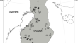
Detecting Spatial Patterns of Peatland Greenhouse Gas Sinks and Sources with Geospatial Environmental and Remote Sensing Data
Peatlands play a key role in the circulation of the main greenhouse gases (GHG) – methane (CH 4 ), carbon dioxide (CO 2 ), and nitrous oxide (N 2 O)....
-
Improving lake chlorophyll-a interpreting accuracy by combining spectral and texture features of remote sensing
Cyanobacterial blooms in lakes fueled by increasing eutrophication have garnered global attention, and high-precision remote sensing retrieval of...

-
Continuous Cover Forestry and Remote Sensing: A Review of Knowledge Gaps, Challenges, and Potential Directions
Purpose of ReviewContinuous cover forestry (CCF) is a sustainable management approach for forestry in which forest stands are manipulated to create...
-
Remote sensing algorithm for retrieving global-scale sea surface solar irradiance
This paper presents a new remote sensing (RS) algorithm for retrieving instantaneous sea surface solar irradiance (SR) by using the XGBoost (XGB)...

-
Remote sensing for map** algal blooms in freshwater lakes: a review
A large number of freshwater lakes around the world show recurring harmful algal blooms, particularly cyanobacterial blooms, that affect public...

-
Determining Changes in Mangrove Cover Using Remote Sensing with Landsat Images: a Review
Mangroves are ecosystems within the intertidal zone of tropical and subtropical coasts; they offer ecosystem services such as protection from coastal...
-
Challenges for monitoring artificial turf expansion with satellite remote sensing
Urban green spaces are central components of urban ecosystems, providing refuge for wildlife while hel** ‘future proof’ cities against climate...

-
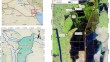
Use of remote sensing techniques to assess water storage variations and flood-related inflows for the Hawizeh wetland
High spatial and temporal resolution remote sensing data are becoming readily available. This has made the use of remote sensing to monitor and...
-
The role of remote sensing in tropical grassland nutrient estimation: a review
The carbon ( C ) and nitrogen ( N ) ratio is a key indicator of nutrient utilization and limitations in rangelands. To understand the distribution of...
-
Thermal Infrared Remote Sensing of Stress Responses in Forest Environments: a Review of Developments, Challenges, and Opportunities
Purpose of ReviewThe successful application of thermal infrared (TIR) remote sensing in the agricultural domain, largely driven by the arrival of new...

-
Map** soil trace metal distribution using remote sensing and multivariate analysis
Trace metal soil contamination poses significant risks to human health and ecosystems, necessitating thorough investigation and management...
-
Application and recent progress of inland water monitoring using remote sensing techniques
Hyperspectral remote sensing, which retrieves the water quality parameters by direct high-resolution analysis of the electromagnetic spectrum...

-
Applications of remote sensing vis-à-vis machine learning in air quality monitoring and modelling: a review
Environmental contamination especially air pollution is an exponentially growing menace requiring immediate attention, as it lingers on with the...

-
Large-scale automatic extraction of agricultural greenhouses based on high-resolution remote sensing and deep learning technologies
Widely used agricultural greenhouses are critical in the development of facility agriculture because of not only their huge capacity in food and...

-
Water optical properties over or around coral reefs in the coastal region: implications for coral reef remote sensing
Coral reefs inhabit clear oceanic-type waters to turbid coastal regimes. For shallow coastal water environments, the coral reefs from remote sensing...

-
Integrating local ecological knowledge and remote sensing reveals patterns and drivers of forest cover change: North Korea as a case study
Satellite-based remote sensing approaches provide a cost-efficient means to collect information on the world’s forests and to repeatedly survey...

-
Role of Remote Sensing and GIS Applications in River-Related Studies: A Review
This study delves into the application of remote sensing and GIS in river-related research. Its primary aims are twofold: firstly, to identify the...
-
Assessing methane emissions from paddy fields through environmental and UAV remote sensing variables
Concerns about methane (CH 4 ) emissions from rice, a staple sustaining over 3.5 billion people globally, are heightened due to its status as the...
