Search
Search Results
-
Diagnosis Strategy and Application of Abnormal Partial Discharge Alarm in UHV GIS
GIS (gas insulated switchgear) is the key equipment in UHV transmission system, which plays the role of removing power system faults and changing...
-
Develo** a New Model for Ecological Capability Evaluation of Irrigated Agriculture Using GIS in Sepidan Township, Iran
Agricultural planning is a critical task that requires assessing numerous factors ranging from soil and terrain to socioeconomic markets and...
-
Tsunami Vulnerability Assessment and Multi-Criteria Decision Making Analysis of Eastern Coast of India Using GIS-Based Tools
The marine environment is a vital resource that sustains many people and a variety of ecosystems rich in biodiversity. However, coastal resources and...
-
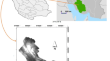
Prediction of debris flow initiation points using high resolution DEM and GIS analysis in South Korea
This study presents a GIS analysis model that utilizes high-resolution Digital Elevation Map data to predict the initiation points of debris flow...

-
Analysis of Morphometric Parameters of Watershed Using GIS
Watershed management is the study for sustainable development of water bodies as well as land in the watershed region. Morphometric parameters of...
-
Calculation of Temperature Field of GIS Disconnect Switches Considering Contact Resistance
Gas Insulated Switchgear is an important device in power systems and is widely used in power systems. However, this equipment is prone to internal...
-
Research on Great Wall section protection and user VR experience innovation based on GIS data visualization
VR technology can enable users to be in a realistic virtual environment, thus bringing them an immersive experience. It has great charm and can...

-
Wetland park environmental data monitoring based on GIS high resolution images and machine learning
High-resolution remote sensing images not only improve the processing quality of image information, but also become more effective, accurate, and...
-
Application of GIS image system and remote sensing technology in physical geography land planning
Physical geography is the foundation of urban social and economic development. The quantity and quality of land resources and their distribution...

-
Simulation Study on Electric Field Variation Under Metal Tip Defects in GIS Chamber
Metal tip defects are typical insulation defects in gas insulated switchgear (GIS), which can distort the electric field in the GIS chamber, thus...
-
Online Diagnosis for Mechanical Faults in GIS Disconnector with Residual Voltages of VFTO
The mechanical performance of the isolating switch in gas insulated switchgear (GIS) is crucial to the safety of the power grid, but existing methods...
-
Partial Discharge Pattern Recognition of High Voltage GIS Defects by Using GWO-SVM Method
This paper focuses on partial discharges (PD) pattern recognition of typical GIS defects by UHF sensor detection and intelligence fault algorithm. 4...
-
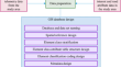
Municipal Solid Waste Management: A Case Study Utilizing DES and GIS
This research aims to compare two well-known solution methodologies, namely Geographical Information Systems (GIS) and Discrete Event Simulation...
-
Condition Monitoring of GIS for Flexible Multi-state Switch Based on SWT-KPCA
GIS is one of the essential primary equipment for Flexible Multi-state Switch (FMS), which is important for the secure and stable power supply for...
-
Develo** an Integrated BIM+GIS Web-Based Platform for a Mega Construction Project
Construction projects are usually characterised by their large scale, complicated technologies, long periods of time to complete, and challenging...
-
GIS Equipment Abnormal Noise Diagnosis Technology Based on Acoustic Imaging and Its Field Application
In order to obtain the acoustic imaging characteristics of typical defects caused by partial discharge and mechanical looseness of GIS equipment,...
-
Fast Calculation of the Impedence Using Tensor-Based FEM for Evaluating Very Fast Transient Overvoltage in GIS
To solve the VFTO in GIS, it is necessary to perform the earth and GIS interconnection system, and then calculate the impedance to earth. The GIS...
-
Geographical Information System (GIS)-Based Solar Photovoltaic Farm Site Suitability Using Multi-criteria Approach (MCA) in Southern Tamilnadu, India
Tamil Nadu is the eleventh largest state by area and it constitutes 9% of the total installed electricity generation capacity of India which is...

-
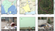
Identification of potential landfill site suitability for urban solid waste disposal of Balurghat Municipality of Dakshin Dinajpur District using GIS and multi-criteria decision-making approach
The production of urban solid waste is one of the most dangerous environmental health risks on the planet. By selecting suitable landfill sites, it...
-
Validity Analysis of GIS Equipment Status Quantity with Voltage Level of 500 kV and Above
In order to effectively improve the efficiency of GIS equipment condition maintenance, it is necessary to accurately evaluate its health status, and...