Search
Search Results
-
Spatial differentiation and dynamic mechanism of micro-geomorphology based on acoustic spectrum data of the Huanghe (Yellow) River Delta
Submarine micro-geomorphology is a geo-morphological type occurring in shallow and surface areas of seabed. The combined relationships and...
-
Utilization of LiDAR DTM for Systematic Improvement in Map** and Classification of Coastal Micro-Geomorphology
The dynamicity of the coastal landforms necessitates monitoring from space-borne or aerial remote sensing platforms. Precise elevation information is...
-
An Integrated Geohydrology and Geomorphology Based Subsurface Solid Modelling for Site Suitability of Artificial Groundwater Recharge: Bhalki Micro-watershed, Karnataka
The groundwater resources of basaltic terrains in peninsular India are decreasing rapidly, due to indiscriminate extraction without considering the...
-
Identification of Groundwater Potential Zone in Poondi Micro-watershed, Thiruvallur, Tamil Nadu
Water is essential for all living organisms, but in recent years groundwater is declining due to various manmade activities. The rainwater received...
-
Changes in organic matter properties and carbon chemical stability in surface soils associated with changing vegetation communities in permafrost peatlands
The organic matter (OM) properties of peat soils play an important role in maintaining the stability of the peatland carbon pool and carbon cycling...

-
The paleoclimatic environment reconstruction of Lop Nur in NW China in UAV spectroscopy
The change in the ecological environment in the arid core area is a critical issue in the context of global warming. To study the paleoclimate...
-
Sedimentary characteristics and depositional evolution of carbonate platform during the Cambrian and Ordovician in eastern Tarim Basin, NW China
The eastern Tarim Basin (Tadong Area) has gained wide attentions on large-scale marine carbonate reservoirs in Cambrian-Ordovician due to significant...
-
Sedimentology, geochemistry, and geomorphology of a dry-lake playa, NE Iran: implications for paleoenvironment
This study aims to investigate Sabzevar playa in the northeast of the Great Kavir in terms of geomorphology, bulk and clay mineralogy, as well as the...

-
Integrated passive and active seismic profiling for detection of buried faults: a case study at the north end of the Miryang Fault in the Geoncheon Valley, southeastern Korean Peninsula
We present the results of seismic profiling aimed to characterize the structure of shallow formation in the Geoncheon Valley (GCV), an area we...
-
Morphotectonic analysis of petroliferous Barmer rift basin (Rajasthan, India)
AbstractGeomorphologic studies can set important constraints on the petroleum geosciences of sedimentary basins. In the western Rajasthan area of...

-
Side-scan Sonar and Sub-bottom Profiler Surveying
Side-scan sonar and sub-bottom profiler are two types of equipment commonly used in submarine geomorphological exploration. Side-scan sonar is...
-
Geological heritage and geotourism potential of Udaipur region, Rajasthan, India
The Rajasthan state of India is always been a region of diversity in its geology, geomorphology, flora, fauna, ethnology, history, civilization,...

-

-
Delineation of the Groundwater Potential Zones of Upper Tigris Diyarbakır Sub-basin in Turkey Using GIS and Analytical Hierarchical Process (AHP) Techniques
With its water resources and agricultural activities, the Diyarbakir basin is considered as an important field not only in Turkey but also in the...
-
Peak extraction and classification from digital elevation models based on the relationship between morphological characteristics and spatial position
A peak is an important topographic feature crucial in quantitative geomorphic feature analysis, digital geomorphological map**, and other fields....
-
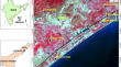
Indicator Based Approach and Geospatial Technology for Coastal Vulnerability Assessment along Chennai District Coast, Tamil Nadu State, India
Coastlines are dynamic in nature and always work in the favor of maintaining the natural equilibrium. Coastal areas have the most diverse ecosystem...

-
Prediction and significance of intra-platform shoals distribution of Changxing formation in Gaoshiti area of Sichuan Basin
In view of the unclear understanding of the development and distribution characteristics of the intra-platform shoal of the Changxing formation in...

-
Landslide Susceptibility Analysis by Frequency Ratio Model and Analytical Hierarchical Process in Mirik and Kurseong, Darjeeling Himalaya, India
Landslide is a common phenomenon in the hilly region. The Himalayan region the one of the best examples of this type of landslide-prone region....
-
Spatial and decision-making approaches for identifying groundwater potential zones: a review
Effective assessment of any region's groundwater resources depends greatly on the levels of the sub-surface water. Since groundwater resources are...

-
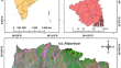
Optimization of conditioning factors for groundwater potential zonation using GIS-based single parameter and map removal sensitivity analysis in Alipurduar district of West Bengal, India
Groundwater potential zonation is crucial for sustainable groundwater resource management, especially in regions with high groundwater demand. This...