Search
Search Results
-
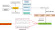
Analysis on the station-based and grid- based integration for dynamic-statistic combined predictions
Summer precipitation prediction in China is important to society and economic development, but still a challenging issue in current meteorological...

-
INS-aiding information error modeling in GNSS/INS ultra-tight integration
In the ultra-tight integration system of the global navigation satellite system/ inertial navigation system (GNSS/INS), the error models of INS...

-
Multiscalar Integration of Dense and Sparse Spatial Data: an Archaeological Case Study with Magnetometry and Geochemistry
Integration of different kinds of data is an important issue in archaeological prospection. However, the current methodological approaches are...

-
Integrated framework for geological modeling: integration of data, knowledge, and methods
Three-dimensional (3D) geological modeling from limited and scattered information is essential for engineering geological investigation and design....

-
Improving GNSS carrier phase tracking using a long coherent integration architecture
High-sensitivity carrier phase tracking is essential for new GNSS high-precision applications such as unmanned vehicles and smartphones. Increasing...

-
Kalman filter-based integration of GNSS and InSAR observations for local nonlinear strong deformations
The continuous monitoring of ground deformations can be provided by various methods, such as leveling, photogrammetry, laser scanning, satellite...

-
Processes and influences of integration of Yellow River water into a hillslope-riparian-stream continuum
The hillslope-riparian-stream continuum (HRSC) may be significantly influenced by interbasin transfer of water. However, the integration processes of...

-
Semantic integration of heterogeneous healthcare data based on hybrid root linked health record ontology
Merging data from several databases is called heterogeneous database integration. Integrating diverse databases in the same area faces three major...

-
Execution of an applicable hybrid integration procedure for mineral prospectivity map**
Delimiting mineralization targets executing various exploratory data is a challenging issue especially in deposit scale studies. Deposit scale...

-
New Version of the CMA-GFS Dynamical Core Based on the Predictor–Corrector Time Integration Scheme
The operational numerical weather prediction system established by the China Meteorological Administration (CMA), based on the Global/Regional...
-
Probabilistic Integration of Geomechanical and Geostatistical Inferences for Map** Natural Fracture Networks
Geomechanical modeling of the fracturing process accounts for the physical factors that inform the propagation and termination of the fractures....

-
Intelligent real-time predicting method for rock characterization based on multi-source information integration while drilling
Real-time digital description of rock boring while drilling process is of great significance for the development of geological exploration...
-
Climate change adaptation through policy integration by local governments in Indonesia
Although adaptation initiative in Indonesia has progressed considerably after the development and integration of National Adaptation Plan (NAP), the...

-
Integration between sustainable construction materials and sustainable furniture design
Producing unattractive concrete usually reduces the importance of its use in public products. This research focuses mainly on the applications of...

-
New insights into the geometry of gas chimneys in the Gorgan plain through seismic attribute integration
Gas chimneys and gas clouds in the subsurface media are known as one of the indications of possible petroleum reservoirs. Investigations of their...

-
New time-differenced carrier phase approach to GNSS/INS integration
The accuracy of navigation information is essential for modern transport systems. Such information includes position, velocity and attitude. Because...

-
Stability conditions of explicit integration algorithms when using 3D viscoelastic artificial boundaries
Viscoelastic artificial boundaries are widely adopted in numerical simulations of wave propagation problems. When explicit time-domain integration...
-
Comparison of different ensemble precipitation forecast system evaluation, integration and hydrological applications
The examination and integration of numerical forecast products are essential for using and develo** numerical forecasts and hydrological forecasts....
-
Integration of Building Information Modeling (BIM) and Geographic Information System (GIS): a new approach for IFC to CityJSON conversion
Within the contemporary urban development discourse, the paradigm of smart cities has gained prominence over the past two decades. Ensuring...

-
A Study on the Assessment and Integration of Multi-Source Evapotranspiration Products over the Tibetan Plateau
Evapotranspiration (ET) is a crucial variable in the terrestrial water, carbon, and energy cycles. At present, a large number of multisource ET...