Search
Search Results
-
Applying wavelet transform to suppress ghost in ocean-bottom node dual-sensor technology
In ocean-bottom node (OBN) seismic exploration, a ghost is a common interference wave that affects the accuracy of seismic data interpretation....

-
Research and application of microseismic nonlinear optimal positioning methods
The impact of vibration wave propagation and various anisotropic media can cause divergence problems in the traditional linear positioning solution...
-
Data and early results from temporary seismic arrays for monitoring and investigating magmatic processes beneath Mt. Halla and Ulleung Island volcanoes, South Korea
Temporary seismic networks on Mt. Halla and Ulleung Island volcanoes were deployed, which employ broadband and geophone arrays to monitor potential...
-
Seismic Acquisition Essentials
Seismic data acquisition is performed to answer a specific scientific problem (e.g., the most favourable place to inject and store CO2, the location...
-
Some improvement strategies for the time-domain dual-sensor full waveform inversion
Full waveform inversion (FWI) is an effective method in retrieving high-resolution subsurface parameters from seismic data. In this paper, we review...

-
Exploration and Evaluation of Deposits
This chapter is concerned with the process of analyzing an area to find aggregate deposits as well as their resource/reserve evaluation. The...
-
Multiphysics monitoring of cementation operation: implications for wellbore integrity and hydrogeological characterization
The application of optical fibers for assessing cemented wellbore’s integrity attracted considerable attention recently, because of low cost, decent...

-
The Merapi Volcano Monitoring System
Merapi volcano has the most advanced and comprehensive monitoring system in Indonesia. Monitoring at the volcano started in 1920, when the Dutch East...
-
Generative adversarial networks review in earthquake-related engineering fields
Within seismology, geology, civil and structural engineering, deep learning (DL), especially via generative adversarial networks (GANs), represents...

-
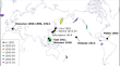
Site Characterization of Urban Centers from Himalayan Region Using Active and Passive Seismic Methods
Active and passive seismic survey was performed in Kangra valley using three different methods i.e. Horizontal-to-Vertical Spectral Ratio (HVSR),...

-
Effect of Bottom Currents on Recording Seismic Signals on the Seabed
AbstractThe recording of seismic signals at the bottom of water areas is in most cases accompanied by intense noise, whose sources are near-bottom...

-
Failure Mechanism of Grouted Floor with Confined Aquifer Based on Mining-Induced Data
Grouting in the key region is a preferred method to prevent the water inrush in underground engineering. Based on the special geological structure of...

-
Simultaneous receiver-side deghosting and denoising method based on the sparsity constraint
In marine seismic exploration, the sea surface ghost causes frequency notches and low-frequency loss, which affects the signal-to-noise ratio (SNR)...
-
One hundred years of advances in volcano seismology and acoustics
Since the 1919 foundation of the International Association of Volcanology and Chemistry of the Earth’s Interior (IAVCEI), the fields of volcano...
-
Broadband Marine Seismic Acquisition Technologies: Challenges and Opportunities
AbstractThe paper addresses marine broadband seismic data acquisition technologies, including conventional seismic oil exploration (frequencies no...

-
Site Application: Forensic Civil Cases
In this chapter, some problems related to civil cases are addressed and solved. Many litigations in the courtrooms concern damage caused by neglect...
-
Focal Mechanism of Mining-Induced Seismicity in Fault Zones: A Case Study of Yongshaba Mine in China
It is essential to investigate focal mechanisms of induced seismicity for understanding the rock fracturing, the failure mode, and the hazard...

-
Seismic Geophysics
Geophysics plays a central role in the modern hydrocarbon exploration and production industry. A brief overview of gravity and electromagnetic...
-
MAR Hydrogeological and Hydrochemistry Evaluation Techniques
Hydrogeological and hydrochemical data collection programs for managed aquifer recharge (MAR) systems need to be designed to meet project-specific...
-
Notch effect and frequency compensation of dual-sensor OBC data in shallow water
Reverberation is significant in shallow water and produces obvious notches in OBC spectra. It also degrades the quality of sections and increases the...