Search
Search Results
-
Validation of Space-Wise GOCE Gravitational Gradient Grids Using the Spectral Combination Method and GNSS/Levelling Data
The launch of gravity-dedicated satellite missions at the beginning of the new millennium led to an accuracy improvement of global Earth gravity...

-
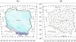
PL-geoid2021: A quasigeoid model for Poland developed using geophysical gravity data inversion technique
This paper presents the results of research and analyses related to the development of a new quasigeoid model fitted to GNSS/levelling data for the...
-
Topographic Gravity Field Modelling for Improving High-Resolution Global Gravity Field Models
The global gravitational potential generated by the attraction of the Earth’s topographic masses has been computed in spectral domain. The...
-
On correct definition and use of normal heights in geodesy
Physical heights is one of the most important topics in physical geodesy. Their original concept, introduced in the 19-th century, defined physical...
-
Long-term spatiotemporal evolution of land subsidence in the urban area of Bologna, Italy
Land subsidence in urban areas is a highly significant and globally widespread geological hazard. This type of ground deformation process commonly...

-
Can an Earth Gravitational Model Augmented by a Topographic Gravity Field Model Realize the International Height Reference System Accurately?
In this study, we evaluate the suitability of recent Earth Gravitational Models (EGMs) for the realization of the International Height Reference...
-
Potential of cold-atom airborne gravimetry to improve coastal gravity field and quasigeoid modelling
We investigate using the GIRAFE cold-atom gravimeter during an airborne gravity survey for improving gravity field and quasigeoid modelling. The...

-
Hybrid geoid model over peninsular Malaysia (PMHG2020) using two approaches
We describe the development of a hybrid geoid model for Peninsular Malaysia, based on two approaches. The first approach is utilising an ordinary...
-
An internally damped inertial platform for marine gravimetry and a test case in the South China Sea
To dampen periodic off-levelling motions within an inertial platform while undergoing horizontal accelerations of the same period and to achieve a...
-
A user-friendly software package for modelling gravimetric geoid by the classical Stokes-Helmert method
With the progress in Global Navigation Satellite Systems (GNSS) technology, accurate geoid modelling has started to play an essential role in...
-
Case study of the accuracy calculations of corrections in different height systems
Works on establishment of the spirit levelling network in the Balkan countries were ruled by the political and economic circumstances. This was...

-
Examining subsidence change regularity in high groundwater level coal mining areas using Sentinel-1A time-series data
The high groundwater level coal mining areas have a long history of mining and are mainly located in east-central region of China. Subsidence caused...

-
Recent Reactivation of Variscan Tectonic Zones: A Case of Rodl-Kaplice-Blanice Fault System (Bohemian Massif, Austria/Czech Republic)
The Rodl-Kaplice-Blanice fault system (RKB) of Variscan shear origin, repeatedly active since the Late Paleozoic to the Recent, is expressed by a...

-
Unravelling the dynamics and causes of land subsidence in the National Capital Territory of Delhi, India, by spaceborne and in situ observations
This paper identified severe groundwater depletion and land subsidence in parts of the National Capital Territory of Delhi (NCT Delhi), India, by...

-
Improving the Accuracy of Local Gravimetric Geoid Modelling Using Simulated Terrestrial Gravity Data
Geodetic observations in any country or region require a precise local geoid model. Hence, this study has improved the geoid modelling using...

-
Analysis of Spatiotemporal Land Subsidence Patterns of Suzhou City, China, over the Past 15 years Based on Multisource SAR Data
The effect of land subsidence causes geo-hazards to the natural environment and the infrastructure in Suzhou city, the most economically developed...

-
Diachronic study of coastline behavior using remote sensing: a case study of Korba beach, Tunis
This study analyzed the spatiotemporal changes of the Korba coastline over 18 years using LANDSAT 5 and 7 and Sentinel 2A imagery. The research,...

-
Combined volcano-tectonic processes for the drowning of the Roman western coastal settlements at Campi Flegrei (southern Italy)
The active Campi Flegrei caldera in southern Italy has a remarkably long history of coexistence between volcanism and human settlements, and it is...

-
A practical software package for computing gravimetric geoid by the least squares modification of Hotine’s formula
Today’s geodetic community starts to model an accurate gravimetric geoid within a 5 mm level, which entirely meets the demands of all technical and...

-
Refinement of gravimetric geoid model by incorporating terrestrial, marine, and airborne gravity using KTH method
We compute a new gravimetric geoid model for Peninsular Malaysia (PMGG2020) based on the Royal Institute of Technology (KTH) method. The PMGG2020 was...
