Search
Search Results
-
Models for topographic ground motion amplification based on finite element analyses considering topographic features and ground motions in Japan
Surface topographic irregularities can alter ground motion. In this study, we investigated the influence of various topographic factors such as...

-
Spatiotemporal evolution of ecosystem service value and topographic gradient effect in the Da-**ao Liangshan Mountains in Sichuan Province, China
The Da-**ao Liangshan mountains are critical ecological function areas and essential ecological barriers in the upper reaches of the Yangtze River in...
-
Topographic Effect for Rossby Waves on Non-Zonal Shear Flow
AbstractThis work continues a series of studies by the authors, where a comparative analysis of the influence of topography, β-effect, and gradient...

-
Assessing Seismic Hazard Potential Considering Topographic Amplification: Combined Analysis of Topographic Slopes, Land Use, and Landslides
Northeast India is severely exposed to geological hazards, especially earthquakes and landslides, due to its complex seismotectonic setting and...
-
Topographic Waves of the Aleutian Trench
Based on the mesoscale eddy trajectory data, the propagation of topographic Rossby waves south of the Aleutian Ridge in various areas of topography...
-
Understanding fatal landslides at global scales: a summary of topographic, climatic, and anthropogenic perspectives
Landslides are a common global geohazard that lead to substantial loss of life and socio-economic damage. Landslides are becoming more common due to...

-
On the topographic bias by analytical continuation in geoid determination
We consider the topographic bias in gravimetric geoid determination when analytically downward continuing the disturbing potential from the Earth’s...
-
Topographic seismic effects and avalanche hazard: A case study of Mount Siella (L’Aquila, Central Italy)
In mountainous areas, snow avalanches could be triggered by the shaking produced by earthquakes. The forces induced by the earthquake can cause an...
-
Impacts of Using the Rigorous Topographic Gravity Modeling Method and Lateral Density Variation Model on Topographic Reductions and Geoid Modeling: A Case Study in Colorado, USA
Until now, the prismatic mass approximation of the topography and the constant density assumption have been mostly utilized in topographic...

-
Geomorphic indices based topographic characterization of Alaknanda catchment, Western Himalaya using spatial data
Morphometry is an important method for understanding geomorphic processes, such as drainage development, impact of tectonics on the landscape,...

-
A generalized time-domain velocity-stress seismic wave equation for composite viscoelastic media with a topographic relief and an irregular seabed
Accurate seismic wave modeling of viscoelastic anisotropic medium is a fundamental tool for seismic data processing, interpretation and full waveform...
-
Effect of topographic slope on the interaction between debris flows and riparian forests
Forests, serving as natural barriers in mountainous regions, can reduce surface erosion, enhance water flow resistance and facilitate sedimentation....

-
Mixed Topographic-Planetary Waves in a Stratified Ocean on a Background Flow
The work presents the development of Rhines' theory for mixed topographic-planetary waves in a stratified ocean on a background current. The vertical...

-
On the combined effect of topographic irregularities and wave passage on the spatial variation of seismic ground motion
The spatial variation of ground motion (SVGM) can significantly affect the response of distributed infrastructure systems including bridges, dams,...

-
A modified TOPMODEL introducing the bedrock surface topographic index in Huangbengliu watershed, China
Subsurface stormflow is a dominant runoff mechanism in steep humid mountainous areas. An insite measurement of subsurface stormflow suggests that the...
-
Spatio-temporal evolution and topographic gradient effect of land use and ecosystem service value in the Lhasa River Basin
The Lhasa River Basin forms an essential human settlement area in the southern part of the Qinghai-Tibet Plateau. This study employed ecosystem...
-
Response of Grain-Size Distribution Characteristics of a Gravel Bar to Topographic and Hydraulic Conditions: A Case Study from the Upper Yangtze River in China
AbstractThe characteristics of grain-size distribution on the surface of gravel bars have important implications for riverbed development and fish...

-
Predicting topographic collapse following lava dome growth at Ibu volcano (North Maluku, Indonesia) using high-resolution PlanetScope images
In this study, we described a rare case of lava dome growth at Mt. Ibu in West Halmahera Regency, North Maluku Province, Indonesia, in which the...

-
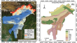
Topographic classification of North Eastern Region of India using geospatial technique and following seismic code provisions
The availability of high-resolution digital elevation models (DEM) and advancements in geospatial techniques enable a more accurate measure of slope...
-
High-resolution numerical simulation of topographic influence on the heavy rainfall of Typhoon Rammasun
The heavy rainfall caused by Super Typhoon Rammasun (2014), the strongest typhoon that has landed in China since meteorological records began, has...
