Search
Search Results
-
Petrographic and structural analysis of Paleoproterozoic Birimian granitoids and associated rocks of Boankra areas in the Kumasi Basin of Ghana
The petrographical and structural analyses of the Paleoproterozoic Birimian granitoids of Boankra and its environs in the Ashanti region of Ghana and...

-
Application of electrical and electromagnetic data to delineate shallow aquifer zones: a case study of Vea catchment, Ghana
Access to groundwater for use in semi-arid regions is costly due to consistent failures in borehole drilling programs attributable to either a survey...

-
Validating local drivers influencing land use cover change in Southwestern Ghana: a mixed-method approach
Addressing undesirable changes associated with the driving forces of land use cover change are critical to sustainable land management, and the...

-
Modeling the impact of land cover changes on water balance in the Vea catchment of Ghana, 1985–2040
The ensuing effect of global land use changes on watershed hydrology is enormous, particularly in rapidly develo** countries such as Ghana....

-
A multi-method approach for slope stability assessment: a case study at Anglogold Ashanti Iduapriem Mine, Ghana
A mine slope failure could result in severe repercussions for a mining operation. This paper employs a multi-method approach to evaluate the...

-
Regional-residual depth estimation and edge detection characterization over the southern Kibi–Winneba belt, Ghana using aeromagnetic data
An essential procedure that facilitates the analysis and interpretation of magnetic anomalies is the use of data enhancement and filtering approaches...
-
Petrography and geochemistry of metasedimentary rocks from the Paleoproterozoic Birimian at the Chagupana area, North-West Ghana: implications for provenance and tectonic setting
This study uses petrographical and whole-rock geochemical data to determine the provenance, paleo-weathering conditions, tectonic settings,...

-
Assessment of groundwater development potential of aquifers within the Ajumako–Enyan–Essiam district of Ghana
The groundwater development potential of the Ajumako–Enyan–Essiam (AEE) District has been assessed using vertical electrical sounding (VES) and...

-
A three-dimensional numerical groundwater flow model to assess the feasibility of managed aquifer recharge in the Tamne River basin of Ghana
Increasing population growth and global climatic changes threaten water security in semiarid regions such as Northern Ghana. The Tamnean Plutonic...

-
Investigation of Geophysical Signatures for Successful Exploration of Groundwater in Highly Indurated Sedimentary Basins: A Look at the Nasia Basin, NE Ghana
An integrated geophysical and geological approach to ensure improved success rates in groundwater development has been proposed for a partially...

-
Seismic risk analysis for large dams in West Coast basin, southern Ghana
Dams are parts of the critical infrastructure of any nation, the failure of which would have a high-risk potential on the people and properties...

-
Computation of area-characteristic seismicity parameters in Ghana, Nigeria, and immediate neighbors
Although probabilistic seismic hazard assessment (PSHA) has been carried out in a few countries in West Africa (WA), large-scale PSHA is still...

-
Geochemistry and petrogenetic evolution of metasedimentary rocks in Bunu Area, part of Kabba-Lokoja-Igarra schist belt, SW Nigeria
Field and geochemical studies of the Bunu area, SW Nigeria, were carried out on gneiss-metasedimentary rocks that consist of migmatised gneiss,...

-
Paleoweathering, provenance and tectonic setting of metasedimentary rocks at Ayanfuri area in the Paleoproterozoic Kumasi basin in Ghana: evidence from petrography and geochemistry
This study investigates the provenance, paleoweathering, and tectonic setting of some metasedimentary rocks at Ayanfuri, in the Paleoproterozoic...

-
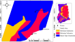
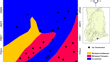
Best worst method-based mineral prospectivity modeling over the Central part of the Southern Kibi-Winneba Belt of Ghana
The best–worst method (BWM), though a recently developed multi-criteria decision-making (MCDM) technique, has its application evolving in recent...
-
Integrating 2D hydrodynamic, SWAT, GIS and satellite remote sensing models in open channel design to control flooding within road service areas in the Odaw river basin of Accra, Ghana
Infrastructure network security and resiliency have become major problems in recent years as a result of an increasing number of catastrophic...

-
Hydrochemical peculiarities and groundwater quality assessment of the Birimian and Tarkwaian aquifer systems in Bosome Freho District and Bekwai Municipality of the Ashanti Region, Ghana
The Birimian and Tarkwaian aquifer systems are the main sources of water supply for the Bosome Freho District and Bekwai Municipality inhabitants in...

-
Lithostructural controls in Douala-Buea Region landscape (SW Cameroon margin): Insights from morphometric analysis
The Douala-Buea Region (DBR; 4°–5°N, 9°–10°30′E), a portion of the southern Cameroon passive margin, developed on the Proterozoic granito-gneissic...
-
Characterisation of alluvial gold exploration data to improve gold recovery in Ghana
This study uses exploration data to optimise overburden thickness, cut-off grade and strip** ratio at some alluvial gold mines in the Kibi mining...

-
The hydrocarbon prospectivity of the Mesoproterozoic–Paleozoic intracratonic Voltaian Basin, West African Craton, Ghana
Neoproterozoic sedimentary basins are increasingly gaining hydrocarbon exploration attention globally following results of significant discoveries in...
