Search
Search Results
-
Urban landscape modeling and algorithms under machine learning and remote sensing data
Traditional urban landscape modeling relies on limited geographic information data and sensor observation data, but urban landscapes are dynamic and...

-
Manifestation of Upwellings in the Black Sea in Multisensor Remote Sensing Data
AbstractResults of upwelling research in the Black Sea, namely in the northeastern part of the sea, near the Tendrovskaya Spit and western coast of...

-
A service-oriented framework for remote sensing big data processing
In recent years, one of the biggest concerns of researchers has been environmental knowledge. This concern can be resolved by collecting and...

-
Modeling and map** sea surface gage height using satellite remote sensing data
Sea surface gage height (SSGH) data are commonly measured at sparsely deployed tidal stations while coastal resources management requires spatially...

-
Deck Spectroradiometer for Measuring Remote Sensing Reflectance
AbstractThe results of the development and field testing of a compact high-speed deck spectroradiometer for remote sensing reflectance measurements...

-
Review of airborne oceanic lidar remote sensing
Airborne oceanic lidars act as an active remote sensing technique have been proved to be one of the most effective and reliable means of oceanic...

-
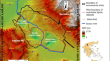
Map** Arable Lands in Agricultural Landscapes of Volgograd Region According to Remote Sensing Data
AbstractCurrently, more and more attention is being paid to the development of technologies for the satellite monitoring of land use and the state of...

-
Assessment of prediction model of the CPUE of neon flying squid with different sources of remote sensing data
Accurately building the relationship between the oceanographic environment and the distribution of neon flying squid ( Ommastrephes bartramii ) is very...
-
Monitoring Maritime Ship Characteristics Using Satellite Remote Sensing Data from Different Sensors
Ship monitoring is important for understanding human maritime activities. Automatic identification systems are widely adopted for ship monitoring. It...

-
Seasonal Chlorophyll Variability in the Caspian Sea Based on Remote Sensing Data
AbstractThe patterns of seasonal phytoplankton variability in the Caspian Sea were studied using the SeaWiFS and MODIS-Aqua scanners. The chlorophyll...

-
A Machine Learning-Based Semantic Pattern Matching Model for Remote Sensing Data Registration
Remote sensing image registration can benefit from a machine learning method based on the likelihood of predicting semantic spatial position...

-
Remote sensing data processing and analysis for the identification of geological entities
As Earth observation technology has advanced, the volume of remote sensing big data has grown rapidly, offering significant obstacles to efficient...

-
Extension of the Ice-Free Period in the Laptev Sea According to Remote Sensing Data
AbstractThe features of the spatial distribution of the long-term average ice-free period (IFP) characteristics and their trends in the Laptev Sea...

-
Dynamic monitoring of flood disaster based on remote sensing data cube
High-frequency dynamic monitoring of flood disaster using remote sensing technology is crucial for accurate decision-making of disaster prevention...

-
Advancements in drought using remote sensing: assessing progress, overcoming challenges, and exploring future opportunities
The use of remote sensing for monitoring and managing droughts is examined in this review study. Drought has a significant impact on how water...

-
Remote Sensing Data and Indices to Support Water Management: A Holistic Post-mining Approach for Lignite Mining in Greece
Entering the coal phase-out era, major priorities of the Greek lignite mining industry are sustainable mine closure, land reclamation, and planning...
-
Characterization of pre- and post-failure deformation and evolution of the Shanyang landslide using multi-temporal remote sensing data
On August 12, 2015, a catastrophic landslide occurred in Shanyang County, Shaanxi Province, China, resulting in 7 deaths and 53 missing. This study...

-
PyLST: a remote sensing application for retrieving land surface temperature (LST) from Landsat data
Understanding land surface temperature (LST) dynamics is crucial for assessing the impacts of changes in land use and land cover (LULC) through...

-
The morphological changes of basal channels based on multi-source remote sensing data at the Pine Island Ice Shelf
The basal channel is a detailed morphological feature of the ice shelf caused by uneven basal melting. This kind of specifically morphology is widely...
-
Using Deep Learning and Cloud Services for Map** Agricultural Fields on the Basis of Remote Sensing Data of the Earth
AbstractIn recent years, research has been conducted in scientific institutions of the Ministry of Agriculture of the Russian Federation and the...
