Search
Search Results
-
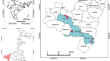
Landslide susceptibility map** of Rangamati District of Bangladesh using statistical and machine intelligence model
Landslides have become a common lithospheric hazard in the mountainous areas of Bangladesh, increasing rapidly in the last 20 years. This study aims...

-
Assessment of seismic slope stability of Rangamati Hill Tracts, Bangladesh
Slope stability is an essential aspect of geotechnical engineering. Unstable slopes or stable slopes influenced by external factors may result in a...

-
Map** of Landslide Susceptibility Using State-of-the-Art Method and Geospatial Techniques in the Rangamati District in the Chattogram Hill Tracts Region of Bangladesh
The chapter aims to map the susceptibility of landslides in the Rangamati district of the Chattogram Hill Tracts region in Bangladesh using...
-
Landslide Susceptibility Map** Using Weighted-Overlay Approach in Rangamati, Bangladesh
Rainfall-induced landslide hazards have become a common phenomenon in the Rangamati Sadar area of the south-eastern folded part of Bangladesh. The...

-
Slope stability analysis of the Rangamati District using geotechnical and geochemical parameters
Landslide and human mortality have been a common phenomenon in the Rangamati district over the past several years. This study examined the...

-
Landslide Hazard Risk Assessment Using GIS and Analytical Hierarchy Process (AHP) Approach: Evidence from 2017 Rangamati Hill Tracts Landslide Event, Bangladesh
A large number of local people and property losses have been reported in the Rangamati Hill Tracts (RHT) of Bangladesh due to the 17 June 2017...
-
Vulnerability and Exposures to Landslides in the Chittagong Hill Region, Bangladesh: A Case Study of Rangamati Town for Building Resilience
Landslide is a major significant natural disaster in the hilly regions of Bangladesh. Over the last three decades, the Chittagong Hilly Region (CHR)...
-
Landslide Susceptibility and Risk Assessment in Hilly Regions of Bangladesh: A Geostatistical and Geospatial Modeling Approach for Sustainability
Landslides significantly threaten human life, infrastructure, and environmental balance. In the hilly regions of Bangladesh, including Sylhet and...
-
Women’s role in water resource management: a case study on upper catchment area of Kangsabati river basin under Purulia district, West Bengal
Worldwide uncountable distressed people are agonizing dreadfully due to the acute problem of water scarcity. Women hold a very momentous position in...
-
Influence of anthropogenic activities on landslide susceptibility: A case study in Solan district, Himachal Pradesh, India
Landslides in the Himalayan region are primarily controlled by natural parameters, including rainfall, seismic activity, and anthropogenic...
-
Long-term trends and spatial variability in rainfall in the southeast region of Bangladesh: implication for sustainable water resources management
Accurate and in-depth rainfall studies are crucial for understanding and assessing precipitation events’ patterns, intensities, and impacts, enabling...

-
The Anthropogenic Aggravation of Landslide Disasters in Bangladesh: Key Informants’ Perspectives
Landslide disasters in Bangladesh’s Chittagong hill districts (CHD) put lives, livelihood, and the ecosystem at risk. Therefore, understanding the...
-
Vulnerability assessment of tropical cyclones and deep depressions: an index-based spatio-temporal assessment along the coastal zones of Bangladesh
Over the last three decades, Bangladesh has been repeatedly subjected to devastating impacts of many tropical cyclones, resulting in significant...

-
Landslide, Agricultural Vulnerability, and Community Initiatives: A Case Study in South-East Part of Bangladesh
The landslide has become a common hazard in Bangladesh. The south-east and north-east part has been identified as one of the significant hotspots...
-
Climate change effects on potential evapotranspiration in Bangladesh
Potential evapotranspiration (ETo) is considered to be one of the key factors in water resource practices. Insights into the effects of climate...

-
Assessment of the responses of spatiotemporal vegetation changes to climatic variability in Bangladesh
Understanding the effects of vegetative land cover in Bangladesh on climatic variability and dynamics is still a critical issue for environmental...

-
Delineating Flood Zones upon Employing Synthetic Aperture Data for the 2020 Flood in Bangladesh
Delineating a flood map is critical to perceive the potential risks of the event at diverse communities living both in urban and rural settings in...

-
Exploring the relationship of climate change and land-use dynamics with satellite-derived surface indices and temperature in greater Dhaka, Bangladesh
This paper addresses the assessment of the relation of land-use dynamics and climate change based on the relationship of land surface temperature...

-
Recent changes in temperature extremes in subtropical climate region and the role of large-scale atmospheric oscillation patterns
Understanding the recent variations in temperature extremes is crucial to anticipate the forthcoming incidences of extreme phenomena. However,...

-
Assessing and Map** Spatial Variations in Climate Change and Climatic Hazards in Bangladesh
Climate change and the frequency and severity of climatic hazards vary significantly by region. There is a pressing need for increased understanding...