Search
Search Results
-
Need for structured conservation inputs: a geospatial approach for habitat prioritization to restrict disturbance regime in the protected areas of the Western Himalayan region
The population boom increases land-use requirements, and shrinking regions are available to preserve natural biodiversity. Unfortunately, scientific...

-
A GIS-based morphometric prioritization of watersheds for soil erosion planning: a case study
Morphometric analysis is essential for determining soil erosion-prone areas in drainage basins. In the present study, identification and...

-
A Multi-Criteria Combination Approach to Determine Spatial Intervention Prioritization of Urban Flood Based on Source Tracking Analysis
Under the increasing stormwater events and consequent flood hazards, integrated flood management is increasingly becoming the most essential...

-
RiskSchools: a prioritization-based system for the risk assessment of school buildings combining rapid visual screening smartphone app and detailed vulnerability analysis
A multi-purpose and multi-scale tool for the seismic vulnerability and risk classification of critical buildings, such as schools, is proposed for...

-
Watershed prioritization for conservation planning using RUSLE and morphometric methods, Northwestern Ethiopia
Soil erosion and the subsequent sedimentation are serious environmental problems. Improper land management coupled with intense rainfall has...
-
Social norms explain prioritization of climate policy
Most people in the United States recognize the reality of climate change and are concerned about its consequences, yet climate change is a low...
-
Groundwater potentiality and soil erodibility prioritization in Kuzhithuraiyar sub-basin, Kanniyakumari district, Tamil Nadu, India
The aim of this study is to investigate the morphometric characteristics of Kuzhithuraiyar sub-basin using geographical information system and...

-
Comparative Prioritization of Sub-Watersheds in Flood Generation Using Co-Management Best-Worst Method and Game Theory Algorithm
This study used the Best-Worst Method (BWM) and the Game Theory Algorithm (GTA) to prioritize and determine critical sub-watersheds based on flood...

-
Understanding flood risk in urban environments: spatial analysis of building vulnerability and hazard areas in the Lisbon metropolitan area
Climate change has brought about new risks while exacerbating existing ones, with floods now accounting for about 45% of global disasters. This trend...

-
Quantitative Morphometric Analysis and Prioritization of Sub-Watersheds for Soil Erosion Susceptibility: A Comparison between Fuzzy Analytical Hierarchy Process and Compound Parameter Analysis Method
The identification of critical sub-watersheds susceptible to soil erosion risk is the preliminary step in any watershed management plan. To achieve...

-
Prioritization of sub-watersheds in Tuirial river basin through geo-environment integration and morphometric parameters
Watersheds are the basic planning units. Topography is one of the predominant controlling factors which augment erosion. Tuirial watershed in Mizoram...

-
Prioritization of sub-watersheds of Teesta River according to soil erosion susceptibility using multi-criteria decision-making in Sikkim and West Bengal
Identification of the areas vulnerable to soil erosion through the prioritization of watersheds can help in the planning and execution of suitable...

-
An integrated approach for the identification and prioritization of areas based on their livelihood vulnerability index: a case study of agro-pastoral community from Western Indian Himalaya
Recent changes in climatic conditions are expected to intensify the existing risk of hunger and malnutrition along with the vulnerability of...

-
Identification and prioritization of multidimensional resilience factors for incorporation in coastal state transportation infrastructure planning
Effective integration of resilience in transportation planning requires the identification and prioritization of multifaceted resilience factors. In...

-
Seismic risk assessment and hotspots prioritization: a develo** country perspective
Natural disasters pose a negative impact not only on human lives but also on infrastructures such as healthcare systems, supply chains, logistics,...

-
Flash flood-risk areas zoning using integration of decision-making trial and evaluation laboratory, GIS-based analytic network process and satellite-derived information
Assessing areas prone to flash floods is crucial for effective disaster management and mitigation. This study proposes a framework for map**...

-
Flood prioritization based on fuzzy best worse multi-criteria decision-making method
Flood is one of the major problems in the Sad Ekbatan Watershed, northern Hamadan province, Iran. This problem imposes severe damage related to...

-
Develo** a new multi-criteria decision-making for flood prioritization of sub-watersheds using concept of D numbers
Floods are one of the most dangerous natural disasters that humanity has ever faced. In this study, a modified version of D number technique as a...

-
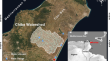
Integrated decisional approach for watershed vulnerability prioritization using water and soil hazard index (WSHI) and AHP methods: Chiba watershed, Cap-Bon region, northeast Tunisia
The present work has been conducted to comprehend multi-influencing parameters on water and soil degradation in watershed to undertake the...
-
Remote sensing, and (GIS) approach, for morphometric assessment and sub-watershed prioritization according to soil erosion and groundwater potential in an endorheic semi-arid area of Algeria
The application of remote sensing (RS), and geographical information system (GIS), has emerged as one of the most useful methods for the assessment...
