Search
Search Results
-
Long-term changes in temperature, specific humidity, and precipitation in Bangladesh revealed by ERA5 data
Bangladesh is known as one of the countries that are most vulnerable to climate change, which promotes continuous scientific attention to the changes...

-
Intelligent Analysis of Multi-source Long-Term Landslide Ground Monitoring Data
Landslide displacement is an important indicator for early warning. It is of great importance to predict the landslide displacement for its...
-
Long-term evaluation of rainfall in the arid region of Pakistan using multi-source data
Reliable long-term precipitation estimation data holds immense hydrometeorological value due to its extensive spatial coverage and extended temporal...

-
Long-term ocean temperature trend and marine heatwaves
Marine heatwaves (MHWs) can cause irreversible damage to marine ecosystems and livelihoods. Appropriate MHW characterization remains difficult,...
-
Deep Learning for Long-Term Landslide Change Detection from Optical Remote Sensing Data
Landslides are widespread in China, but are only mapped in detail in limited scales and within a short period of time. In this study, long-term...
-
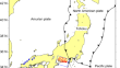
Spatiotemporal slip distribution associated with the 2012–2016 Tokai long-term slow slip event inverted from GNSS data
We used Global Navigation Satellite System (GNSS) time series data to estimate the spatiotemporal slip distribution for a long-term slow slip event...
-
A short-term prediction model of global ionospheric VTEC based on the combination of long short-term memory and convolutional long short-term memory
The ionospheric vertical total electron content (VTEC) is an essential parameter for studying the ionosphere's dynamic variations, and its short-term...

-
Effects of Long-Term and Short-Term Droughts on the Hydrolytic Enzymes in Haplic Luvisol
AbstractThe transformation of organic matter in the soil is largely determined by hydrolytic enzymes. Under the conditions of climate change,...

-
Assessing long-term rainfall trends and changes in a tropical watershed Brantas, Indonesia: an approach for quantifying the agreement among satellite-based rainfall data, ground rainfall data, and small-scale farmers questionnaires
The agreement between meteorological data and societal perception is essential in supporting a robust policy making and its implementation. In humid...

-
Long short-term memory integrating moving average method for flood inundation depth forecasting based on observed data in urban area
Since flooding in urban areas is rarely observed using sensors, most researchers use artificial intelligence (AI) models to predict flood hazards...

-
Quantifying long-term cloud feedback over East Asia combining with radiative kernels and CMIP6 data
Understanding the cloud feedback (CFB) process remains a critical challenge for climate projection. While previous studies have mainly focused on the...

-
Is AquaCrop a useful tool for rapeseed growth and yield prediction in semi-arid regions: model evaluation under different water-saving using long-term weather data
Crop models are widely used to simulate and predict crop production under different field conditions. Therefore, the AquaCrop model was used to...

-
Identification and analysis of long-term changes in river deltas and riparian zones using time-series multispectral data
Today’s remote sensing data and technologies offer the capability to effectively monitor diverse and challenging environments around the world, such...

-
Application Analysis of Long-Term High Temperature Monitoring Technology in Bohai Oilfield
Due to the particularity of the Bohai oilfield steam stimulation Wells and steam injection wellhead temperature above 350, conventional downhole...
-
Spatio-temporal trend and change detection of rainfall for Kosi River basin, Uttarakhand using long-term (115 years) gridded data
The paper analyzed the spatial-temporal variability of rainfall and detection of potential trend change point over Kosi River basin, Kumaon Lesser...

-
Long-Term Temporal Analysis of Desertification
This study uses remote sensing techniques to map land use and cover in desertified areas as well as analyze visual hazard catastrophes caused by...
-
Long-term and short-term disposal of landslide dams at steep V-shaped valleys
Landslides often occur in V-shaped valleys exhibiting strong river incisions and large elevation differences between the riverbed and surrounding...

-
Long-term vs short-term subsite erosion rates on microtidal shore platforms (Southern Mallorca, Balearic Islands, Western Mediterranean)
We address changes in microtopography of a supratidal rocky surface on calcareous rocks in the shore platform of s'Alavern (S de Mallorca) by means...

-
Long-term seismic network in South China Sea by floating MERMAIDs
Seismic data coverage in ocean regions is sparse, and it is highly challenging to build long-term continuous seismic networks in the oceans due to...
-
Combined BiLSTM and ARIMA models in middle- and long-term polar motion prediction
As one of the main components of the Earth orientation parameters, short-term prediction of the geodetic polar motion series is crucial in the field...