Search
Search Results
-
Landslide detection, monitoring and prediction with remote-sensing techniques
Landslides are widespread occurrences that can become catastrophic when they occur near settlements and infrastructure. Detection, monitoring and...

-
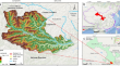
Geospatial technologies for landslide monitoring: a case study of Sighetu Marmației, Romania
Landslides are a significant geological phenomenon with the potential for catastrophic consequences. There are numerous potential causes of...

-
LANDSLIDE MONITOR: a real-time landslide monitoring system
In the current era of computing, communication, and technology, hydrological, metrological, and geographical parameters supported by sensor-based...

-
A study on the monitoring of landslide deformation disasters in Wenxian County, Longnan City based on different time-series InSAR techniques
Interferometry Synthetic Aperture Radar (InSAR) technology is widely employed in the identification of geological hazards. However, in regions...
-
Landslide monitoring and prediction system using geosensors and wireless sensor network
Landslides in hilly regions are a frequently occurring natural phenomenon which takes a heavy toll of human lives and causes damage to different...

-
Landslide Hazard Risk and Vulnerability Monitoring—GIS Based Approach
Recent technological strides have ushered in a transformative era for disaster assessment, monitoring, mitigation, and management. Amid this...
-
Introduction and testing of a cost-effective GNSS system for landslide monitoring
The use of Global Navigation Satellite System (GNSS) in combination with real-time kinematic technique, known as differential GNSS (dGNSS), has...

-
Landslide monitoring based on GNSS and automated inclinometer systems and dynamic modeling using SPH: a case study in Qinghai, China
Landslide deformation monitoring is crucial for early warning and disaster prevention. This study presents a comprehensive landslide monitoring...

-
The use of digital technologies for landslide disaster risk research and disaster risk management: progress and prospects
In the past few decades, digital technologies have played a more and more important role in landslide disaster risk management. To identify the...

-
Landslide identification using machine learning techniques: Review, motivation, and future prospects
The WHO (World Health Organization) study reports that, between 1998-2017, 4.8 million people have been affected by landslides with more than 18000...

-
Reactivated Wuwanchai landslide area monitoring and analysis
Terrain that has previously experienced a landslide is subject to the additional threat of reactivated landslides. The reactivated Wuwanchai...
-
Airborne combined photogrammetry—infrared thermography applied to landslide remote monitoring
The combination between two remote surveying methods is presented herein as a pioneering approach for landslide airborne monitoring. The survey of an...

-
Identification and evaluation of the high mountain upper slope potential landslide based on multi-source remote sensing: the Aniangzhai landslide case study
On June 17, 2020, Aniangzhai landslide, an ancient landslide located in Danba County, southwest China, was reactivated by Meilonggou debris flow. The...

-
Synergetic use of geospatial and machine learning techniques in modelling landslide susceptibility in parts of Shimla to Kinnaur National Highway, Himachal Pradesh
The National Highway-05 (NH-05) stretch from Shimla to Kinnaur in Himachal Pradesh is frequently threatened by landslides, causing disruptions to...

-
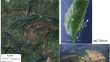
Study on characteristics and impact of Kalikhola landslide, Manipur, NE India, using UAV photogrammetry
Landslide is one of the natural calamities that severely affect society and economy, specifically in the mountainous regions. Monitoring of the...

-
Sendai Framework Voluntary Commitments: Monitoring Landslide Stakeholders’ Contributions
Disasters caused by landslides have continued to occur in recent years resulting in loss of lives and livelihoods around the world. To prevent such...
-
Image compression–based DS-InSAR method for landslide identification and monitoring of alpine canyon region: a case study of Ahai Reservoir area in **sha River Basin
Interferometric Synthetic Aperture Radar (InSAR) technology is capable of detecting large areas of potentially unstable slopes. However, traditional...

-
Deep learning approaches for landslide information recognition: Current scenario and opportunities
In the current era, remote sensing is a powerful platform for detecting and predicting landslides. Moreover, the advancement in computing...

-
A critical review on landslide susceptibility zonation: recent trends, techniques, and practices in Indian Himalaya
The Indian Himalayan region is highly susceptible to landslides because of its complex geology, rugged topography, steep slopes augmented by...

-
Identification of potential failure zones in large progressive landslides: a method to optimize the cost of landslide early warning
The cost of a landslide early warning system (LEWS) is a significant hurdle in its installation and adoption in develo** nations like India, which...
