Search
Search Results
-
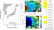
Tectonics and LA-ICP-MS U–Pb zircon geochronology of the Boula Ibi Region (Northern Cameroon Pan-African Orogenic Belt)
The Boula Ibi Region basement in northern Cameroon consists of paragneisses alternating with amphibolites. They are intruded by pre- to post-tectonic...

-
Prediction of Urban Heat Island Effect over **an City Using the Markov-Cellular Automata Model Combined with Urban Biophysical Descriptors
The feasibility of integrating urban biophysical descriptors into land surface temperature (LST) prediction in a rapidly urbanizing region, **an,...

-
Performance testing of selected spectral indices in automated extraction of impervious built-up surface features using Resourcesat LISS-III image
The increasing urban density and spatial expansion of urbanized areas result in changes from the natural landscape to impervious surface features....

-
Assessment of compound occurrence of storm surge and river flood in Ise and Mikawa Bays, Japan using a framework of atmosphere–ocean–river coupling
This study evaluated the compound flood risk of 11 different-sized rivers in the estuaries of the Ise and Mikawa Bays, Japan using an integrated...
-
A novel band selection architecture to propose a built-up index for hyperspectral sensor PRISMA
Processing of hyperspectral remote sensing datasets poses challenges in terms of computational expense pertaining to data redundancy. As such, band...

-
A new regional vegetation map** method based on terrain-climate-remote sensing and its application on the Qinghai-**zang Plateau
Understanding the impact of climate change on vegetation and its evolution trend requires long-term accurate data on regional vegetation types and...
-
A review on spectral indices for built-up area extraction using remote sensing technology
The rapidly occurring urbanization is associated with urban land use change dynamics. The conversion of natural land surfaces to artificial...

-
Development, Application, and Validation of the Urban Flood Susceptibility Index
Modifications to the landscape for urban expansion directly impact the natural hydrological dynamics in Urban Hydrographic Micro-basins (UHMs). This...

-
Geotechnical Behavior and Physico-Chemical Changes of Lime-Treated and Cement-Treated Silty Soil
An investigation performed on the interactions of silty soil treated with cement or lime demonstrates the strong relationship between microstructural...

-
Comparative study on remote sensing-based indices for urban ecology assessment: A case study of 12 urban centers in the metropolitan area of eastern India
This study compared the effectiveness of two indices, the remote sensing ecological index (RSEI) and the comprehensive ecological evaluation index...

-
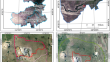
Structural and microstructural features of Neoproterozoic granites in Figuil: Constraints in ductile shear deformations of the Guider Sorawel shear zone
A less prominent N-S oriented continental-scale strike-slip shear zone occurs within the Babouri-Figuil Magmatic Complex (BFMC). Studies have shown...

-
Spatio-temporal evaluation of open access precipitation products with rain gauge observations in Nigeria
Various open access precipitation products are made available for several applications. Evaluating the reliability of these precipitation datasets...

-
Monitoring urban growth in Google Earth Engine from 1991 to 2021 and predicting in 2041 using CA-MARKOV and geometry: case study—Tehran
Urban growth leads to land use/land cover (LULC) changes, especially in develo** countries. Knowledge of land transition, especially agricultural...

-
OPENCoastS: A Tailored Coastal Forecasting WebGIS Service
Predicting the circulation in coastal systems requires a combination of knowledge of physical processes, accurate numerical models that represent all...
-
Comparison of calculation methods of ecological evaluation indexes
The remote sensing evaluation index can quickly monitor and evaluate regional ecological quality. A more convenient method which can also bring...

-
Evaluation of lake wetland ecotourism resources based on remote sensing ecological index
The quality of ecological environment is not only an important basis for judging the sustainable development of economy but also an important factor...

-
Ecology of Fishes of Rivers: Functional Roles
Fish and other fishery resources are representing most important faunal components in the riverine ecosystem by virtue of their vivid presence and...
-
Long-term evolution of winter habitats in Poyang Lake derived from satellite imagery using machine learning methods
Poyang Lake is a freshwater lake in China which is a vital winter habitat for many kinds of wildlife and a critical component of the regional...
-
Assessment of Surface Ecological Quality of Grassland Mining Area and Identification of Its Impact Range
High-intensity coal mining in grasslands has negative impact on the surface ecology of the mining area and its surroundings. This impact shows...
-
A geospatial approach for assessing the relation between changing land use/land cover and environmental parameters including land surface temperature of Chennai metropolitan city, India
Land use/land cover in coastal regions of large cities is affected due to rapid urbanization and industrialization. Chennai, a coastal city of Tamil...
