Search
Search Results
-
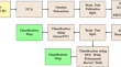
Detection and Classification of Floating and Submerged Polluted Targets at Turbid Water Using Remote Sensing Hyperspectral Imaging
Hyperspectral imaging (HI) is gaining prominence for its rapid and precise remote sensing in aquatic environments to identify and categorize a number...

-
Hyperspectral remote sensing identification of marine oil emulsions based on the fusion of spatial and spectral features
Marine oil spill emulsions are difficult to recover, and the damage to the environment is not easy to eliminate. The use of remote sensing to...
-

-
Hyperspectral remote sensing identification of marine oil spills and emulsions using feature bands and double-branch dual-attention mechanism network
The accurate identification of marine oil spills and their emulsions is of great significance for emergency response to oil spill pollution. The...
-
Enhancing remote target classification in hyperspectral imaging using graph attention neural network
AbstractThe method of target classification known as hyperspectral imaging (HSI) is commonly used in the field of remote sensing. However, recent...

-
A novel hyperspectral remote sensing tool for detecting and analyzing human materials in the environment: a geoenvironmental approach to aid in emergency response
Geology is the backdrop against which environmental disasters, emergencies and conflict occur. A search and discovery tool is developed to aid in...
-
Integration of multispectral and hyperspectral remote sensing data for lithological map** in Zhob Ophiolite, Western Pakistan
This work integrates processed satellite-based remote sensing products and the laboratory data for the geological studies of the Naweoba block of...

-
PKNNet: a novel feature learning architecture for vegetation map** using remote sensing hyperspectral image classification
Feature learning of remote sensing Hyperspectral Image (HSI) using deep learning (DL) models and classification of these features using machine...
-
Assessment of Coastal Water Quality Parameters Along Mangaluru Region from AVIRIS-NG Hyperspectral Remote Sensing Data
Under the ISRO-NASA joint program, airborne hyperspectral campaign and simultaneous in situ data collection were conducted along the Mangaluru...

-
A service-oriented framework for remote sensing big data processing
In recent years, one of the biggest concerns of researchers has been environmental knowledge. This concern can be resolved by collecting and...

-
The study of mineral distribution using hyperspectral Hyperion data along the shores of Lake Salda/Türkiye
Lake Salda is considered the most similar region on Earth to search for evidence of life on Mars, and its shoreline is home to microbialites...

-
Performance evaluation of dimensionality reduction techniques on hyperspectral data for mineral exploration
With recent advances in hardware and wide range of applications, hyperspectral remote sensing proves to be a promising technology for analysing...
-
Monitoring Maritime Ship Characteristics Using Satellite Remote Sensing Data from Different Sensors
Ship monitoring is important for understanding human maritime activities. Automatic identification systems are widely adopted for ship monitoring. It...

-
Review of airborne oceanic lidar remote sensing
Airborne oceanic lidars act as an active remote sensing technique have been proved to be one of the most effective and reliable means of oceanic...

-
Use of Hyperspectral Satellite Data for Identifying Cyanobacteria in the Black and Azov Seas
AbstractIn this paper we use data from the Hyperspectral Imager for the Coastal Ocean (HICO, NASA) hyperspectral satellite sensor to identify and...

-
Advancements in drought using remote sensing: assessing progress, overcoming challenges, and exploring future opportunities
The use of remote sensing for monitoring and managing droughts is examined in this review study. Drought has a significant impact on how water...

-
Remote Sensing Inversion for Simulation of Soil Salinization Based on Hyperspectral Data and Ground Analysis in Yinchuan, China
The **luo area, as an experimental study area in Yinchuan, has been subjected to major environmental degradation due to soil salinization problems....

-
Assessment and detection of biotic and abiotic stresses in field crops through remote and proximal sensing techniques—evidence from earlier findings
Environmental fluctuations have a strong influence on soil, plant, water, air, and flora and fauna, and have a strongassociation and interaction with...

-
A Machine Learning-Based Semantic Pattern Matching Model for Remote Sensing Data Registration
Remote sensing image registration can benefit from a machine learning method based on the likelihood of predicting semantic spatial position...

-
Hyperspectral remote sensing image watermarking using discrete wavelet transform and forensic based investigation archimedes optimization
Rapid advancement in satellite communication over the last decade have resulted in the widespread use of remote sensing images. Additionally, as...
