Search
Search Results
-
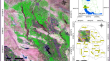
Hierarchical and networked analysis of resilience factors in mountain communities in Southwest China
Communities' pre-disaster resistance, disaster response, and post-disaster recovery processes are all affected by the level of resilience. This...

-
A Hierarchical Index System for Analysis of Water Supply-Demand Situation
An accurate analysis of water supply-demand situation is essential to solve the increasing contradiction between water resources distribution and...

-
Application of hierarchical cluster analysis to spatiotemporal variability of monthly precipitation over Khyber Pakhtunkhwa, Pakistan
Understanding the long-term spatiotemporal variability of precipitation at the regional scale is critical for develo** flood and drought control...

-
Vulnerability and drought risk assessment in Iran based on fuzzy logic and hierarchical analysis
Drought is an intangible natural disaster that can occur in any climate. The present study assessed drought vulnerability in Iran based on fuzzy...

-
Insights in Hierarchical Clustering of Variables for Compositional Data
R-mode hierarchical clustering is a method for forming hierarchical groups of mutually exclusive subsets of variables. This R-mode cluster method...

-
Integrity assessment of shale gas wells in Changning Block based on hierarchical analysis method
The integrity of shale gas wells is crucial in ensuring safety and efficiency throughout the development process. Such integrity spans the entire...

-
A multiscale road matching method based on hierarchical road meshes
Road networks in the maps generally need to keep their up-to-date status to satisfy the requirements of various applications. Road matching is the...

-
Hierarchical pattern recognition of landform elements considering scale adaptation
Landform elements with varying morphologies and spatial arrangements are recognized as feature indicator of landform classification and play a...
-
Optimized Land Suitability Map** for Wheat Cultivation by Integrating Fuzzy Hierarchical Analysis and Satellite Images
This study focuses on identifying optimal areas for wheat cultivation in the northwestern part of the Khuzestan province- southwest Iran. This...
-
Examining TOD node typology using k-means, hierarchical, and latent class cluster analysis for a develo** country
A sustainable urban strategy, transit-oriented development (TOD) encourages mixed-use zoning, compact growth, and pedestrian-friendly community...

-
Redundancy and hierarchical cluster analyses for characterizing geomorphic features contributing to the formation of landslide dams
Landslides frequently produce dams that can cause widespread destruction when breached. Several factors influence the formation of landslide dams....

-
Weighted Markov chain analysis and hierarchical clustering for landslide early warning in open-pit mine
Landslides are primary natural hazard inducing thousands of mortality and casualties as well as momentous damage to property and infrastructure...

-
A new large-area hierarchical PPP-RTK service strategy
Introducing precise atmosphere information into precise point positioning enables rapid ambiguity resolution and introduces a significant accuracy...

-
An Australian convective wind gust climatology using Bayesian hierarchical modelling
To quantify the hazard or risks associated with severe convective wind gusts, it is necessary to have a reliable and spatially complete climatology...
-
Using a Model of a Spatial–Hierarchical Quadtree with Truncated Branches to Improve the Accuracy of Image Classification
AbstractThis article considers the problem of increasing the accuracy of classifying satellite image samples under the assumption that their samples...

-
Development of hierarchical sub-surface energy anomaly index and its significance on seismic hazard study through geoinformatics in Lower Tista sub-basin, India
A significant amount of energy is released from sub-surface during an earthquake which is caused by seismotectonic activity. The occurrences of...

-
A new regionalization of rainfall patterns based on wavelet transform information and hierarchical cluster analysis in northeastern Algeria
Due to its geographical location, Algeria is characterized by high spatiotemporal rainfall variability. In this study, data from 69 rain gauges...

-
Improving Hierarchical Ecosystem Structures and Multicriteria Evaluation for Current Land Ecosystem Classification
AbstractFor the purposes of environmental management and planning, Land Ecosystem Classification (LEC) provides a systematic framework for organizing...

-
Watershed Prioritization in Lower Shivaliks Region of India Using Integrated Principal Component and Hierarchical Cluster Analysis Techniques: A Case of Upper Ghaggar Watershed
The watershed prioritization of soil erosion-affected areas is an utmost requirement to formulate management and conservation practices. In this...

-
Geospatial approach to elucidate anomalies in the hierarchical organization of drainage network in Kuttiyadi River Basin, Southern India
An assessment of anomalies in the hierarchical organization of the drainage network in the Kuttiyadi River Basin (KuRB), Kerala, has been performed...