Search
Search Results
-
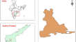
Assessment and distribution of groundwater quality using Water Quality Index and geospatial technology in Vempalli Mandal of Andhra Pradesh, India
Globally, imperishable control of water resources plays a substantial role to ensure continual growth in regions where there is shortage of water for...
-
Towards progressive geospatial information processing on web systems: a case study for watershed analysis in Iowa
Geographic Information Systems (GIS) are available as stand-alone desktop applications as well as web platforms for vector- and raster-based...

-
Pixel-based classification method for earthquake-induced landslide map** using remotely sensed imagery, geospatial data and temporal change information
A series of earthquakes occurred in Kumamoto, Japan, in April 2016, which caused numerous landslides. In this study, high-resolution pre-event and...

-
Google Earth Engine: empowering develo** countries with large-scale geospatial data analysis—a comprehensive review
Google Earth Engine (GEE) serves as a versatile platform for processing and visualising geospatial datasets, with its primary aim being to provide an...

-
Urban Water Security: Geospatial Insights into the Water Scarcity of Bengaluru City during 2023–2024
With a teeming population and rapid urban expansion, water demands in large cities are increasing multi-fold. Co** up with such large demands,...

-
Geospatial technologies for landslide monitoring: a case study of Sighetu Marmației, Romania
Landslides are a significant geological phenomenon with the potential for catastrophic consequences. There are numerous potential causes of...

-
Envisioning spatial justice in health geographies and groundwater governance of Kashmir Himalayas using socio-geospatial approach
Groundwater is emerging as vital resource in view of the changing climate and diminishing water surface availability. Due to the changing demographic...

-
Modeling Geospatial Uncertainty of Geometallurgical Variables with Bayesian Models and Hilbert–Kriging
In mine planning, geospatial estimates of variables such as comminution indexes and metallurgical recovery are extremely important to locate blocks...
-
Anthropogenic climate change accelerating monsoon hydrological hazards in Northeastern Himalayan region of India: geospatial approach
Geoenvironmentally, the northeastern Himalayan region of India is highly susceptible to geohydrological hazards due to heavy annual rainfall (varies...

-
Simulating crop yield estimation and prediction through geospatial data for specific regional analysis
Geospatial imagery play a key role in deciding land usage for agrarian planning and assessment by acknowledging the food security problems, impacts...

-
Geospatial analysis of factors driving gully erosion: a case study from Southeastern Nigeria
Gully erosion studies are usually complex and expensive due to the multiple nature of the causative factors, heterogeneity of the underlying geologic...

-
Role of Geospatial Technology in Shifting Cultivation Studies in India: A Systematic Review
Shifting cultivation is a traditional farming system that has been practised in many parts of the world for centuries. It is rampant in the northeast...

-
Estimation of surface runoff potential of an ungauged watershed in semi-arid region using geospatial techniques
Estimating surface runoff from an ungauged as well as gauged watersheds is vital for its planning besides construction of different water...

-
Geospatial distribution of heavy metals in sediments of water sources in the Drini i Bardhë river basin (Kosovo) using XRF technique
Heavy metals in sediments may have significant effects on environment and human health and can provide basic information for risk assessment of...

-
Geospatial-based climate variability analysis, in Central Ethiopia Rift Valley
Climate variability has been a crosscutting issue across the globe, where the effect is more adverse in develo** countries such as Ethiopia. The...

-
Cultural characteristics and geospatial distribution of landscape ecology in the perspective of regional culture
This paper provides an in-depth analysis and research on the cultural characteristics and geospatial distribution of the landscape environment...

-
Wind energy corridor identification for electricity-deficient areas of Pakistan using geospatial technologies
Pakistan is facing a huge energy crisis although the country has a surplus of renewable energy. Conventional energy sources are unable to meet the...

-
One-dimensional deep learning driven geospatial analysis for flash flood susceptibility map**: a case study in North Central Vietnam
Flash floods rank among the most catastrophic natural disasters worldwide, inflicting severe socio-economic, environmental, and human impacts....

-
Assessing soil erosion vulnerability through geospatial morphometric analysis in the Oued Amter Basin (Northwest Morocco)
Sustainable development is threatened by soil erosion. Since it takes over 300 years for a centimeter of soil to form, preventing soil erosion is...

-
Integrating Harris Hawks optimization and TensorFlow deep learning for flash flood susceptibility map** using geospatial data
Flash floods are recognized as some of the most devastating natural disasters globally, causing significant damage to socio-economic infrastructures,...
