Search
Search Results
-
The Geotechnical Baseline Report as Risk Allocation Tool
Today, timely and adequate attention for the risky subsoil is more than ever necessary for a healthy European infrastructure industry. A key succes...
-
Matching Monitoring, Risk Allocation and Geotechnical Baseline Reports
Monitoring ground and construction behaviour is a well-known risk mitigation tool during the construction of many European infrastructure projects....
-
Robust train length calculation and monitoring method using GNSS multi-constellation moving-baseline positioning resolution
Train length status reflects whether the carriage is uncoupled or thrown away, it directly affects the safety and efficiency of train operations. At...

-
Establishing morpho-dynamic baseline for flow-sediment management of a tidal river in the Ganges–Brahmaputra–Meghna Delta system through field measurement
In tidal environments, implementation of sustainable erosion management and land reclamation programs demands prior understanding of morphodynamic...

-
Coupled Baseline Estimation and Trend Analysis Approach to Differentiate Natural and Mine-Related Stresses on Groundwater Levels
Permitting and regulatory obligations require mine operators to periodically report the spatial extent of mine-induced water-level changes, and to...

-
Single station bias calculation using data from calibrated GNSS station for various baseline distances
Precise ionospheric TEC can be derived from dual-frequency GNSS carrier phase leveled pseudorange measurements. However, differential code biases...

-
AEON Transdisciplinary Natural Baseline in the Karoo (South Africa)
Given the fracking debate in South Africa, AEON initiated a transdisciplinary baseline research ahead of fracking related to possible exploration and...
-
Enhanced orbit and baseline determination for formation-flying LEO satellites with spaceborne accelerometer measurements
The ultra-sensitive accelerometer onboard low Earth orbit (LEO) satellite can measure the non-gravitational accelerations acting on the satellite in...
-
Performance of the local ionospheric model in resolving GPS baseline ambiguity over the Malaysian region
The positioning and navigation accuracy of the Global Positioning System (GPS) is highly affected by ionospheric conditions, especially in the...

-
VC-LAMBDA: a baseline vector constrained LAMBDA method for integer least-squares estimation
Global navigation satellite system (GNSS) ambiguity resolution is the key to realize high-precision navigation and positioning applications. For some...

-
Mitigating the effect of source structure in geodetic VLBI by re-weighting observations using closure delays and baseline-to-jet orientation
An ideal target for geodetic very long baseline interferometry (VLBI) is a strong and point-like radio source. In reality, most celestial sources...

-
Probing a southern hemisphere VLBI Intensive baseline configuration for UT1 determination
The deviation of Universal Time from atomic time, expressed as UT1−UTC, reflects the irregularities of the Earth rotation speed and is key to precise...

-
Geochemical Survey and Estimation of Baseline Concentrations of Major and Trace Elements in Stream Water, Uttar Pradesh, India: Implication for Environmental Studies
Stream water plays an important role in the development of habitats. It is one of the important sources of water used for drinking and irrigation in...
-
Climatic pacing of extreme Nile floods during the North African Humid Period
Understanding how large river systems will respond to an invigorated hydrological cycle as simulated under higher global temperatures is a pressing...

-
Isotope data in Migration Period archaeology: critical review and future directions
Early Mediaeval Archaeology was long influenced by traditional narratives related to so-called Völkerwanderungen . Based on the interpretation of...

-
Triple-frequency ambiguity resolution for GPS/Galileo/BDS between long-baseline network reference stations in different ionospheric regions
Fast and reliable ambiguity resolution (AR) between continuously operating reference stations (CORS) is indispensable in network real-time kinematic...

-
Machine learning-based multipath modeling in spatial domain applied to GNSS short baseline processing
Multipath is the main unmodeled error source hindering high-precision Global Navigation Satellite System data processing. Conventional multipath...

-
Comparison of the calculated frost event return period based on copula models under climate change: a case study of Chadegan region in Isfahan province- Iran
Spring frost, is one of the important phenomena that damage agricultural production in cold areas. Predicting the occurrence of frost events can be...

-
Estimating the Baseline Error of Wide-Swath Altimeters Using Nadir Altimeters via Numerical Simulation
The baseline roll and length errors for wide-swath altimeters are major error sources in sea surface measurements that exhibit strong spatial...
-
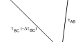
Baseline-dependent clock offsets in VLBI data analysis
The primary goal of the geodetic Very Long Baseline Interferometry (VLBI) technique is to provide highly accurate terrestrial and celestial reference...