Search
Search Results
-
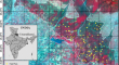
Above Ground Biomass Map** of Tropical Forest of Tripura Using EOS-04 and ALOS-2 PALSAR-2 SAR Data
Above Ground Biomass (AGB) is a vital factor in the forest ecosystem, closely linked to the carbon cycle and global climate change. Synthetic...

-
Assessment of surface soil moisture from ALOS PALSAR-2 in small-scale maize fields using polarimetric decomposition technique
Surface soil moisture knowledge is important, especially in agriculture and irrigation management. Properties of microwave remote sensing like...

-
Postseismic deformation following the 2016 Kumamoto earthquake detected by ALOS-2/PALSAR-2
I have been conducting a study of postseismic deformation following the 2016 Kumamoto earthquake using ALOS-2/PALSAR-2 acquired till 2018. I apply...

-
Deformation monitoring and failure mode research of mining-induced Jianshanying landslide in karst mountain area, China with ALOS/PALSAR-2 images
The Jianshanying landslide in Guizhou province, China, is a typical mining-induced landslide with its complex formation in karst mountainous area....

-
Estimation of Above Ground Biomass with Synthetic Aperture Radar (SAR) Data in Lothian Island, Sundarbans, India
The present study deals with the estimation of aboveground biomass (AGB) using synthetic aperture radar (SAR) data in a highly complex mangrove...

-
Comparison of ASTER GDEM3, SRTM3, NASADEM, TanDEM-X90, AW3D30, and ALOS PALSAR data with TanDEM-X12: a case study of Tagragra of Akka inlier, Moroccan Anti-Atlas
Digital elevation models (DEMs) provide valuable information for many scientific applications that rely on elevation and digital terrain modeling. In...

-
Monitoring Yanwan deep-seated toppling deformation with the impact of water-level fluctuation by SAR observations
Reservoir filling in large hydropower stations triggers or accelerates deep-seated toppling deformations (DSTDs). In the absence of large failures,...

-
Monitoring of landslide displacements in Owakudani, Hakone volcano, Japan, using SAR interferometry
Owakudani (Owakuzawa Valley), the largest fumarole area in Hakone volcano, Japan, is a place where volcanic disasters occur frequently, such as the...

-
Application of Interferometry SAR for Monitoring of Peatland Area—Case Studies in Indonesia
Fires are a significant threat to peat-rich biomes resulting in extensive carbon loss. The peat fires are dominated by smoldering combustion and can...
-
Forest Aboveground Biomass and Forest Height Estimation Over a Sub-tropical Forest Using Machine Learning Algorithm and Synthetic Aperture Radar Data
Forest aboveground biomass (AGB) is a key measurement in studying terrestrial carbon storage, carbon cycle, and climate change. Machine learning...
-
Assessment and quantification of sediment retention and dam management in arid environments using remote sensing techniques
The current study implements an empirical soil erosion model (RUSLE) along with remote sensing data, and TerrSet algorithms to analyze sediment...

-
Assessment of the ASAR and PALSAR Sensors Applicability for Detecting and Monitoring of Landslides in the Zagros Area (Iran) Through Differential Synthetic Aperture Radar Interferometry (DInSAR)
Lunching satellites equipped with the Synthetic Aperture Radar (SAR) sensor for interferometry applications has created a great chance to detect and...

-
Assessment of the Bureya River Landslide Reactivation Using the Persistent Scatterer Interferometry
AbstractThe results from the Bureya landslide study by the method of persistent scatterers using multi-temporal synthetic aperture radar (SAR) data...

-
Four decades of Glacier and Glacial Lake dynamics in Kishtwar high altitude National Park, Chenab Basin, Jammu and Kashmir, India
The Himalayan region is experiencing a heightened risk in downstream habitats due to the effects of climate change, which include rapid glacier...

-
Forest Stand Height Estimation Using Inversion of RVoG Model Over Forest of North-Eastern India
Multiple studies have been carried in the recent years to estimate forest height using remote sensing techniques. The forest height is an essential...
-
L-Band Analysis of the Effects of Oil Slicks on Sea Wave Characteristics
The purpose of this study was to investigate the characteristics of sea surface waves as they pass through oil slicks. The parameterized first-guess...
-
Forest Characterization Using C-band SAR Data—Initial Results of EOS-04 Data
In satellite remote sensing, C-band synthetic aperture radar (SAR) sensors with the frequency of about 5.4 GHz and wavelength of about 5.5 cm...

-
Integration of remote sensing and a GIS-based method for revealing prone areas to flood hazards and predicting optimum areas of groundwater resources
Groundwater is a valuable water resource in the arid/hyper-arid regions where the precipitation is limited. Thus, the need for groundwater has risen...

-
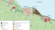
Methods of Radar Interferometry and Optical Satellite Image Processing to Study Negative Effects on the Environment (a Case Study of the Baikalsk Pulp and Paper Mill)
AbstractThe results of the study of the condition of the territory and waste deposits of the Baikalsk Pulp and Paper Mill using radar and optical...
-
Analysis of the Block-Fault Structure Dynamics in the Area of Earthquakes in 2008 and 2020 near Southern Lake Baikal by the Methods of Satellite Radiointerferometry
AbstractThe displacements of the Earth’s surface before and after the earthquakes that took place near the southern shore of Lake Baikal on September...
