Search
Search Results
-
4D seismic co-processing pre-stack depth migration for scarce acquisition repeatability
Time-lapse (4D) seismic processing is routinely used to monitor hydrocarbon reservoir production. Seismic reflections are sensitive to formation...

-
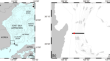
Time-lapse imaging of shallow water coastal regions using a portable ultra-high-resolution 3D seismic survey system: a case study from offshore Pohang, South Korea
Time-lapse seismic imaging, used to detect changes in strata and physical properties beneath the seafloor, plays a crucial role in traditional...

-
Ensemble-based history matching of the Edvard Grieg field using 4D seismic data
The Edvard Grieg field is a highly complex and heterogeneous reservoir with an extensive fault structure and a mixture of sandstone, conglomerate,...
-
Evaluation of High-Resolution 3D and 4D Seismic Data
3D seismic data is acquired with regular, close grid spatial sampling which allows application of high-end processing techniques to deliver high...
-
Implementing 4D seismic inversion based on Linear Programming techniques for CO2 monitoring at the Sleipner field CCS site in the North Sea, Norway
This article provides a comprehensive analysis of CO 2 injection monitoring in the Sleipner Field. Ensuring the safe storage and containment of CO 2 in...

-
Evaluation of 3D seismic survey design parameters through ray-trace modeling and seismic illumination studies: a case study
This paper describes a case study of wavefront construction-based ray-trace modeling to access the 3D seismic exploration parameters that...

-
Characterization of Stronghold Fortifications by 2D/3D/4D Electrical Resistivity Tomography: Major Push Towards Quantitative Interpretation
Geophysical methods are widely used as noninvasive tools for archaeological prospection. In a first step is usually applied basic prospection of vast...

-
Seismic Data Compression: A Survey
With the advent of robust computing power, any sophisticated algorithm for data compression is becoming a trivial task. With more than petabytes of...
-
Characterization of weak layers in the Southwestern slope of Ulleung Basin with seismic data merging and inversion
Failure at steep slopes and areas covered by a landslide can be controlled by laterally extended weak layers within the slope stratigraphy. Seismic...
-
Denoising of multidimensional seismic data in the physical domain by a new non-local self similarity method
Decomposing the seismic data into sparse and low-rank component algorithms is among the applicable methods in efficient seismic random noise...

-
Detection of Dynamic Phenomena Associated with Underground Nuclear Explosion Using Multiple Seismic Surveys and Machine Learning
The application of an active seismic method for detecting the source location of an underground nuclear explosion (UNE) is an ongoing field of...

-
Feasibility Study of Anisotropic Full-Waveform Inversion with DAS Data in a Vertical Seismic Profile Configuration at the Newell County Facility, Alberta, Canada
As an emerging seismic acquisition technology, distributed acoustic sensing (DAS) has drawn significant attention in earth science for long-term and...

-
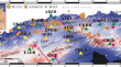
Data and early results from temporary seismic arrays for monitoring and investigating magmatic processes beneath Mt. Halla and Ulleung Island volcanoes, South Korea
Temporary seismic networks on Mt. Halla and Ulleung Island volcanoes were deployed, which employ broadband and geophone arrays to monitor potential...
-
Site characterization of Algerian broadband seismic stations using earthquake and ambient vibration data: topographic and lithological site-effects investigation
A reliable site characterization of a seismic monitoring station helps in the objective determination of the local magnitude. Therefore, 17 broadband...
-
Development of a portable 3D seismic survey system for nearshore surveys and the first case study offshore Pohang, South Korea
The utilization of sea areas adjacent to land has rapidly increased in recent years due to the expansion of economic activities from the land to the...

-
Geophysical Investigation and 3D Modeling of Bedrock Morphology in an Urban Sediment-Filled Basin: The Case of Bolzano (Northern Italy)
Bedrock map** is essential for understanding seismic amplification, particularly in sediment-filled valleys or basins. However, this can be hard in...

-
Study on the shallow gas distribution in Yeongil Bay using seismic attribute analysis
Seismic attribute analysis, a method of highlighting important information in seismic data, has been used in various fields. Recently, several...
-
Interpolated Fast Damped Multichannel Singular Spectrum Analysis for Deblending of Off-the-Grid Blended Data
Blended acquisition offers significant cost and period reduction in seismic data acquisition. However, fired blended sources are usually deployed at...

-
Quantification of modelled 4D response and viability of repeated seismic reservoir monitoring in J-Area Field, Central North Sea
4D reservoir monitoring has recently become a major tool used to manage the hydrocarbon production of reservoirs. When combined to production well...

-
Establishing a High Resolution 3D Fracture Dataset in Chalk: Possibilities and Obstacles Working with Outcrop Data
The offshore industry depends largely on usage of indirect methods, such as conventional seismics, complimented by well-scale test data and cores....