Search
Search Results
-
Integrated hydrological study for flash flood assessment using morphometric analysis and MCDA based on hydrological indices—Al-Sail Al-Kabir, KSA
Flood susceptibility is associated with a variety of factors. A hydrologic study of Wadi Al-Sail Al-Kabir was conducted based on morphometric...

-
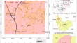
A hybrid integration of analytical hierarchy process (AHP) and the multiobjective optimization on the basis of ratio analysis (MOORA) for landslide susceptibility zonation of Aizawl, India
Landslide susceptibility zonation map** is important to identify the places susceptible to landslides according to the failure probability of...

-
A framework of ecological sensitivity assessment for the groundwater system in the Mi River basin, Eastern China
As a critical natural resource, groundwater plays an important role in the stability of the geological environment and the balance of the ecosystem....

-
Post-mining planning under the prism of land use alternatives: a cellular automata model
Greece committed to the European Green Deal plans to complete mining operations by the end of 2028 and to transition from coal-based electricity to...

-
Indicator of suitability for evaluating the aquifer thermal energy storage using the GIS-based MCDA technique in the Halabja-Khurmal sub-basin
Thermal energy is one of the eco-friendly sources of energy used worldwide for storing heat and cold between seasons. The aquifer thermal energy...

-
Urban waterlogging risk susceptibility within changing pattern of rainfall intensity in Delhi, India
Waterlogging and floods are among the most recurring and devastating natural hazards likely to occur more frequently in cities due to climate changes...

-
Utility of common variance of equally-weighted variables for GIS-based landslide susceptibility map** at the eastern Himalaya
Landslide susceptibility maps are modelled either by knowledge-driven methods (qualitative) or data-driven methods (quantitative) depending on apriori ...

-
Delineation of flood risk terrains and rainfall visualisation in the North Western part of Ghana
Flooding, exacerbated by the challenges of climate change, poses a growing threat to communities in the Upper West Region (UWR) of Ghana. This...

-
Knowledge-Driven Fuzzy AHP Model for Orogenic Gold Prospecting in a Typical Schist Belt Environment: A Mineral System Approach
In this paper, the knowledge-driven fuzzy AHP (FAHP) model was applied in the predictive prospectivity map** of orogenic gold deposits using the...

-
Application of Geostatistical and Geospatial Techniques for Groundwater Quality Vulnerability Assessment Using Hydrogeochemical Parameters: A Case Study of NCT Delhi
We use an integrated approach for evaluating groundwaterGroundwater vulnerabilityVulnerability using the multi-criteria decision makingMulti-Criteria...
-
Forecasting groundwater fluctuations caused by earthquakes using fuzzy logic and AHP Method: A case study from Iran
Earthquakes cause changes in the groundwater level; however, the mechanism of these changes has not been accurately identified or predictable so far....

-
Integrated approach for the assessment of forest fire risk and burn severity map** using GIS, AHP method, and Google Earth Engine in Western Algeria
In Algeria, more than 29% of the forest heritage is located in the western part where forest fires remain the most devastating factor. The assessment...

-
Map** Greater Bandung flood susceptibility based on multi-criteria decision analysis (MCDA) using AHP method
Floods are natural disasters caused by certain factors, and these floods can cause a lot of material or immaterial losses. Bandung Raya is an area...

-
Groundwater harvesting and artificial recharge site identification on upper Shilabati watershed using geospatial approaches
Rainwater harvesting and artificial recharge are substitute procedures to enhance groundwater and surface water for providing an unceasing water...

-
Flooding vulnerability in Algiers (Algeria): an analytic hierarchy process
Flooding is the second most serious hazard in Algeria, after earthquakes. According to the Civil Protection Services census, the department of...

-
Application of Analytical Hierarchy Process (AHP) Method to Flood Risk Assessment at Sub-Himalayan Region Using Geospatial Data: A Case Study of Alipurduar District, West Bengal, India
Floods are widespread natural calamities around the world, frequently resulting in fatalities as well as significant environmental and economic...
-
Enhanced Methods for Evaluating Aquifer Susceptibility: Incorporating Static and Dynamic Vulnerability Assessments
This study transforms the concept of the intrinsic vulnerability of aquifers to pollution by integrating static and dynamic elements into the...

-
AHP GIS-aided flood hazard map** and surface runoff estimation in Gurugram, India
The present study is aimed to perform flood susceptibility map** in the rapidly develo** Gurugram district of India. Major flood-triggering...

-
Integrated GIS-based and geophysical techniques in groundwater potential zonation: a case study of Jos North local government area
Groundwater is the primary water source for domestic and industrial use in Jos North local government area. Being an area classified to be a...
-
Integrating development inhomogeneity into geological disasters risk assessment framework in mountainous areas: a case study in Lushan–Baoxing counties, Southwestern China
The impact of geological disasters on mountainous settlement have been focused on in recent years. Despite the booming development in the modeling of...
