Search
Search Results
-
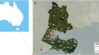
Past anthropogenic activities offset dissolved inorganic phosphorus retention in the Mississippi River basin
The rapid acceleration of anthropogenic phosphorus (P) loadings to watersheds has fuelled massive freshwater and coastal eutrophication and...

-
Revisiting landslide risk terms: IAEG commission C-37 working group on landslide risk nomenclature
Significant effort has been devoted during the last few decades to the development of methodologies for landslide hazard and risk assessment. All of...

-
Integration of RS-GIS with Frequency Ratio, Fuzzy Logic, Logistic Regression and Decision Tree Models for Flood Susceptibility Prediction in Lower Gangetic Plain: A Study on Malda District of West Bengal, India
Flood is one of the most commonly occurring natural calamities in the lower Gangetic flood plain region of India. Hence, the present study aims to...

-
Hydrogeochemical studies of groundwater in semi-arid areas of northern Ethiopia using geospatial methods and multivariate statistical analysis techniques
The present study focused on evaluating the groundwater hydrogeochemical of shallow aquifers in the semi-arid areas of northern Ethiopia, using...

-
Urban Heat Island vulnerability map** using advanced GIS data and tools
Urban Heat Island (UHI) is a phenomenon that can cause hotspots in city areas due to dense, impervious infrastructure and minimal vegetation cover....
-
A Geospatial Review Analysis of Increased Frequency of Large Glacier-Related Landslides in Mountainous Regions
As the world warms, many glaciers throughout the world are melting. Glacier melting has been linked to climate change as a major cause of landslides...
-
Rare earth elements in an intercrop** cover crop to evaluate the trace element transfer from soil to plant
Transfer of trace elements, such as toxic metals, from soil to plant is a corner stone for risk assessment. Rare earth elements (REE) are frequently...

-
Trends and impacts of temperature and fire regimes in South Africa’s coastal national parks: implications for tourism
Climate change poses significant risks on coastal national park-based tourism through its effect on accessibility, comfort levels, and spatiotemporal...

-
Spatial modelling of deforestation in Romanian Carpathian Mountains using GIS and Logistic Regression
Deforestation process represents a wide concern mainly in the mountain environments due to its role in global warming, biodiversity loss, land...
-
The ambiguity in IPCC’s risk diagram raises explanatory challenges
The concept of risk remains a key aspect in the recently published 6th Assessment Report of the Intergovernmental Panel on Climate Change (IPCC). The...

-
Landslide impacting factors and susceptibility assessment in part of the Purvanchal Himalayas using data mining approaches
This research was to assess the terrain factors responsible for landslide and generation of landslide susceptibility map (LSM) in the Mao-Maram of...

-
On rogue La Niñas, with below-average monsoon rainfall
Prediction of the seasonal monsoon rainfall over India relies largely on the well-known relationship with El Niño and Southern Oscillation (ENSO) and...

-
Modelling impacts of climate change on coastal West African rainfall
Several tropical regions of the world, including West Africa are strong climatic hotspots where increase in extreme climatic events (e.g., droughts)...

-
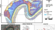
Unraveling engineering disturbance effects on deformation in red-bed mudstone railway cuttings: incorporating crack-facilitated moisture diffusion
Red-bed mudstone, prevalent in southwest China, poses a formidable challenge due to its hydrophilic clay minerals, resulting in expansion,...
-
Geospatial assessment of landslide-prone areas in the southern part of Anambra State, Nigeria using classical statistical models
As global greenhouse gas concentrations intensify climate change impacts, the risk of landslides increases, particularly in Southern Anambra State,...

-
A Novel Approach to Measuring Spatiotemporal Changes in Social Vulnerability at the Local Level in Portugal
Social vulnerability, as one of the risk components, partially explains the magnitude of the impacts observed after a disaster. In this study, a...

-
The Role of Urban Planning and Landscape Tools Concerning Flash Flood Risk Reduction Within Arid and Semiarid Regions
This chapter highlights some substantial questions inquired by researchers to comprehend the flood risks (FRs) that occur in their cities as follows:...
-
Application of the AHP method for prioritizing actions to reduce risk associated with gravitational mass movements in areas along the margins of watercourses of the city of Rio Branco, Brazil
Problems related to gravitational mass movements at the margins of watercourses are present in different parts of the world, but in the Amazon, whose...
-
An integrated approach for landslide susceptibility map** by considering spatial correlation and fractal distribution of clustered landslide data
Natural disasters often show highly heterogeneous character due to complex geo-environmental settings. The spatial distribution of landslides is...

-
Investigation on Rockburst Mechanism Due to Inclined Coal Seam Combined Mining and its Control by Reducing Stress Concentration
Combined mining is when two working faces separated by a certain distance simultaneously advance in the same direction, which commonly results in...
