Search
Search Results
-
Water leakage susceptible areas in loess multi-arch tunnel operation under the lateral recharge conditions
In this study, the water leakage susceptible areas in a loess multi-arch tunnel were examined, providing a basis for the prevention and control of...

-
Effects of the Dicranopteris linearis root system and initial moisture content on the soil disintegration characteristics of gully erosion
Benggang erosion is caused by a special type of gully erosion in southern China that seriously endangers the local ecology and environment. In this...
-
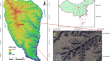
Bank gully extraction from DEMs utilizing the geomorphologic features of a loess hilly area in China
As one of most active gully types in the Chinese Loess Plateau, bank gullies generally indicate soil loss and land degradation. This study addressed...
-
Peak extraction and classification from digital elevation models based on the relationship between morphological characteristics and spatial position
A peak is an important topographic feature crucial in quantitative geomorphic feature analysis, digital geomorphological map**, and other fields....
-
Characteristics and influencing factors of proximity distance index on the northern Shaanxi Loess Plateau in China
Topographic feature points and lines are the framework of topography, and their spatial distance relationship is an breakthrough in the study of...
-
The rainfall erosion mechanism of high and steep slopes in loess tablelands based on experimental methods and optimized control measures
The geological integrity of the Loess Plateau is extremely weak. Following the concept and goal of harmonious co-existence between the human race and...

-
Spatiotemporal Distribution Characteristics of Land Resources in the Middle Reaches of the Yellow River in China from 1980 to 2018: An Asset Perspective Based on Multi-source Data
A land resource asset (LRA) table is highly valued by the Chinese government for resource management. However, most of China’s researches on LRA...

-
Terrace extraction based on remote sensing images and digital elevation model in the loess plateau, China
Terraces are important objects of soil and water conservation and land use surveys in the Loess Plateau and considerably impact soil erosion and...

-
Evaluation of gully head retreat and fill rates based on high-resolution satellite images in the loess region of China
The acceleration of large gully erosion in the loess environments of China is a matter of concern because of the changing land use and urban...
-
Influence of crack characteristics on the morphological development of Benggang and hydrological processes
Benggang is a special type of soil erosion, which widely distributes in the granite residual soil area of southern China. Owing to the influence of...
-
Evaluation of Various Deep Learning Algorithms for Landslide and Sinkhole Detection from UAV Imagery in a Semi-arid Environment
Sinkholes and landslides occur due to soil collapse in different slope types, often triggered by heavy rainfall, presenting challenges in the...
-
Terrain relief periods of loess landforms based on terrain profiles of the Loess Plateau in northern Shaanxi Province, China
The Loess Plateau is densely covered by numerous types of gullies which represent different soil erosion intensities. Therefore, research on...
-
Identify runoff generation patterns of check dams and terraces and the effects on runoff: a case study
Over the past 50 years, China has implemented a series of ecological construction projects in the Loess Plateau that have significantly decreased the...

-
Quaternary integrative stratigraphy, biotas, and paleogeographical evolution of the Qinghai-Tibetan Plateau and its surrounding areas
The Quaternary strata on the Qinghai-Tibet Plateau contain rich information about the paleoclimate and environmental evolution, record the evolution...
-
Wireless remote spatiotemporal monitoring of high-fill foundation deformation
The spatial and temporal deformation patterns and deformation control indicators of high-fill foundations directly affect the design, construction...
-
Identifying sediment sources from the inter-gully area and gully area in a small watershed in the Loess Hilly Region of China
Understanding the sediment source is very significant for erosion control in small watersheds. On the Loess Plateau of China, over 110 thousands of...

-
Estimation of Soil Erosion Using RUSLE Model and GIS Tools: A Study of Chilika Lake, Odisha
Chilika Lake is the largest coastal lagoon on the eastern coast of India. The aerial extension of the lake fluctuates between 1165 km 2 to 906 km 2 ....
-
Landslide susceptibility modeling using bivariate statistical-based logistic regression, naïve Bayes, and alternating decision tree models
The main aim of this study is to use weights of evidence (WoE), logistic regression (LR), naïve Bayes (NB), and alternating decision tree (ADTree)...

-
Identifying ephemeral gullies from high-resolution images and DEMs using flow-directional detection
Ephemeral gullies, which are widely developed worldwide and threaten farmlands, have aroused a growing concern. Identifying and map** gullies are...
-
Map** the dynamics of urban land creation from hilltop removing and gully filling Projects in the river-valley city of Lanzhou, China
Lanzhou is located in the long, narrow valley of the Yellow River Basin, China. With the development of urbanization, the contradiction between its...
