Search
Search Results
-
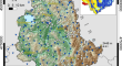
Long-term analysis of rainfall-induced landslides in Umbria, central Italy
Analyses of historical records of landslides and climate variables are useful tools to search for correlations between damaging landslide events and...
-
Discovering patterns in the topography of existing settlements: the case of the China-Pakistan Economic Corridor (CPEC) route
It is important to recognize the influence of terrain characteristics on the spatial distribution of settlements as it can aid policymakers in...

-
Hydrus-3D-Based Study on Water Retention in Chinese Slo** Farmland
AbstractSoil moisture affects the regional water cycles and the processing of afforestation. However, how the soil moisture varied and distributed...
-
Statistical downscaling of precipitation in northwestern Iran using a hybrid model of discrete wavelet transform, artificial neural networks, and quantile map**
Downscaling of daily precipitation from Global Circulation Models (GCMs)-predictors at a station level, especially in arid and semi-arid regions, has...
-
Effects of bed longitudinal inflexion and sediment porosity on basal entrainment mechanism: insights from laboratory debris flows
Channel morphology and bed sediment erodibility are two crucial factors that significantly affect debris flow entrainment processes. Current debris...

-
Evaluation of total dissolved solids in rivers by improved neuro fuzzy approaches using metaheuristic algorithms
Substantial deterioration of surface water quality, mainly caused by human activities and climate change, makes the assessment of water quality a...

-
Assessing the Impact of Habitat Fragmentation on the Distribution of Juvenile and Larval Sillago Species in the Ka Long Estuary Located in Northern Vietnam
Habitat fragmentation has the potential to impact animal diversity by diminishing ecological connectivity, particularly in estuarine and mangrove...

-
Quantitative analysis of the effects of climate change and human activities on the runoff in the Shiyang River Basin
Linear regression, inverse distance weighting analyses, and Budyko’s hypothesis were applied to the Shiyang River Basin. The spatial and temporal...

-
Variability and trends in tropical precipitation intensity in observations and climate models
Variations and changes in the tropical (30 o N-30 o S) precipitation amount and precipitation intensity during the satellite era (1979-present) are...
-
Natural hazards fatalities in Brazil, 1979–2019
The impact of natural hazards on nations and societies is a global challenge and concern. Worldwide, studies have been conducted within and between...

-
The characteristics and future projections of fire danger in the areas around mega-city based on meteorological data–a case study of Bei**g
It is crucial to investigate the characteristics of fire danger in the areas around Bei**g to increase the accuracy of fire danger monitoring,...
-
The role of susceptibility, exposure and vulnerability as drivers of flood disaster risk at the parish level
Fluvial flooding continues to be a process that has a major impact on society, the environment and the economy. Although its natural triggering...

-
Evaluation of Freshwater Water Quality with Indexes and GIS-Based: A Case Study, Güren Stream (Küre Mountains National Park, Western Black Sea Basin, Turkey)
AbstractTurkey is separated into 25 river basins, and the Güren Stream is found in Kastamonu Province’s West Black Sea Basin. Güren Stream originates...

-
A critical review on landslide susceptibility zonation: recent trends, techniques, and practices in Indian Himalaya
The Indian Himalayan region is highly susceptible to landslides because of its complex geology, rugged topography, steep slopes augmented by...

-
Landslide Hazard Susceptibility Analysis and Modelling in the Vicinity of the Proposed Subansiri Lower HE Project, Arunachal Pradesh
The Himalayan region of India, in particular, faces an escalating slope instability due to landslides, posing significant pressure on rapid...
-
Incident of lightning-related casualties in Bihar, India: An analysis and vulnerability assessment
In terms of natural disasters, lightning is India's most devastating threat, causing over 2500 casualties per year, according to the latest annual...

-
Measuring spatial structure in time-averaged deposits insights from Roc de Marsal, France
The use of space, both at the landscape and the site level, is considered an important aspect of hominin adaptations that changed through time. At...

-
Subgrid Variability of Atmospheric Surface-Layer Parameters in Complex Terrain
This paper reports analysis of eddy-covariance data collected during the WFIP2 field campaign in the complex-terrain of the US Pacific Northwest. A...

-
Regional-scale landslide susceptibility assessment for the hilly state of Uttarakhand, NW Himalaya, India
Landslide and related mass movement activities are common and one of the most destructive natural hazards in the mountainous terrain including the...

-
The evolution of “riskscapes”: 100 years of climate change and mountaineering activity in the Lake Louise area of the Canadian Rockies
Climate change is contributing to the rapid warming of mountain environments, resulting in glacial retreat, diminished snowpacks, and permafrost...
