Search
Search Results
-
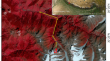
Detecting Chamoli landslide precursors in the southern Himalayas using remote sensing data
On 7 February 2021, a catastrophic flood destroyed two hydropower plants, killing at least 150 people in the Himalayan Uttarakhand state of India....
-
Monitoring slope stabilization of a reactivated landslide in the Three Gorges Reservoir Region (China) with multi-source satellite SAR and optical datasets
This study presents a long-term reactivation monitoring approach using multi-source satellite SAR and optical data. It also explores the relationship...

-
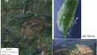
Combination of satellite InSAR, stereo map**, and LiDAR to improve the understanding of the Chuwang**g landslide in the Three Gorges Reservoir Area
Since its impoundment in 2003, more than 5,000 landslides have been identified in the Three Gorges Reservoir, and more than 600 slides have apparent...

-
Dynamic deformation monitoring and scenario simulation of the **aomojiu landslide in the **sha River Basin, China
The **aomojiu landslide is a typical high-elevation, long-runout landslide located in the **sha River Corridor. In this study, sequential InSAR...

-
Preliminary analysis of the catastrophic February 22nd 2023 **n**g open-pit mine landslide, Inner Mongolia, China
On February 22, 2023, a devastating landslide occurred on the mining slope of an open-pit coal mine in Inner Mongolia, China, leading to the mining...

-
Reactivated Wuwanchai landslide area monitoring and analysis
Terrain that has previously experienced a landslide is subject to the additional threat of reactivated landslides. The reactivated Wuwanchai...
-
The Kangjiapo landslide in Wanzhou district, Chongqing city: reactivation of a deep-seated colluvial landslide in the Three Gorges Reservoir
How to reduce landslide risk economically and effectively is a very meaningful and challenging research topic. In particular, it is difficult and...

-
Active fault control led to the Moli landslide triggered by rainfall on 26 February 2021 in Zhouqu County, Gansu, China
The reactivation of ancient landslides, a persistent issue that hinders urban development and threatens human safety, is the central focus of this...

-
Effect of Landslide Deformation on the Stability of St. Andrew’s Church (Kyiv, Ukraine): Applications of Remote Sensing and Mathematical Modeling
This article presents the work conducted by the authors to analyze the stability of the St. Andrew’s Church which contains architecture, painting and...
-
Optimising landslide initiation modelling with high-resolution saturation prediction based on soil moisture monitoring data
It has been widely recognised that the degree of soil wetness before precipitation events can be decisive for whether or not shallow rainfall-induced...

-
Understanding the occurrences of fault and landslide in the region of West-Cameroon using remote sensing and GIS techniques
Remote sensing was used to visualize the West region with the purpose of investigating recent natural hazards observed in this area. Various...

-
A local rainfall-triggered giant landslide occurred in a region along a high-speed railway on the Qinghai–Tibetan Plateau
An increasing number of geological hazards along high-speed railways on the Qinghai–Tibetan Plateau have occurred and have resulted in a profound...
-
Investigation on the development characteristics and reactivation mechanism of the Zhama ancient landslide in Batang County, Eastern Tibetan Plateau, China
This study examines the Zhama ancient landslide, one of several large-scale ancient landslides with complex formation mechanisms and significant...

-
Landslide Hazard and Monitoring
Landslides are a widespread geological event with nearly 12% of India’s land area being prone to this natural hazard. The development of a reliable...
-
Wireless remote spatiotemporal monitoring of high-fill foundation deformation
The spatial and temporal deformation patterns and deformation control indicators of high-fill foundations directly affect the design, construction...
-
From landslide characterization to nature reserve management: The “Scialimata Grande di Torre Alfina” landslide Geosite (Central Apennines, Italy)
Italy is characterized by widespread geomorphological instability, among which landslides leave impressive marks on the landscape. Nevertheless,...
-
Tracking deformation velocity via PSI and SBAS as a sign of landslide failure: an open-pit mine-induced landslide in Himmetoğlu (Bolu, NW Turkey)
A destructive landslide occurred in Himmetoğlu village in Göynük District (Bolu, NW Turkey) caused by open-pit coal mining activities. Field...

-
Comprehensive investigation of a dangerous counter-tilt landslide in the upper reaches of **sha River, China
Timely and detailed investigation of dangerous landslides is crucial for preventing catastrophic disasters. On June 29, 2023, the local collapse of...

-
Formation mechanism and dynamic process of open-pit coal mine landslides: a case study of the **n**g landslide in Inner Mongolia, China
Expanding open-pit mining towards larger mining scales and greater strip** depths increases the potential risks of landslides on high and steep...

-
Integrating predictive modeling techniques with geospatial data for landslide susceptibility assessment in northern Pakistan
The eastern road section of the China-Pakistan Economic Corridor (CPEC) traverses the challenging terrain of northern Pakistan, where frequent...