Search
Search Results
-
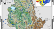
Analysis of Urban Expansion Patterns Through Landscape Metrics in an Emerging Metropolis of Mangaluru Community Development Block, India, During 1972–2018
Urban growth in the twenty-first century, unlike the conventional mega-city centred development, is occurring in small- and medium-sized cities of...

-
Distribution and migration characteristics of heavy metals around rainfall in soil–water system at closed gold and iron mines in Bei**g, China
This study investigated the migration, transformation, and clustering characteristics of trace elements in the abandoned mining areas before and...

-
Prediction of Relatively High-Energy Seismic Events Using Spatial–Temporal Parametrisation of Mining-Induced Seismicity
Mining-induced seismicity has been reported almost in every mining country. Large seismic events with high-energy (HE) radiation can pose a serious...

-
Characterization of wet and dry periods over southern South America
This study characterizes wet and dry conditions in southern South America, defined through the standardized precipitation evapotranspiration index...

-
Debris flow susceptibility map** using the Rock Engineering System (RES) method: a case study
The main purpose of the present study is to develop a debris flow susceptibility map of a mountain area (Susa Valley, Western Italian Alps) by using...
-
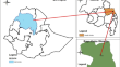
Impacts of small-scale irrigation on rural households’ income in north eastern Ethiopia
Irrigation is one means by which agricultural production can be increased to meet the growing food demand in Ethiopia. Small-scale irrigation is...
-
Quantify the Effect of China’s Emission Trading Scheme on Low-carbon Eco-efficiency: Evidence from China’s 283 Cities
The establishment of a carbon trading market is crucial for China to fulfil its carbon emission commitments through a market mechanism. As a...

-
Evolution, Extinction, Homology and Homoplasy of the Larger Benthic Foraminifera from the Carboniferous to the Present Day, as Exemplified by Planispiral-Fusiform and Discoidal Forms
Examples of evolution, extinction and homoplasy of the larger benthic foraminifera (LBF) occur throughout their history. Since the Carboniferous, LBF...
-
Landslide Hazard and Risk Management Framework for Alaknanda Basin in the Indian Himalayan Region
Landslides in the Indian Himalayan Region (IHR) primarily result from extreme precipitation events, distinctive topography, and inadequate soil and...
-
Simultaneous increase in temperature and dry days in West African transboundary Benue River Basin
This study examines the spatial and temporal changes in temperature and precipitation extremes from 1951 to 2020 in the West African transboundary...

-
NPP spatio-temporal change characteristics and contribution analysis of land-use type in the Shendong mining area
While driving regional economic development, coal mining also causes environmental problems. Changes in land use are associated with mining impact...

-
GIS-based flood susceptibility analysis using multi-parametric approach of analytical hierarchy process in Majuli Island, Assam, India
Flood is a natural disaster that impacts each and every sector of a society directly or indirectly. The geography of Assam makes it a suitable land...

-
Urban Flooding in Manaus, Northern Brazil: Extreme Events, Susceptibility, and Inequalities
In the state of Amazonas, the capital Manaus underwent several transformations in its content forms, associated with the temporal-spatial aspects of...
-
Understanding the role of training sample size in the uncertainty of high-resolution LULC map** using random forest
High-resolution sensors onboard satellites are generally reputed for rapidly producing land-use/land-cover (LULC) maps with improved spatial detail....

-
A Method for Automatic Assessment of Rockfall Susceptibility Based on High-Resolution Point Clouds
Typical rockfall analysis requires detailed discontinuity measurements; however, the use of conventional contact approaches can be challenging on...

-
Hillslope elements and soil–landscape analysis in Himalayas for characterizing soil quality parameters using digital terrain model and remote-sensing data
Hillslope elements and land cover types are primarily determining the spatial variability of soils in the hilly and mountainous landscape. Among the...

-
Identification of soil erosion-prone areas and annual average soil loss of Siddheswari River basin, Eastern India
Soil erosion is one of the major environmental issues influencing productivity and soil deterioration. Various erosion agents have contributed to...

-
Spatial Analysis
The most important function of GIS is the analysis of spatial data and their attributes for purposes of decision support. Indeed, spatial...
-
Seasonal prediction of European summer heatwaves
Under the influence of global warming, heatwaves are becoming a major threat in many parts of the world, affecting human health and mortality, food...

-
Long-term analysis of rainfall-induced landslides in Umbria, central Italy
Analyses of historical records of landslides and climate variables are useful tools to search for correlations between damaging landslide events and...