Search
Search Results
-
Automated Extraction of Slum Built-up Areas from Multispectral Imageries
Slum areas are dense urban areas in which the building size is quite small, and the buildings are interconnected with each other. Also, there is a...
-
Map** and monitoring of mangrove species in Eastern Lagoon National Park, Abu Dhabi, using Landsat 8 OLI data
Mangrove species are shrubs and trees that are ecologically efficient and salt tolerant, predominantly grow in the intertidal region where land and...
-
Using multispectral and radar remote sensing data for geological investigation, Qena-Safaga Shear Zone, Eastern Desert, Egypt
In the present study, Qena-Safaga Shear Zone (QSSZ) has been the subject matter of detailed remote sensing investigation using Landsat-8, ASTER, and...

-
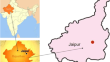
Automated Tax Map** from UAV Multispectral Imagery
Tax map** is an essential element for efficient management of real estate property and tax management, paving the way for effective implementation...

-
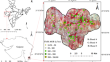
Estimating Above-Ground Biomass of the Regional Forest Landscape of Northern Western Ghats Using Machine Learning Algorithms and Multi-sensor Remote Sensing Data
Estimating above-ground biomass (AGB) using machine learning (ML) algorithms and multi-sensor satellite data is a promising approach for monitoring...
-
Long-Term Temporal Analysis of Desertification
This study uses remote sensing techniques to map land use and cover in desertified areas as well as analyze visual hazard catastrophes caused by...
-
A Computation Framework for LISS-III Analysis Ready Data (ARD) Products for Indian Spatial Data Cube Generation
The velocity and volume of MultiSpectral (MS) remote sensing data have recently increased exponentially. In recent times, however, the absence of a...

-
Geospatial Assessment of Long-Term Changes (1937–2019) in Mangrove Vegetation and Shoreline Dynamics of Godavari Estuary, East Coast of India
Godavari mangroves are the second largest mangrove ecoregion of India located on its eastern coast. Mangroves perform major ecological functions...

-
Comparison of Sentinel-2 Multispectral Imager (MSI) and Landsat 8 Operational Land Imager (OLI) for Vegetation Monitoring
The availability of the coarse to moderate resolution no-cost remote sensing data and advances in image processing algorithms have exponentially...
-
Assessment and Comparison of DEM Generated Using Cartosat-1 Stereo Pair Data for Hydrological Applications
Accurate depiction of the topography of Earth’s surface is an essential requirement to produce photogrammetric products like DEM and ortho-images as...

-
Feasibility of Ship Detection and Tracking Using GOCI-II Images
The availability of high-resolution synthetic aperture radar (SAR), optical, radio frequency (RF), and other types of satellite imagery has improved,...

-
A Narrative Review of Geospatial Techniques for assessing Climate Change Impacts on Cryosphere, Geo-environmental Hazards and Risks in the Himalayan Region
Geospatial techniques provide an important tool to understand the earth surface processes and its dynamics in space and time. Under the influence of...
-
Performance Evaluation of MBT, OBIA and PBRF Method for High-Altitude Water Body Map**: A Case Study of Mago River Basin of Arunachal Pradesh
Accurate map** of high-altitude water bodies in a hilly region is a challenging task due to the hill shadows that have a similar signature as water...

-
Interaction of image fusion techniques and atmospheric correction for improve SVM accuracy
Changes in land cover (LC) influence the geological, climatic, and biological environments of the earth. A precise LC map provides detailed...

-
Evaluation of the effect of spatial and temporal resolutions for digital change detection: case of forest fire
One of the most important subjects in remote sensing is digital change detection which identifies the differences between the before and after an...

-
Multispectral to Panchromatic Image Fusion Based on Morphological Extended-Half-Gradient
Pansharpening refers to the fusion of remotely sensed multispectral and panchromatic images which are characterized by different levels of...

-
Two drifting paths of Sargassum bloom in the Yellow Sea and East China Sea during 2019–2020
The macroalgal blooms of floating brown algae Sargassum horneri are increasing in the Yellow Sea and East China Sea during the past few years....
-
Water indices for surface water extraction using geospatial techniques: a brief review
Water is essential for global water cycle. This natural wealth is invaluable. Water is used for drinking, making food, to make a living, and to...
-
Spatiotemporal trends of urban-induced land use and land cover change and implications on catchment surface imperviousness
Urbanization, changes in land use and land cover (LULC), and an increase in population collectively have significant impacts on urban catchments....

-
A novel band selection architecture to propose a built-up index for hyperspectral sensor PRISMA
Processing of hyperspectral remote sensing datasets poses challenges in terms of computational expense pertaining to data redundancy. As such, band...
