Search
Search Results
-
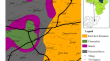
A detailed analysis of hydro-parameters of the Adamawa Plateau watershed derived from the application of geoelectrical technique
This research revises and improves previous studies conducted in the Adamawa region regarding aquifer characterisation. Linear regression technique...

-
Numerical modeling of 2-D and 3-D geoelectrical resistivity data for engineering site investigation and groundwater flow direction study in a sedimentary terrain
In the design of engineering structures, collaborative efforts must be ensured to determine in-situ subsurface soil conditions and depth to competent...

-
Application of geographical information system to geoelectrical data for evaluation of the vulnerability of aquifers in parts of Bauchi, Northeastern Nigeria
The poor quality and inconsistent nature of most surface water supply in arid and semi-arid regions of the world has increased the reliance on...
-
Evaluation of groundwater potential, aquifer parameters and vulnerability using geoelectrical method: a case study of parts of the Sanaga Maritime Division, Douala, Cameroon
A geoelectric survey was carried out in parts of the Sanaga maritime division where the limited quality of surface water sources, insufficient...

-
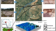
Electrical resistivity imaging and 3D geological modelling of the sedimentary architecture of the Sanaga floodplain (Cameroon, Central Africa)
The sedimentary architecture of the Middle Sanaga deposits in the Central Cameroon Region was studied by combining sedimentological and surface...

-
Impact of subsurface structures on groundwater exploration using aeromagnetic and geoelectrical data: a case study at Aswan City, Egypt
Geological evaluation and groundwater assessment, especially in arid areas, are considerable targets for constructing recent and sustainable...

-
Geoelectrical integrated models for determining the geometry of karstic cavities in the Zarrinabad area, west of Iran: combination of fuzzy logic, C-A fractal model and hybrid AHP-TOPSIS procedure
The main aim of this study is to determine the location of the cave and cavities in Zarrinabad area, Lorestan province, west of Iran. For this...

-
Integrated geoelectrical and hydrogeological study of Garaat Sened area, west-central Tunisia
A detailed hydrogeological investigation is combined with electrical resistivity imaging using the Schlumberger depth sounding method in Garaat...

-
Modeling of geophysical derived parameters for groundwater potential zonation using GIS-based multi-criteria conceptual model
This study modeled geophysical derived parameters and multi-critically synthesized their themes based on geospatial and analytical hierarchy...

-
Application of geoelectrical resistivity for delineating crystalline basement aquifers in Basiri, Ado-Ekiti, Southwestern Nigeria
Delineating crystalline basement aquifers with adequate capacity to store and transmit sufficient groundwater is quite challenging as substantial...

-
Geoelectrical Resistivity and Geological Characterization of Hydrostructures for Groundwater Resource Appraisal in the Obudu Plateau, Southeastern Nigeria
Electrical resistivity tomography (ERT) and vertical electrical sounding (VES) techniques were employed to assess the hydrogeological structures and...

-
Geophysical Researches to Detect Karst Caves in the Main Polje of Apulia
Canale di Pirro, the main polje in Apulia, extends for 12 km in the Low Murge karst area. It hosts the deepest cave in the region, reaching the depth...
-
Investigation of Groundwater Occurrences Along the Nile Valley Between South Cairo and Beni Suef, Egypt, Using Geophysical and Geodetic Techniques
Water is becoming one of the most critical strategic challenges for any country. Egypt has numerous water resources, the most notable being the Nile...

-
Estimation of the hydraulic parameters by using an alternative vertical electrical sounding technique: case study from semiarid Khanasser valley region, Northern Syria
Vertical electrical sounding technique (VES) is proposed as an alternative geoelectrical approach to estimate the hydraulic conductivity and...

-
Geoelectrical characterisation of CO2–water systems in porous media: application to carbon sequestration
Carbon sequestration is a promising method for the reduction of carbon dioxide (CO 2 ) emissions as it permits the storage of compressed CO 2 in the...

-
A review on the use of geoelectrical methods for characterization and monitoring of contaminant plumes
Geophysical characterization of contaminated sites is an important procedure in pre- and post-site remediation. It has been carried out in several...

-
Contribution of Geophysical and Borehole Data in the Study of the Geological Structures of the Gantour Plateau and Bahira Basin (Morocco)
Geophysical methods and geological investigations are efficient techniques for studying the geological structures of the sedimentary basins (Jaffal...
-
Analysis of Geoelectric Data Through Machine Learning Algorithms for Waste Leachate Detection
Electrical resistivity tomography (ERT) is an effective method for detecting the leachate plume due to the plume's very low resistivity values....
-
Geoelectrical characterisation of aquifers in Bauchi-Alkaleri-Kirfi geological transition zones, Northeast Nigeria
Geological transition zones (GTZ) have proved to be hydrogeologically problematic, owing to poorly defined basal and lateral contacts between the...
-
Hydrogeochemical status and geoelectrical characteristics of the shallow aquifers of Kalanad Basin, Kasaragod, Kerala, India
Groundwater demand has increased due to overpopulation and intensive irrigation which resulted in decline of water resources and deterioration of...
