Search
Search Results
-
Map** the flood hazard potential of small watercourses in a mountain river basin
This study presents a methodological approach for the map** of the flood hazard potential of small watercourses, based on their hydromorphological...

-
Influence of buffer distance on environmental geological hazard susceptibility assessment
Previous researches seldom studied the selection of buffer distance between geological hazards (positive samples) and non-geological hazards...

-
Road Surface Translation Under Snow-Covered and Semantic Segmentation for Snow Hazard Index
In 2020, there was a record heavy snowfall owing to climate change. In reality, 2,000 vehicles were stuck on the highway for three days. Because of...
-
Flood risk assessment in Kogi State Nigeria through the integration of hazard and vulnerability factors
Annually, Kogi State in Nigeria experiences significant flooding events, leading to serious fatalities, the destruction of livelihoods, and damage to...

-
Development of hierarchical sub-surface energy anomaly index and its significance on seismic hazard study through geoinformatics in Lower Tista sub-basin, India
A significant amount of energy is released from sub-surface during an earthquake which is caused by seismotectonic activity. The occurrences of...

-
Building information modeling integrated with environmental flood hazard to assess the building vulnerability to flash floods
Recently, significant global regions have encountered unparalleled consequences arising from climate change, notably manifesting in the heightened...

-
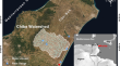
Integrated decisional approach for watershed vulnerability prioritization using water and soil hazard index (WSHI) and AHP methods: Chiba watershed, Cap-Bon region, northeast Tunisia
The present work has been conducted to comprehend multi-influencing parameters on water and soil degradation in watershed to undertake the...
-
A transformer model for cause-specific hazard prediction
BackgroudModelling discrete-time cause-specific hazards in the presence of competing events and non-proportional hazards is a challenging task in...
-
Tropical cyclone multi-hazard risk map** for Queensland, Australia
Tropical cyclones (TCs) are dangerous and destructive natural hazards that impact population, infrastructure, and the environment. TCs are...

-
Understanding flood risk in urban environments: spatial analysis of building vulnerability and hazard areas in the Lisbon metropolitan area
Climate change has brought about new risks while exacerbating existing ones, with floods now accounting for about 45% of global disasters. This trend...

-
Application of artificial intelligence in the hazard indexes of recycled agricultural waste materials
Radioactive substances are emitted during the recycling of agricultural waste materials, putting both the environment and people at risk. Thus, the...

-
Liquefaction hazard analysis of Varanasi city of Northern India
Seismically induced soil liquefaction is one of the major causes for loss of life and property because of its critical impact and significant...

-
Seismically-induced landslide probabilistic hazard map** of Aba Prefecture and Chengdu Plain region, Sichuan Province, China for future seismic scenarios
The purpose of this work is to carry out seismically induced landslide probabilistic hazard map** for future seismic scenarios of Aba Prefecture...
-
Thermal hazard assessment of 1,3-dinitrobenzene: evaluating the influence of accidental impurities on thermal hazard
To address the research gap concerning the risks associated with 1,3-dinitrobenzene (1,3-DNB) and to mitigate the potential for 1,3-DNB accidents,...

-
Debris flow susceptibility and hazard assessment in Fushun based on hydrological response units
Fushun, located in Northeast China, is prone to debris flow disasters due to its complex topographical and geological conditions. In 2013,...

-
Co-seismic and rainfall-triggered landslide hazard susceptibility assessment for Uganda derived using fuzzy logic and geospatial modelling techniques
Uganda has suffered from many damaging landslides like the 1966 Rwenzori, 1994 Kisomoro and 2010 Bududa events. Despite escalating landslide risks...

-
Deterministic seismic hazard and landslide hazard zonation of Arunachal Pradesh
This paper presents a seismically induced landslide hazard assessment for the state of Arunachal Pradesh, India, based on GIS techniques. A...

-
Using radial basis artificial neural networks to predict radiation hazard indices in geological materials
The estimation of exposures to humans from the various sources of radiation is important. Radiation hazard indices are computed using procedures...

-
Machine learning based urban sprawl assessment using integrated multi-hazard and environmental-economic impact
The increasing demand for land development due to human activities has fueled urbanization. However, uncontrolled urban development in some regions...

-
An integration of geospatial and fuzzy-logic techniques for flood-hazard map**
A hazard is a natural occurrence that might harm humans, animals or the environment. It may cause loss of life, illness or other health consequences,...
