Search
Search Results
-
Spatio-temporal characterization of drought variability in data-scarce regions using global precipitation data: a case study in Cauto river basin, Cuba
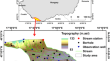
Drought is considered the most severe water-related disaster in the Cauto river basin, which is the longest river and the main agricultural producer...

-
Multiorder hydrologic Position for Europe — a Set of Features for Machine Learning and Analysis in Hydrology
The presented dataset EU-MOHP v013.1.1 provides multiscale information on the hydrologic position (MOHP) of a geographic point within its respective...

-
Assessment of natural groundwater reserve of a morphodynamic system using an information-based model in a part of Ganga basin, Northern India
Assessment of morphodynamic groundwater reserves is important for the sustainable management of water resources. It is a truth that groundwater...

-
Geospatial data on the sediments of Lake Balaton
Freshwater lakes in most inhabited areas of the world are threatened by water quality issues. Standard water conservation measures have shown...

-
The study of early human settlement preference and settlement prediction in **njiang, China
When studying the human settlement process, it is of great significance to understand the prehistoric environment, economy and society by exploring...

-
Prediction and experimental evidence of the optimisation of the angular branching process in the thallus growth of Podospora anserina
Based upon apical growth and hyphal branching, the two main processes that drive the growth pattern of a fungal network, we propose here a...

-
Changes in the spatial and temporal characteristics of China’s arid region in the background of ENSO
Arid regions are sensitive to changes in precipitation, while El Niño-Southern Oscillation strongly influences worldwide hydrometeorological...

-
A dataset of winter wheat aboveground biomass in China during 2007–2015 based on data assimilation
As a key variable to characterize the process of crop growth, the aboveground biomass (AGB) plays an important role in crop management and...

-
Exploring methods for map** seasonal population changes using mobile phone data
Data accurately representing the population distribution at the subnational level within countries is critical to policy and decision makers for many...

-
A simulated ‘sandbox’ for exploring the modifiable areal unit problem in aggregation and disaggregation
We present a spatial testbed of simulated boundary data based on a set of very high-resolution census-based areal units surrounding Guadalajara,...

-
The Spatial Patterns of Red Beds and Danxia Landforms: Implication for the formation factors–China
This research examined the distribution features of red beds and 1,100 Danxia landform sites across China, while probing the relationship between...

-
Spatial response of water level and quality shows more significant heterogeneity during dry seasons in large river-connected lakes
The spatial response mechanism of hydrology and water quality of large river-connected lakes is very complicated. In this study, we developed a...

-
A spatial analysis of TB cases and abnormal X-rays detected through active case-finding in Karachi, Pakistan
Tuberculosis (TB) is the leading cause of avoidable deaths from an infectious disease globally and a large of number of people who develop TB each...

-
Coupling antecedent rainfall for improving the performance of rainfall thresholds for suspended sediment simulation of semiarid catchments
Suspended sediment transport is one of the essential processes in the geochemical cycle. This study investigated the role of rainfall thresholds in...

-
Temperature lapse rate estimation and snowmelt runoff simulation in a high-altitude basin
As a key parameter of hydrological process modeling, the near-surface air temperature lapse rate reflects the vertical changes in air temperature...

-
Integrated assessment of the impact of land use changes on groundwater recharge and groundwater level in the Drava floodplain, Hungary
Land-use/land-cover (LULC) change is considered a key human factor influencing groundwater recharge in floodplains. Without accurate estimations, the...
-
A comprehensive, multisource database for hydrometeorological modeling of 14,425 North American watersheds
The Hydrometeorological Sandbox - École de technologie supérieure (HYSETS) is a rich, comprehensive and large-scale database for hydrological...

-
Spatio-Temporal Analysis of Climate Change in Belgaum District, Karnataka
Belgaum district in Karnataka has been experiencing drought continuously for the past few years. To study the phenomenon of low rainfall in the...
-
A 2.5° × 2.5° gridded drought/flood grades dataset for eastern China during the last millennium
Hydroclimate reconstruction for the last millennium is essential to understand the differences in hydroclimate extremes and their causes under...

-
Exploring short- and long-term meteorological drought parameters in the Vaippar Basin of Southern India
Evaluating drought parameters at the basin level is one of the fundamental processes for planning sustainable crop production. This study aimed to...
