Search
Search Results
-
A high-throughput multispectral imaging system for museum specimens
We present an economical imaging system with integrated hardware and software to capture multispectral images of Lepidoptera with high efficiency....

-
Integrating citizen science and multispectral satellite data for multiscale habitat management
Habitat management is necessary for the conservation of threatened species, yet best practices in fragmented human-dominated landscapes have remained...

-
Quantifying corn LAI using machine learning and UAV multispectral imaging
Predicting leaf area index (LAI) is essential for understanding crop growth status and water-fertilizer management. The aim of this study was to...

-
Evaluation of winter-wheat water stress with UAV-based multispectral data and ensemble learning method
AimsCombining multiple features of UAV-based multispectral images with the stacking ensemble model, to improve the feasibility and accuracy of...

-
Classification of dog skin diseases using deep learning with images captured from multispectral imaging device
BackgroundDog-associated infections are related to more than 70 human diseases. Given that the health diagnosis of a dog requires expertise of the...

-
Karst vegetation coverage detection using UAV multispectral vegetation indices and machine learning algorithm
BackgroundKarst vegetation is of great significance for ecological restoration in karst areas. Vegetation Indices (VIs) are mainly related to plant...
-
Non‑invasive leaf hydration status determination through convolutional neural networks based on multispectral images in chrysanthemum
The potential of employing multispectral data (400–1050 nm) for estimating leaf relative water content (RWC) and water content (WC) was investigated...

-
Multispectral-derived genotypic similarities from budget cameras allow grain yield prediction and genomic selection augmentation in single and multi-environment scenarios in spring wheat
With abundant available genomic data, genomic selection has become routine in many plant breeding programs. Multispectral data captured by UAVs...

-
Multispectral confocal 3D imaging of intact healthy and tumor tissue using mLSR-3D
Revealing the 3D composition of intact tissue specimens is essential for understanding cell and organ biology in health and disease. State-of-the-art...

-
Nitrogen assessment by remote sensing and multispectral imagery in maize (Zea mays L.)
Over-application of nitrogen fertilizers in farm lands is the main reason to contaminate nitrogen components in the environment. Nitrogen can play a...

-
Using UAV multispectral photography to discriminate plant species in a seep wetland of the Fynbos Biome
Wetlands harbour a wide range of vital ecosystems. Hence, map** wetlands is essential to conserving the ecosystems that depend on them. However,...

-
Evaluation of canopy fraction-based vegetation indices, derived from multispectral UAV imagery, to map water status variability in a commercial vineyard
Water stress is a major factor affecting grapevine yield and quality. Standard methods for measuring water stress, such as midday stem water...

-
Detection of soil-borne wheat mosaic virus using hyperspectral imaging: from lab to field scans and from hyperspectral to multispectral data
Hyperspectral imaging allows for rapid, non-destructive and objective assessments of crop health. Narrowband-hyperspectral data was used to select...

-
Using UAV-based multispectral remote sensing imagery combined with DRIS method to diagnose leaf nitrogen nutrition status in a fertigated apple orchard
Monitoring plant growth information by timely and effective approaches, such as UAV remote sensing, is crucial to achieve the precise nutrient...

-
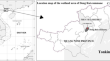
Assessing the characteristics and seasonal changes of mangrove forest in Dong Rui commune, Quang Ninh Province, Vietnam based on multispectral UAV data
Mangroves are estuarine and coastal ecosystems strongly influenced by the local tidal regime and climate, so there is a strong variation between...
-
UAV-based canopy monitoring: calibration of a multispectral sensor for green area index and nitrogen uptake across several crops
The fast and accurate provision of within-season data of green area index ( GAI ) and total N uptake ( total N ) is the basis for crop modeling and...

-
Tree-Level Evapotranspiration Estimation of Pomegranate Trees Using Lysimeter and UAV Multispectral Imagery
This chapter presents an in-depth investigation into the tree-level evapotranspiration estimation of pomegranate trees, employing a novel approach...
-
Evaluation of transpiration in different almond production systems with two-source energy balance models from UAV thermal and multispectral imagery
A growing number of intensive irrigated production systems of the almond crop have been established in recent years. However, there is little...

-
Spatial estimation of actual evapotranspiration over irrigated turfgrass using sUAS thermal and multispectral imagery and TSEB model
Green urban areas are increasingly affected by water scarcity and climate change. The combination of warmer temperatures and increasing drought poses...

-
Satellite multispectral indices to estimate canopy parameters and within-field management zones in super-intensive almond orchards
Continuous canopy status monitoring is an essential factor to support and precisely apply orchard management actions such as pruning, pesticide and...
