Search
Search Results
-
UAV Applications in Agriculture
Unmanned Aerial Vehicle (UAV) technology was initially developed for agricultural crop dusting in the 1980s in Japan. Since then, UAVs have been...
-
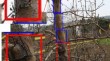
Map** fire blight cankers and autumn blooming in pear trees using Faster R-CNN
Fire blight disease causes significant losses in pear orchards. Fire blight infection is accompanied by visual symptoms that can easily be recognized...
-
Unmanned Aerial System Technologies for Pesticide Spraying
Modern agriculture demands highly rapid ground information in the cultivated tracts and equally quick execution of remedial measures. There is no...
-
Growth monitoring of field-grown onion and garlic by CIE L*a*b* color space and region-based crop segmentation of UAV RGB images
Canopy coverage-based crop growth monitoring is highly dependent on the performance of crop segmentation algorithms. Under field conditions, crop...

-
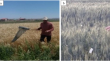
Chemical control of wheat sunn pest, Eurygaster integriceps, by UAV sprayer and very low volume knapsack sprayer
The Sunn pest, Eurygaster integriceps Puton (Heteroptera: Scutelleridae), is one of the most important pests of wheat crops in Iran and the Middle...
-
Sugarcane yield estimation in Thailand at multiple scales using the integration of UAV and Sentinel-2 imagery
Timely and accurate estimates of sugarcane yield provide valuable information for food management, bio-energy production, (inter)national trade,...

-
Evaluation of canopy fraction-based vegetation indices, derived from multispectral UAV imagery, to map water status variability in a commercial vineyard
Water stress is a major factor affecting grapevine yield and quality. Standard methods for measuring water stress, such as midday stem water...

-
Forest in situ observations using unmanned aerial vehicle as an alternative of terrestrial measurements
BackgroundLately, terrestrial point clouds have drawn attention as a new data source for in situ forest investigations. So far, terrestrial laser...

-
Ongoing Fen–Bog Transition in a Boreal Aapa Mire Inferred from Repeated Field Sampling, Aerial Images, and Landsat Data
Northern aapa mire complexes are characterized by patterned fens with flarks (wet fen surfaces) and bog zone margins with Sphagnum moss cover....

-
A systematic approach to obtain optimized low-cost balsa wood structure subjected to the effects of uncertainties: A FEM approach
Lightweight structures are of paramount importance in engineering applications. Optimal designs combining various optimization techniques can...

-
Map** hailstorm damage on winter wheat (Triticum aestivum L.) using a microscale UAV hyperspectral approach
Hailstorms pose a direct threat to agriculture, often causing yield losses and worsening farmers’ agricultural activity. Traditional methods of hail...

-
A method for small-sized wheat seedlings detection: from annotation mode to model construction
The number of seedlings is an important indicator that reflects the size of the wheat population during the seedling stage. Researchers increasingly...

-
Dynamic delineation of management zones for site-specific nitrogen fertilization in a citrus orchard
Estimating crop nitrogen status to optimize production and minimize environmental pollution is a major challenge for modern agriculture. The study...

-
Multi-temporal NDVI analysis using UAV images of tree crowns in a northern Mexican pine-oak forest
The use of unmanned aerial vehicles (UAV) for forest monitoring has grown significantly in recent years, providing information with high spatial...

-
Recent Advances in UAV-Based Structure-from-Motion Photogrammetry for Aboveground Biomass and Carbon Storage Estimations in Forestry
Due to economical, ecological, and social changes over the last decade, managers and researchers in nature-based disciplines intend to use both...
-
Allosuckling in southern right whale calves
Allosuckling, the suckling of milk from a non-biological mother, occurs in some species of mammals. Allosuckling has not been quantified in baleen...

-
Locating Drainage Tiles at a Wetland Restoration Site within the Oak Openings Region of Ohio, United States Using UAV and Land Based Geophysical Techniques
Drainage tiles were used to drain wetlands in the midwestern United States to convert them into farmlands. With decades of farm operations, utility...

-
Economic Evaluation of UAV-Based Soil Sampling Approaches
Unmanned aerial vehicles (UAVs) are used for soil sampling in agricultural contexts, and this book chapter examines the comprehensive evaluation of...
-
Red-green-blue to normalized difference vegetation index translation: a robust and inexpensive approach for vegetation monitoring using machine vision and generative adversarial networks
High-resolution multispectral imaging of agricultural fields is expensive but helpful in detecting subtle variations in plant health and stress...

-
The estimation of wheat tiller number based on UAV images and gradual change features (GCFs)
Wheat ( Triticum aestivum L. ) is an essential crop that is widely consumed globally. The tiller density is an important factor affecting wheat yield....
