Search
Search Results
-
Processing CORONA image for generation of Digital Elevation Model (DEM) and orthophoto of Bilaspur district, Himachal Pradesh
Declassified CORONA images provide stereo pairs that could be used for preparation of Digital Elevation Models (DEMs) and orthophotos that could be...

-
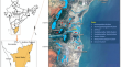
Late Holocene morphodynamic evolution of Thamirabarani delta and Thoothukudi tombolo in South India: insights from integrated analysis of early cartographic documents and satellite images
The age of discovery and exploration (fifteenth-sixteenth century CE) in Europe and later colonisation of newly explored territories by Portuguese,...
-
Remote Sensing Roman and Byzantine Eastern Frontier Zone in Landscape: Case Studies from Syria and Turkey
The Euphrates and the Tigris valleys in greater Mesopotamia provide a treasure trove for archaeologists studying the Roman and Byzantine eras. There...
-
The Science and Technology of Remote Sensing in the Context of Archaeology
Particularly for the benefit of readers without a background in remote sensingRemote Sensing (RS), we review the fundamental concepts and terminology...
-
How Natural and Positional Factors Influenced Land-Use Change During the Last 250 Years in Temperate Russia
The analysis of spatial and temporal dynamics of the land-use structure in the Meschera Lowland since the late eighteenth century has been realized...
-
South/Southeast Asia Research Initiative (SARI) and Agricultural Research Projects
The South/Southeast Asia Research Initiative (SARI) is a NASA Land Cover/Land Use Change (LC/LUC) funded regional research initiative that has been...
-
Glacier area changes in the Nujiang-Salween River Basin over the past 45 years
Automated image classification and visual interpretation of Landsat imagery were used to extract the glacier boundary in the Nujiang-Salween River...
-
Remote Sensing
This chapter presents an analysis of historical and present-day remote sensing methods (e.g., LiDAR and satellite imagery) that can be very useful in...
-
Dryland Dynamics and Driving Forces
Drylands are the largest biomes on Earth, yet also one of the most vulnerable to climate change and human activities. Dryland ecosystems in the world...
-
Archaeological Landscapes and Built Heritage: Climate Risk and Contribution of Remote Sensing Technologies
The focus of this chapter is the contribution of remote sensing (RS) technologies in climate risk mainly for archaeological landscapes and built...
-
Photography
Photography has become outdated and obsolete. However, it is important from the point of view of using the archival data of 1920’s–1980’s....
-
Sensing the Past from Space: Approaches to Site Detection
This chapter is concerned with site detection by using earth observation technologies with particular reference to optical satellite data. Three...
-
Changes in Canadian Arctic Ice Shelf Extent Since 1906
The ice shelves along the northern coast of Ellesmere Island have been in a state of decline since at least the early twentieth century. Available...
-
Heterogeneity in Fluctuations of Glacier with Clean Ice-Covered, Debris-Covered and Proglacial Lake in the Upper Ravi Basin, Himachal Himalaya (India), During the Past Four Decades (1971–2013)
Comprehensive multi-temporal observations of Himalayan glaciers during the past half century indicate the continuous shrinkage of most of the...
-
Combining Different Data Sources for City Growth Analysis and Architectural Heritage Map**
This chapter discusses our research effort on city growth documentation and architectural heritage map** through the combined use of maps and...
-
Himalayan Glaciers (India, Bhutan, Nepal): Satellite Observations of Thinning and Retreat
This chapter summarizes the current state of remote sensing of glaciers in the India, Nepal, and Bhutan regions of the Himalaya, and focuses on new...
-
Remote Sensing of Glaciers in Afghanistan and Pakistan
Glaciers in Afghanistan and Pakistan are parts of an Asian “critical region” having significant roles in rising sea level, local and regional water...