Search
Search Results
-
Geomorphology-oriented theoretical framework and construction method for value-added DEM
Digital elevation model (DEM) plays a fundamental role in the study of the earth system by expressing surface configuration, understanding surface...
-
Processing CORONA image for generation of Digital Elevation Model (DEM) and orthophoto of Bilaspur district, Himachal Pradesh
Declassified CORONA images provide stereo pairs that could be used for preparation of Digital Elevation Models (DEMs) and orthophotos that could be...

-
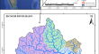
Morphometric analysis of Bichom River basin, Arunachal Pradesh, India using ALOS PALSAR RTC DEM and geospatial technology
Morphometric analysis provides an essential understanding of the geo-hydrological nature of a drainage basin. The advancements in remote sensing...
-
Assessment of TanDEM-X DEM 2020 Data in Temperate and Boreal Forests and Their Application to Canopy Height Change
Space-borne digital elevation models (DEM) are considered as important proxy for canopy surface height and its changes in forests. Interferometric...

-
Influence of land cover, slope, and aspect on the vertical accuracy of SPOT DEM at selected sites in Nigeria
The 20 m SPOT DEM (Digital Elevation Model) was acquired by the Office of the Surveyor-General of the Federation (OSGoF) in Nigeria for use in...

-
Auf dem Weg zum Fahrradland – Barrieren von Nichtradfahrer*innen identifizieren und überwinden
Increasing cycling traffic is seen as a key element of the transformation towards sustainable mobility. The National Cycling Plan 3.0, entitled...

-
A GIS Framework to Demarcate Suitable Lands for Combine Harvesters Using Satellite DEM and Physical Properties of Soil
Rice harvesting in Bangladesh is impacted by the absence of advanced harvesting technologies, high labor costs, and natural calamities, which...

-
A study on historical location and evolution of Lop Nor in China with maps and DEM
Lop Sea, located at the east end of the Tarim Basin, Northwest China, dried up permanently, which is the terminal lake of the Tarim River. Lop Sea...
-
Von Canoes und Steamboats auf dem ‚mighty Mississippi‘
Ziel des vorliegenden Beitrages ist die Betrachtung der Entwicklung von Reisen auf dem Mississippi, von ersten Entdeckungstouren bis hin zu heutigen...
-
Low-Cost UAV in Photogrammetric Engineering and Remote Sensing: Georeferencing, DEM Accuracy, and Geospatial Analysis
Conventional land surveying, while reliable, is limited by factors such as restricted area coverage, time-intensive procedures, and high costs. In...

-
Using LiDAR-DEM based rapid flood inundation modelling framework to map floodplain inundation extent and depth
Map** floods is important for policy makers to make timely decisions in regards to emergency responses and future planning. It is therefore crucial...
-
Regionalökonomische Wirkungen von Sportgroßveranstaltungen – ein Fallbeispiel aus dem Motorsport
Sportveranstaltungen unterscheiden sich je nach Besucherzahl, Sportart und Reichweite erheblich in ihren regionalökonomischen Wirkungen. Am Beispiel...
-
Aspect in Topography to Enhance Fine-detailed Landform Element Extraction on High-resolution DEM
The value of the high-resolution data lies in the high-precision information discovery. The fine-detailed landform element extraction is thus the...
-
Using UAV imagery to generate DEMs of the intertidal zone
With the rapid development of UAV (Unmanned Aerial Vehicle) and photography technology, it is now possible to conduct aerial photogrammetry at low...

-
Comparison and Validation of Elevation Data at Selected Ground Control Points and Terrain Derivatives Derived from Different Digital Elevation Models
Digital elevation model (DEM) is a precisely defined 3D representation of terrain surface. DEM from satellite imageries have grown in popularity over...

-
Wo sitzen Tübingens Studierende auf dem Trockenen?
Worin liegt der Sinn des Studierendenlebens? Bestimmt nicht im nächtlichen Arbeiten für die nächste Abgabefrist oder Klausur, nein, natürlich liegt...
-
Erkenntnisse aus einer körpersensiblen Lehre mit und zu dem digitalen Medium VR
Nutzer*innen von Virtual Reality erleben die virtuellen Umgebungen sehr immersiv, mit vielfältigen affektiven und emotionalen Reaktionen. Diese...
-
Was Stadtwälder auszeichnet: Beispiele aus dem Kanton Zürich
Vor gut 100 Jahren hat der Verschönerungsverein Zürich mit seinem gesamtheitlichen Verständnis von Mensch, Natur, Landschaft und Heimat die Zürcher...
-
Assessing the accuracy of open-source digital elevation models for the geomorphological analysis of very small islands of Indonesia
Digital elevation models (DEMs) are used for many geosciences studies; hence, their accuracy is essential. Throughout the world, there are many small...
